
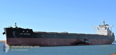
CAPE AUSTRALIA
Cargo
Current Trip
| Time Travelled | 7 days |
|---|---|
| Remaining Time | --- |
| Distance Travelled | 1934.47 nm |
| Remaining Distance | --- |
| AVG Speed | 11.2 Knopen |
| MAX Speed | 14.2 Knopen |
| AVG Wind | 10 knots |
| MAX Wind | 20 knots |
| MIN Temp | 25.5°C / 77.9°F |
| MAX Temp | 30.1°C / 86.18°F |
| Diepgang | 18.1 M |
| Positie ontvangen | 7 d geleden |
Current Position
| Lengtegraad | 118.22938° |
|---|---|
| Breedtegraat | -19.02531° |
| Status | Under way using engine |
| Snelheid | 12.1 Knopen |
| Koers | 345.2° |
| Gebied | Indian Ocean |
| Station | T-AIS |
| Positie ontvangen | 7 d geleden |
Info
Information
The current position of CAPE AUSTRALIA is in Indian Ocean with coordinates -19.02531° / 118.22938° as reported on 2024-05-08 08:10 by AIS to our vessel tracker app. The vessel's current speed is 12.1 Knopen and is heading at the port of FANGCHENG. The estimated time of arrival as calculated by MyShipTracking vessel tracking app is 2024-05-19 09:00 LT
The vessel CAPE AUSTRALIA (IMO: 9654763, MMSI: 564196000) is a Cargo It's sailing under the flag of [SG] Singapore.
In this page you can find informations about the vessels current position, last detected port calls, and current voyage information. If the vessels is not in coverage by AIS you will find the latest position.
The current position of CAPE AUSTRALIA is detected by our AIS receivers and we are not responsible for the reliability of the data. The last position was recorded while the vessel was in Coverage by the Ais receivers of our vessel tracking app.
The current draught of CAPE AUSTRALIA as reported by AIS is 18.1 meters
Weather
| Temperature | 29.9°C / 85.82°F |
|---|---|
| Wind Speed | 7 knots |
| Direction | 91° E |
| Pressure | 1008.1 hPa |
| Humidity | 75.1 % |
| Cloud Coverage | 100 % |
Featured Company
Last Port Calls
| Port | Arrival | Departure | Time In Port |
|---|---|---|---|
| 2024-05-07 01:37 | 2024-05-08 09:07 | 1 d | |
| 2024-04-09 11:45 | 2024-04-11 11:25 | 1 d | |
| 2024-03-21 11:10 | 2024-03-22 21:02 | 1 d |
Most Visited Ports (Last year)
| Port | Arrivals | |
|---|---|---|
| 4 | ||
| 2 | ||
| 2 | ||
| 2 | ||
| 1 | ||
| 1 |
Last Trips
| Origin | Departure | Destination | Arrival | Distance | |
|---|---|---|---|---|---|
| 2024-04-11 11:25 | 2024-05-07 01:37 | 3663.64 nm | |||
| 2024-03-22 21:02 | 2024-04-09 11:45 | 3222.62 nm | |||
| 2024-02-28 11:10 | 2024-03-21 11:10 | 3920.96 nm |
Events
| Tijd | Evenement | Details | Positie / Bestemming | Info |
|---|---|---|---|---|
| 2024-05-08 08:15 | Status Changed | Default Under way using engine |
-19.00836 / 118.22514
FANGCHENG CN
|
Snelheid: 12.1 kn Koers: 345.2° |
| 2024-05-08 08:10 | Buitenbereik |
-19.02531 / 118.22938
Indian Ocean
FANGCHENG CN
|
Snelheid: 12.1 kn Koers: 345.2° |
|
| 2024-05-08 08:09 | Status Changed | Under way using engine Default |
-19.02910 / 118.23043
FANGCHENG CN
|
Snelheid: 12.1 kn Koers: 348° |
| 2024-05-08 07:49 | Status Changed | Default Under way using engine |
-19.09456 / 118.24683
FANGCHENG CN
|
Snelheid: 12.4 kn Koers: 346.5° |
| 2024-05-08 07:23 | Destination Changed | FANGCHENG CN QDG CN |
-19.18517 / 118.27289
FANGCHENG CN
|
Snelheid: 12.6 kn Koers: 345° |
| 2024-05-08 07:23 | ETA Changed | 2024/05/19 01:00 2024/05/22 08:00 |
-19.18517 / 118.27289
FANGCHENG CN
|
Snelheid: 12.6 kn Koers: 345° |
| 2024-05-08 07:14 | Status Changed | Under way using engine Default |
-19.21497 / 118.28164
QDG CN
|
Snelheid: 12.7 kn Koers: 345° |
| 2024-05-08 07:10 | Status Changed | Default Under way using engine |
-19.22694 / 118.28422
QDG CN
|
Snelheid: 12.6 kn Koers: 347.9° |
| 2024-05-08 06:40 | Status Changed | Under way using engine Default |
-19.32945 / 118.30846
QDG CN
|
Snelheid: 12.8 kn Koers: 348° |
| 2024-05-08 06:35 | Status Changed | Default Under way using engine |
-19.34855 / 118.31293
QDG CN
|
Snelheid: 12.8 kn Koers: 347.7° |