
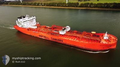
BOW EXPLORER
Tanker B
Current Trip
USNYC
| Time Travelled | 2 days |
|---|---|
| Remaining Time | --- |
| Distance Travelled | 325.44 nm |
| Remaining Distance | --- |
| AVG Speed | 10.6 Knots |
| MAX Speed | 15 Knots |
| AVG Wind | 10.6 knots |
| MAX Wind | 14 knots |
| MIN Temp | 24.4°C / 75.92°F |
| MAX Temp | 25.2°C / 77.36°F |
| Draught | 9.8 m |
| Position Received | 7 d ago |
Current Position
| Longitude | --- |
|---|---|
| Latitude | --- |
| Status | Under way using engine |
| Speed | 11.5 Knots |
| Course | 188° |
| Area | North Atlantic Ocean |
| Station | T-AIS |
| Position Received | 7 d ago |
Info
Information
The current position of BOW EXPLORER is in North Atlantic Ocean with coordinates 29.87539° / -89.97516° as reported on 2025-12-20 08:41 by AIS to our vessel tracker app. The vessel's current speed is 11.5 Knots
The vessel BOW EXPLORER (IMO: 9828211, MMSI: 257595000) is a Tanker B It's sailing under the flag of [NO] Norway.
In this page you can find informations about the vessels current position, last detected port calls, and current voyage information. If the vessels is not in coverage by AIS you will find the latest position.
The current position of BOW EXPLORER is detected by our AIS receivers and we are not responsible for the reliability of the data. The last position was recorded while the vessel was in Coverage by the Ais receivers of our vessel tracking app.
The current draught of BOW EXPLORER as reported by AIS is 9.8 meters
Weather
| Temperature | 24.6°C / 76.28°F |
|---|---|
| Wind Speed | 10 knots |
| Direction | 149° SSE |
| Pressure | 1015.4 hPa |
| Humidity | 73.2 % |
| Cloud Coverage | 3 % |
Featured Company
Last Port Calls
| Port | Arrival | Departure | Time In Port |
|---|---|---|---|
| 2025-12-22 16:08 | 2025-12-25 13:42 | 2 d | |
| 2025-12-18 20:51 | 2025-12-20 03:15 | 1 d | |
| 2025-12-10 04:51 | 2025-12-12 22:16 | 2 d | |
| 2025-11-21 11:54 | 2025-11-24 23:46 | 3 d | |
| 2025-10-19 21:23 | 2025-10-22 16:38 | 2 d | |
| 2025-10-16 08:18 | 2025-10-17 10:03 | 1 d |
Last Trips
| Origin | Departure | Destination | Arrival | Distance | |
|---|---|---|---|---|---|
| 2025-12-20 03:15 | 2025-12-22 16:08 | 781.23 nm | |||
| 2025-12-12 22:16 | 2025-12-18 20:51 | 2009.64 nm | |||
| 2025-11-24 23:46 | 2025-12-10 04:51 | 5090.24 nm | |||
| 2025-10-22 16:38 | 2025-11-21 11:54 | 9130.62 nm | |||
| 2025-10-17 10:03 | 2025-10-19 21:23 | 807.79 nm | |||
| 2025-09-30 16:27 | 2025-10-16 08:18 | 617.59 nm |
Events
| Time | Event | Details | Position / Dest | Info |
|---|---|---|---|---|
| 2025-12-25 19:42 | PORT DEPARTURE |
|
19.20134 / -96.11132
USNYC
|
Speed: 8.4 kn Course: 102° |
| 2025-12-25 19:34 | START Moving |
19.20446 / -96.12964
[MX] VERACRUZ
|
Speed: 5.3 kn Course: 105° |
|
| 2025-12-22 22:32 | STOP Moving |
19.21167 / -96.13850
[MX] VERACRUZ
|
Speed: Course: 329° |
|
| 2025-12-22 22:08 | PORT ARRIVAL |
|
19.20776 / -96.13324
[MX] VERACRUZ
|
Speed: 10.2 kn Course: 266° |
| 2025-12-22 21:15 | START Moving | 6.33 nm, East of VERACRUZ |
19.17306 / -96.01861
USNYC
|
Speed: 9 kn Course: 281° |
| 2025-12-22 17:05 | STOP Moving | 6.54 nm, North East of BOCA DEL RIO |
19.16540 / -96.01129
USNYC
|
Speed: 0.1 kn Course: 16° |
| 2025-12-22 15:36 | START Moving | 6.87 nm, East of VERACRUZ |
19.17591 / -96.00811
USNYC
|
Speed: 4.2 kn Course: 35° |
| 2025-12-22 15:20 | STOP Moving | 6.6 nm, North East of BOCA DEL RIO |
19.16572 / -96.01032
USNYC
|
Speed: 0.2 kn Course: 351° |
| 2025-12-20 09:15 | PORT DEPARTURE |
|
29.75784 / -90.02405
USNYC
|
Speed: 13.5 kn Course: 204° |
| 2025-12-20 08:41 | OUT of Coverage |
29.87539 / -89.97516
North Atlantic Ocean
|
Speed: 11.5 kn Course: 192.7° |