
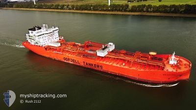
BOW EXPLORER
Tanker B
Current Trip
NLRTM
| Time Travelled | 13 days |
|---|---|
| Remaining Time | --- |
| Distance Travelled | 175.57 nm |
| Remaining Distance | --- |
| AVG Speed | 8.2 Knop |
| MAX Speed | 13.1 Knop |
| AVG Wind | 18.8 knots |
| MAX Wind | 36.4 knots |
| MIN Temp | 6.3°C / 43.34°F |
| MAX Temp | 12.7°C / 54.86°F |
| Djupgående | 8.8 m |
| Position mottagen | 24 m sen |
Current Position
| Longitud | 3.74427° |
|---|---|
| Latitude | 51.94780° |
| Status | At anchor |
| Fart | |
| Kurs | 211° |
| Område | North Sea |
| Station | T-AIS |
| Position mottagen | 24 m sen |
Info
Information
The current position of BOW EXPLORER is in North Sea with coordinates 51.94780° / 3.74427° as reported on 2024-04-27 17:02 by AIS to our vessel tracker app. The vessel's current speed is 0 Knop
The vessel BOW EXPLORER (IMO: 9828211, MMSI: 257595000) is a Tanker B It's sailing under the flag of [NO] Norway.
In this page you can find informations about the vessels current position, last detected port calls, and current voyage information. If the vessels is not in coverage by AIS you will find the latest position.
The current position of BOW EXPLORER is detected by our AIS receivers and we are not responsible for the reliability of the data. The last position was recorded while the vessel was in Coverage by the Ais receivers of our vessel tracking app.
The current draught of BOW EXPLORER as reported by AIS is 8.8 meters
Weather
| Temperature | 12.5°C / 54.5°F |
|---|---|
| Wind Speed | 8 knots |
| Direction | 50° NE |
| Pressure | 1002.9 hPa |
| Humidity | 77.1 % |
| Cloud Coverage | 100 % |
Featured Company
Last Port Calls
| Port | Arrival | Departure | Time In Port |
|---|---|---|---|
| 2024-04-12 04:48 | 2024-04-13 19:47 | 1 d | |
| 2024-04-11 05:10 | 2024-04-12 02:54 | 21 h | |
| 2024-04-09 13:56 | 2024-04-11 03:13 | 1 d | |
| 2024-04-08 22:23 | 2024-04-09 11:24 | 13 h | |
| 2024-04-06 23:57 | 2024-04-08 20:44 | 1 d | |
| 2024-04-05 09:16 | 2024-04-06 23:35 | 1 d | |
| 2024-03-27 16:36 | 2024-04-02 23:30 | 6 d | |
| 2024-03-10 13:10 | 2024-03-12 06:05 | 1 d | |
| 2024-03-02 13:13 | 2024-03-07 17:20 | 5 d | |
| 2024-02-21 12:27 | 2024-02-25 15:34 | 4 d |
Most Visited Ports (Last year)
| Port | Arrivals | |
|---|---|---|
| 12 | ||
| 8 | ||
| 5 | ||
| 4 | ||
| 2 | ||
| 2 |
Last Trips
| Origin | Departure | Destination | Arrival | Distance | |
|---|---|---|---|---|---|
| 2024-04-12 04:54 | 2024-04-12 06:48 | 17.85 nm | |||
| 2024-04-11 05:13 | 2024-04-11 07:10 | 19.46 nm | |||
| 2024-04-09 13:24 | 2024-04-09 15:56 | 19.79 nm | |||
| 2024-04-08 22:44 | 2024-04-09 00:23 | 19.50 nm | |||
| 2024-04-07 01:35 | 2024-04-07 01:57 | 1.79 nm | |||
| 2024-04-03 01:30 | 2024-04-05 11:16 | 446.22 nm | |||
| 2024-03-12 01:05 | 2024-03-27 17:36 | 5233.72 nm | |||
| 2024-03-07 11:20 | 2024-03-10 08:10 | 296.49 nm | |||
| 2024-02-25 09:34 | 2024-03-02 07:13 | 65.89 nm | |||
| 2024-02-20 17:09 | 2024-02-21 06:27 | 101.56 nm |
Events
| Tid | Event | Detaljer | Position / Dest | Information |
|---|---|---|---|---|
| 2024-04-27 17:08 | Status ändrad | Default At anchor |
51.94764 / 3.74432
NLRTM
|
Fart: Kurs: 211° |
| 2024-04-27 17:02 | Status ändrad | At anchor Default |
51.94780 / 3.74427
NLRTM
|
Fart: 0.1 kn Kurs: 214° |
| 2024-04-27 16:50 | Status ändrad | Default At anchor |
51.94774 / 3.74436
NLRTM
|
Fart: Kurs: 214° |
| 2024-04-27 16:38 | Status ändrad | At anchor Default |
51.94793 / 3.74429
NLRTM
|
Fart: Kurs: -1° |
| 2024-04-27 16:13 | Status ändrad | Default At anchor |
51.94833 / 3.74500
NLRTM
|
Fart: 0.2 kn Kurs: 220° |
| 2024-04-27 16:08 | Status ändrad | At anchor Default |
51.94792 / 3.74446
NLRTM
|
Fart: Kurs: -1° |
| 2024-04-27 16:04 | Status ändrad | Default At anchor |
51.94833 / 3.74500
NLRTM
|
Fart: 0.1 kn Kurs: 211° |
| 2024-04-27 15:56 | Status ändrad | At anchor Default |
51.94790 / 3.74428
NLRTM
|
Fart: Kurs: -1° |
| 2024-04-27 15:42 | Status ändrad | Default At anchor |
51.94833 / 3.74500
NLRTM
|
Fart: Kurs: 212° |
| 2024-04-27 15:38 | Status ändrad | At anchor Default |
51.94797 / 3.74417
NLRTM
|
Fart: 0.2 kn Kurs: 206° |