
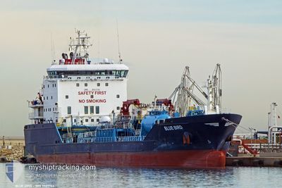
BLUE BIRD
Oil/Chemical Tanker
Current Trip
| Time Travelled | 10 days |
|---|---|
| Remaining Time | --- |
| Distance Travelled | 1651.16 nm |
| Remaining Distance | --- |
| AVG Speed | 10.1 Knots |
| MAX Speed | 12.1 Knots |
| AVG Wind | 12.9 knots |
| MAX Wind | 25.5 knots |
| MIN Temp | 10.2°C / 50.36°F |
| MAX Temp | 18°C / 64.4°F |
| Draught | 7.5 m |
| Position Received | 1 m ago |
Current Position
| Longitude | --- |
|---|---|
| Latitude | --- |
| Status | At anchor |
| Speed | 0.3 Knots |
| Course | 310° |
| Area | Aegean Sea |
| Station | T-AIS |
| Position Received | 1 m ago |
Info
Information
The current position of BLUE BIRD is in Aegean Sea with coordinates 37.91751° / 23.55468° as reported on 2026-01-08 19:22 by AIS to our vessel tracker app. The vessel's current speed is 0.3 Knots
The vessel BLUE BIRD (IMO: 9527764, MMSI: 215691000) is a Oil/Chemical Tanker that was built in 2011 ( 15 years old ). It's sailing under the flag of [MT] Malta.
In this page you can find informations about the vessels current position, last detected port calls, and current voyage information. If the vessels is not in coverage by AIS you will find the latest position.
The current position of BLUE BIRD is detected by our AIS receivers and we are not responsible for the reliability of the data. The last position was recorded while the vessel was in Coverage by the Ais receivers of our vessel tracking app.
The current draught of BLUE BIRD as reported by AIS is 7.5 meters
Weather
| Temperature | 10.2°C / 50.36°F |
|---|---|
| Wind Speed | 19 knots |
| Direction | 294° WNW |
| Pressure | 1010.8 hPa |
| Humidity | 44.6 % |
| Cloud Coverage | 3 % |
Featured Company
Last Port Calls
| Port | Arrival | Departure | Time In Port |
|---|---|---|---|
| 2025-12-28 17:33 | 2025-12-29 13:57 | 20 h | |
| 2025-12-26 11:50 | 2025-12-28 00:40 | 1 d | |
| 2025-12-23 12:00 | 2025-12-24 06:52 | 18 h | |
| 2025-12-17 15:52 | 2025-12-18 11:44 | 19 h | |
| 2025-12-10 07:50 | 2025-12-12 00:39 | 1 d | |
| 2025-12-05 01:42 | 2025-12-06 18:33 | 1 d | |
| 2025-11-27 08:15 | 2025-11-28 15:42 | 1 d | |
| 2025-11-19 17:11 | 2025-11-20 13:55 | 20 h | |
| 2025-11-16 16:14 | 2025-11-17 09:38 | 17 h | |
| 2025-11-13 03:21 | 2025-11-14 15:00 | 1 d |
Last Trips
| Origin | Departure | Destination | Arrival | Distance | |
|---|---|---|---|---|---|
| 2025-12-28 00:40 | 2025-12-28 17:33 | 142.75 nm | |||
| 2025-12-24 06:52 | 2025-12-26 11:50 | 310.44 nm | |||
| 2025-12-18 11:44 | 2025-12-23 12:00 | 1195.72 nm | |||
| 2025-12-12 00:39 | 2025-12-17 15:52 | 805.92 nm | |||
| 2025-12-06 18:33 | 2025-12-10 07:50 | 284.77 nm | |||
| 2025-11-28 15:42 | 2025-12-05 01:42 | 1453.80 nm | |||
| 2025-11-20 13:55 | 2025-11-27 08:15 | 304.20 nm | |||
| 2025-11-17 09:38 | 2025-11-19 17:11 | 193.50 nm | |||
| 2025-11-14 15:00 | 2025-11-16 16:14 | 435.70 nm | |||
| 2025-11-08 08:24 | 2025-11-13 03:21 | 358.75 nm |
Events
| Time | Event | Details | Position / Dest | Info |
|---|---|---|---|---|
| 2026-01-08 18:18 | ETA Changed | 2026/01/05 06:00 2026/01/01 06:00 |
37.91761 / 23.55467
ESHUV>GRPER
|
Speed: 0.1 kn Course: 310° |
| 2026-01-08 18:12 | ETA Changed | 2026/01/01 06:00 2026/01/05 06:00 |
37.91774 / 23.55483
ESHUV>GRPER
|
Speed: 0.2 kn Course: 299° |
| 2026-01-08 17:42 | ETA Changed | 2026/01/05 06:00 2026/01/01 06:00 |
37.91774 / 23.55474
ESHUV>GRPER
|
Speed: 0.1 kn Course: 300° |
| 2026-01-08 17:36 | ETA Changed | 2026/01/01 06:00 2026/01/05 06:00 |
37.91752 / 23.55467
ESHUV>GRPER
|
Speed: 0.2 kn Course: 311° |
| 2026-01-08 13:48 | ETA Changed | 2026/01/05 06:00 2026/01/01 06:00 |
37.91821 / 23.55504
ESHUV>GRPER
|
Speed: 0.1 kn Course: 295° |
| 2026-01-08 13:42 | ETA Changed | 2026/01/01 06:00 2026/01/05 06:00 |
37.91822 / 23.55503
ESHUV>GRPER
|
Speed: 0.1 kn Course: 295° |
| 2026-01-08 13:37 | Status Changed | At anchor Default |
37.91836 / 23.55498
ESHUV>GRPER
|
Speed: 0.2 kn Course: 290° |
| 2026-01-08 13:34 | Status Changed | Default At anchor |
37.91835 / 23.55509
ESHUV>GRPER
|
Speed: 0.2 kn Course: 296° |
| 2026-01-08 13:24 | ETA Changed | 2026/01/05 06:00 2026/01/01 06:00 |
37.91864 / 23.55519
ESHUV>GRPER
|
Speed: 0.4 kn Course: 281° |
| 2026-01-08 12:24 | ETA Changed | 2026/01/01 06:00 2026/01/05 06:00 |
37.91812 / 23.55500
ESHUV>GRPER
|
Speed: 0.2 kn Course: 294° |