
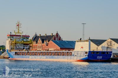
ARAMIS
Cargo
Current Trip
| Time Travelled | 3 days |
|---|---|
| Remaining Time | --- |
| Distance Travelled | 674.21 nm |
| Remaining Distance | --- |
| AVG Speed | 9 Knots |
| MAX Speed | 12.1 Knots |
| AVG Wind | 12.2 knots |
| MAX Wind | 19.8 knots |
| MIN Temp | 11.5°C / 52.7°F |
| MAX Temp | 15.7°C / 60.26°F |
| Draught | 6.6 m |
| Position Received | 1 d ago |
Current Position
| Longitude | --- |
|---|---|
| Latitude | --- |
| Status | Under way using engine |
| Speed | 8.5 Knots |
| Course | 1.6° |
| Area | North Atlantic Ocean |
| Station | T-AIS |
| Position Received | 1 d ago |
Info
Information
The current position of ARAMIS is in North Atlantic Ocean with coordinates 39.22395° / -9.83906° as reported on 2026-01-09 01:01 by AIS to our vessel tracker app. The vessel's current speed is 8.5 Knots and is heading at the port of UDDEVALLA. The estimated time of arrival as calculated by MyShipTracking vessel tracking app is 2026-01-15 10:00 LT
The vessel ARAMIS (IMO: 9815329, MMSI: 255915755) is a Cargo It's sailing under the flag of [PT] Portugal.
In this page you can find informations about the vessels current position, last detected port calls, and current voyage information. If the vessels is not in coverage by AIS you will find the latest position.
The current position of ARAMIS is detected by our AIS receivers and we are not responsible for the reliability of the data. The last position was recorded while the vessel was in Coverage by the Ais receivers of our vessel tracking app.
The current draught of ARAMIS as reported by AIS is 6.6 meters
Weather
| Temperature | 12.3°C / 54.14°F |
|---|---|
| Wind Speed | 13 knots |
| Direction | 242° WSW |
| Pressure | 1025.3 hPa |
| Humidity | 74.1 % |
| Cloud Coverage | 100 % |
Featured Company
Last Port Calls
| Port | Arrival | Departure | Time In Port |
|---|---|---|---|
| 2026-01-07 10:10 | 2026-01-07 14:18 | 4 h | |
| 2025-12-24 23:53 | 2025-12-30 02:20 | 5 d | |
| 2025-12-10 18:41 | 2025-12-16 17:02 | 5 d | |
| 2025-12-02 18:42 | 2025-12-04 12:22 | 1 d | |
| 2025-11-30 07:07 | 2025-11-30 14:47 | 7 h | |
| 2025-11-22 17:21 | 2025-11-23 23:58 | 1 d | |
| 2025-11-19 21:01 | 2025-11-20 22:26 | 1 d | |
| 2025-11-12 14:38 | 2025-11-16 20:06 | 4 d | |
| 2025-11-01 12:14 | 2025-11-04 00:06 | 2 d |
Last Trips
| Origin | Departure | Destination | Arrival | Distance | |
|---|---|---|---|---|---|
| 2025-12-30 02:20 | 2026-01-07 10:10 | 1806.73 nm | |||
| 2025-12-16 17:02 | 2025-12-24 23:53 | 893.11 nm | |||
| 2025-12-04 12:22 | 2025-12-10 18:41 | 1349.80 nm | |||
| 2025-11-30 14:47 | 2025-12-02 18:42 | 565.72 nm | |||
| 2025-11-23 23:58 | 2025-11-30 07:07 | 1047.18 nm | |||
| 2025-11-20 22:26 | 2025-11-22 17:21 | 370.24 nm | |||
| 2025-11-16 20:06 | 2025-11-19 21:01 | 782.10 nm | |||
| 2025-11-04 00:06 | 2025-11-12 14:38 | 1540.32 nm | |||
| 2025-10-31 08:25 | 2025-11-01 12:14 | 101.96 nm |
Events
| Time | Event | Details | Position / Dest | Info |
|---|---|---|---|---|
| 2026-01-09 01:09 | Status Changed | Default Under way using engine |
39.24387 / -9.83851
SE UDD
|
Speed: 8.5 kn Course: 1.6° |
| 2026-01-09 01:01 | OUT of Coverage |
39.22395 / -9.83906
North Atlantic Ocean
SE UDD
|
Speed: 8.5 kn Course: 1.6° |
|
| 2026-01-09 00:48 | Status Changed | Under way using engine Default |
39.19290 / -9.84056
SE UDD
|
Speed: 7.8 kn Course: 5° |
| 2026-01-09 00:44 | Status Changed | Default Under way using engine |
39.18537 / -9.84104
SE UDD
|
Speed: 8.2 kn Course: 1.3° |
| 2026-01-09 00:24 | Status Changed | Under way using engine Default |
39.13854 / -9.84336
SE UDD
|
Speed: 8 kn Course: 3° |
| 2026-01-09 00:22 | Status Changed | Default Under way using engine |
39.13167 / -9.84333
SE UDD
|
Speed: 8.6 kn Course: 4.4° |
| 2026-01-09 00:07 | Status Changed | Under way using engine Default |
39.09839 / -9.84574
SE UDD
|
Speed: 8 kn Course: 0° |
| 2026-01-09 00:04 | Status Changed | Default Under way using engine |
39.08833 / -9.84500
SE UDD
|
Speed: 9.1 kn Course: 3.5° |
| 2026-01-08 19:07 | Status Changed | Under way using engine Default |
38.32128 / -9.73421
SE UDD
|
Speed: 9.2 kn Course: 348° |
| 2026-01-08 18:51 | IN Coverage |
38.32128 / -9.73421
North Atlantic Ocean
SE UDD
|
Speed: 9.4 kn Course: 347° |