
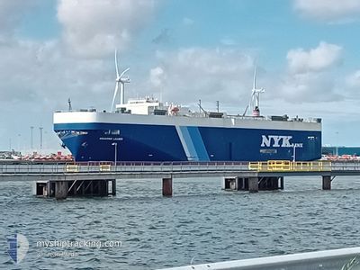
AQUARIUS LEADER
Vehicles Carrier
Current Trip
| Trip Time | 9 days |
|---|---|
| Trip Distance | 2854.43 nm |
| AVG Speed | 11.5 Knots |
| MAX Speed | 17.7 Knots |
| Draught | 8.6 m |
| AVG Wind | 11.9 knots |
| MAX Wind | 32 knots |
| MIN Temp | 7.8°C / 46.04°F |
| MAX Temp | 28.4°C / 83.12°F |
| Position Received | 2 m ago |
Current Position
| Longitude | --- |
|---|---|
| Latitude | --- |
| Status | Moored |
| Speed | |
| Course | 30° |
| Area | Singapore Strait |
| Station | T-AIS |
| Position Received | 2 m ago |
Info
Information
The current position of AQUARIUS LEADER is in Singapore Strait with coordinates 1.28274° / 103.75139° as reported on 2025-01-03 00:16 by AIS to our vessel tracker app. The vessel's current speed is 0 Knots and is currently inside the port of SINGAPORE.
The vessel AQUARIUS LEADER (IMO: 9158276, MMSI: 373630000) is a Vehicles Carrier that was built in 1998 ( 27 years old ). It's sailing under the flag of [PA] Panama.
In this page you can find informations about the vessels current position, last detected port calls, and current voyage information. If the vessels is not in coverage by AIS you will find the latest position.
The current position of AQUARIUS LEADER is detected by our AIS receivers and we are not responsible for the reliability of the data. The last position was recorded while the vessel was in Coverage by the Ais receivers of our vessel tracking app.
The current draught of AQUARIUS LEADER as reported by AIS is 8.6 meters
Weather
| Temperature | 25.9°C / 78.62°F |
|---|---|
| Wind Speed | 9 knots |
| Direction | 9° N |
| Pressure | 1010.3 hPa |
| Humidity | 85 % |
| Cloud Coverage | 59 % |
Featured Company
Last Port Calls
| Port | Arrival | Departure | Time In Port |
|---|---|---|---|
| 2025-01-02 23:05 | |||
| 2024-12-23 08:12 | 2024-12-24 08:02 | 23 h | |
| 2024-12-22 21:51 | 2024-12-23 07:24 | 9 h | |
| 2024-12-19 23:45 | 2024-12-21 06:48 | 1 d | |
| 2024-12-18 21:20 | 2024-12-19 10:11 | 12 h | |
| 2024-12-16 04:10 | 2024-12-16 07:33 | 3 h | |
| 2024-12-08 22:40 | 2024-12-09 10:29 | 11 h | |
| 2024-12-04 21:39 | 2024-12-05 03:58 | 6 h | |
| 2024-11-23 18:20 | 2024-11-23 22:20 | 4 h | |
| 2024-11-22 19:02 | 2024-11-23 00:24 | 5 h |
Last Trips
| Origin | Departure | Destination | Arrival | Distance | |
|---|---|---|---|---|---|
| 2024-12-24 17:02 | 2025-01-03 07:05 | 2854.43 nm | |||
| 2024-12-23 16:24 | 2024-12-23 17:12 | 8.86 nm | |||
| 2024-12-21 15:48 | 2024-12-23 06:51 | 398.67 nm | |||
| 2024-12-19 19:11 | 2024-12-20 08:45 | 203.97 nm | |||
| 2024-12-16 15:33 | 2024-12-19 06:20 | 1045.69 nm | |||
| 2024-12-09 17:29 | 2024-12-16 12:10 | 2014.99 nm | |||
| 2024-12-05 11:58 | 2024-12-09 05:40 | 836.88 nm | |||
| 2024-11-24 02:20 | 2024-12-05 05:39 | 3337.56 nm | |||
| 2024-11-23 04:24 | 2024-11-23 22:20 | 277.76 nm | |||
| 2024-11-22 18:56 | 2024-11-22 23:02 | 39.83 nm |
Events
| Time | Event | Details | Position / Dest | Info |
|---|---|---|---|---|
| 2025-01-02 23:25 | Status Changed | Moored Under way using engine |
1.28276 / 103.75133
[SG] SINGAPORE
|
Speed: 0.2 kn Course: 30° |
| 2025-01-02 23:17 | STOP Moving |
1.28293 / 103.75103
[SG] SINGAPORE
|
Speed: 0.3 kn Course: 37° |
|
| 2025-01-02 23:05 | PORT ARRIVAL |
|
1.28079 / 103.74774
[SG] SINGAPORE
|
Speed: 1.5 kn Course: 51° |
| 2025-01-02 20:38 | Change Sea Area | Singaporean part of the Singapore Strait Indonesian part of the Singapore Strait |
1.26506 / 104.02181
Singapore Strait
|
Speed: 7.7 kn Course: 259.4° |
| 2025-01-02 20:17 | Detected in Sea | Indonesian part of the Singapore Strait |
1.27115 / 104.06903
Singapore Strait
|
Speed: 8.3 kn Course: 260.2° |
| 2025-01-02 19:49 | ETA Changed | 2025/02/01 21:45 2025/01/01 04:00 |
1.28237 / 104.13079
SIN PEBGA
|
Speed: 9.3 kn Course: 260.7° |
| 2025-01-02 19:20 | Status Changed | Under way using engine Default |
1.29360 / 104.20116
SIN PEBGA
|
Speed: 8.4 kn Course: 262° |
| 2025-01-02 19:17 | Status Changed | Default Under way using engine |
1.29455 / 104.20843
SIN PEBGA
|
Speed: 8.4 kn Course: 261.7° |
| 2025-01-02 19:11 | Status Changed | Under way using engine Default |
1.29660 / 104.22266
SIN PEBGA
|
Speed: 8.4 kn Course: 262° |
| 2025-01-02 19:09 | Status Changed | Default Under way using engine |
1.29722 / 104.22686
SIN PEBGA
|
Speed: 8.4 kn Course: 263.4° |