
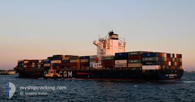
ANL WANGARATTA
Container Ship
Current Trip
| Time Travelled | 16 h, 30 mins |
|---|---|
| Remaining Time | 18 h, 20 mins |
| Distance Travelled | 198.55 nm |
| Remaining Distance | 205.59 nm |
| AVG Speed | 13.2 Knots |
| MAX Speed | 18 Knots |
| AVG Wind | 14.5 knots |
| MAX Wind | 20.7 knots |
| MIN Temp | 9.2°C / 48.56°F |
| MAX Temp | 13.1°C / 55.58°F |
| Draught | 9.7 m |
| Position Received | 9 m ago |
Current Position
| Longitude | --- |
|---|---|
| Latitude | --- |
| Status | Under way using engine |
| Speed | 0.7 Knots |
| Course | 30° |
| Area | Philippine Sea |
| Station | T-AIS |
| Position Received | 9 m ago |
Info
Information
The current position of ANL WANGARATTA is in Philippine Sea with coordinates 33.99814° / 134.98913° as reported on 2025-12-10 03:09 by AIS to our vessel tracker app. The vessel's current speed is 0.7 Knots and is heading at the port of OMAEZAKI. The estimated time of arrival as calculated by MyShipTracking vessel tracking app is 2025-12-11 06:39 LT
The vessel ANL WANGARATTA (IMO: 9334167, MMSI: 215167000) is a Container Ship that was built in 2008 ( 17 years old ). It's sailing under the flag of [MT] Malta.
In this page you can find informations about the vessels current position, last detected port calls, and current voyage information. If the vessels is not in coverage by AIS you will find the latest position.
The current position of ANL WANGARATTA is detected by our AIS receivers and we are not responsible for the reliability of the data. The last position was recorded while the vessel was in Coverage by the Ais receivers of our vessel tracking app.
The current draught of ANL WANGARATTA as reported by AIS is 9.7 meters
Weather
| Temperature | 12.3°C / 54.14°F |
|---|---|
| Wind Speed | 17 knots |
| Direction | 326° NW |
| Pressure | 1024.6 hPa |
| Humidity | 55.4 % |
| Cloud Coverage | 74 % |
Featured Company
Last Port Calls
| Port | Arrival | Departure | Time In Port |
|---|---|---|---|
| 2025-12-09 00:01 | 2025-12-09 19:49 | 19 h | |
| 2025-12-08 07:33 | 2025-12-08 16:17 | 8 h | |
| 2025-12-07 07:45 | 2025-12-07 20:37 | 12 h | |
| 2025-12-05 21:40 | 2025-12-06 17:24 | 19 h | |
| 2025-12-03 07:11 | 2025-12-04 05:19 | 22 h | |
| 2025-11-26 10:40 | 2025-11-28 13:33 | 2 d | |
| 2025-11-20 10:37 | 2025-11-21 10:47 | 1 d | |
| 2025-11-12 07:03 | 2025-11-13 00:27 | 17 h | |
| 2025-11-10 17:00 | 2025-11-11 13:57 | 20 h | |
| 2025-11-10 07:26 | 2025-11-10 16:24 | 8 h |
Last Trips
| Origin | Departure | Destination | Arrival | Distance | |
|---|---|---|---|---|---|
| 2025-12-08 16:17 | 2025-12-09 00:01 | 13.74 nm | |||
| 2025-12-07 20:37 | 2025-12-08 07:33 | 109.72 nm | |||
| 2025-12-06 17:24 | 2025-12-07 07:45 | 122.10 nm | |||
| 2025-12-04 05:19 | 2025-12-05 21:40 | 16.37 nm | |||
| 2025-11-28 13:33 | 2025-12-03 07:11 | 1789.71 nm | |||
| 2025-11-21 10:47 | 2025-11-26 10:40 | 1345.86 nm | |||
| 2025-11-13 00:27 | 2025-11-20 10:37 | 2723.55 nm | |||
| 2025-11-11 13:57 | 2025-11-12 07:03 | 245.56 nm | |||
| 2025-11-10 16:24 | 2025-11-10 17:00 | 8.62 nm | |||
| 2025-11-09 19:30 | 2025-11-10 07:26 | 115.62 nm |
Events
| Time | Event | Details | Position / Dest | Info |
|---|---|---|---|---|
| 2025-12-10 03:17 | Status Changed | Default Under way using engine |
33.99735 / 134.99077
JP OMZ
|
Speed: 0.7 kn Course: 31° |
| 2025-12-10 03:08 | Status Changed | Under way using engine Default |
33.99825 / 134.98891
JP OMZ
|
Speed: 0.7 kn Course: 24° |
| 2025-12-10 02:57 | Status Changed | Default Under way using engine |
33.99893 / 134.98624
JP OMZ
|
Speed: 1.1 kn Course: 30° |
| 2025-12-10 02:47 | Status Changed | Under way using engine Default |
33.99824 / 134.98232
JP OMZ
|
Speed: 0.6 kn Course: 52° |
| 2025-12-10 02:45 | Status Changed | Default Under way using engine |
33.99852 / 134.98200
JP OMZ
|
Speed: 0.4 kn Course: 34° |
| 2025-12-10 02:36 | Status Changed | Under way using engine Default |
33.99962 / 134.98136
JP OMZ
|
Speed: 0.5 kn Course: 23° |
| 2025-12-10 02:36 | STOP Moving | 5.46 nm, West of OBIKI |
33.99962 / 134.98136
JP OMZ
|
Speed: 0.3 kn Course: 29° |
| 2025-12-10 02:25 | Status Changed | Default Under way using engine |
33.99974 / 134.97952
JP OMZ
|
Speed: 4.1 kn Course: 6° |
| 2025-12-10 02:15 | Status Changed | Under way using engine Default |
33.99483 / 134.97805
JP OMZ
|
Speed: 6.1 kn Course: 7° |
| 2025-12-10 02:13 | Status Changed | Default Under way using engine |
33.99098 / 134.97749
JP OMZ
|
Speed: 6.4 kn Course: 7° |