
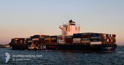
ANL WANGARATTA
Container Ship
Current Trip
| Time Travelled | 3 days |
|---|---|
| Remaining Time | 1 day |
| Distance Travelled | 1511.52 nm |
| Remaining Distance | 644.17 nm |
| AVG Speed | 16.7 Knots |
| MAX Speed | 19.4 Knots |
| AVG Wind | 5 knots |
| MAX Wind | 9.9 knots |
| MIN Temp | 26.4°C / 79.52°F |
| MAX Temp | 31.1°C / 87.98°F |
| Dybgang | 8.3 m |
| Position Modtaget | 3 d siden |
Current Position
| Longitude | 104.29603° |
|---|---|
| Latitude | 1.28404° |
| Status | Under way using engine |
| Fart | 17 Knots |
| Kurs | 77.2° |
| Område | Singapore Strait |
| Station | T-AIS |
| Position Modtaget | 3 d siden |
Info
Information
The current position of ANL WANGARATTA is in Singapore Strait with coordinates 1.28404° / 104.29603° as reported on 2024-05-03 06:39 by AIS to our vessel tracker app. The vessel's current speed is 17 Knots and is heading at the port of YANGSHAN. The estimated time of arrival as calculated by MyShipTracking vessel tracking app is 2024-05-08 08:36 LT
The vessel ANL WANGARATTA (IMO: 9334167, MMSI: 215167000) is a Container Ship that was built in 2008 ( 16 år gamle ). It's sailing under the flag of [MT] Malta.
In this page you can find informations about the vessels current position, last detected port calls, and current voyage information. If the vessels is not in coverage by AIS you will find the latest position.
The current position of ANL WANGARATTA is detected by our AIS receivers and we are not responsible for the reliability of the data. The last position was recorded while the vessel was in Coverage by the Ais receivers of our vessel tracking app.
The current draught of ANL WANGARATTA as reported by AIS is 8.3 meters
Weather
| Temperature | 26.4°C / 79.52°F |
|---|---|
| Wind Speed | 5 knots |
| Direction | 276° W |
| Pressure | 1012.1 hPa |
| Humidity | 81.8 % |
| Cloud Coverage | 86 % |
Featured Company
Last Port Calls
| Port | Arrival | Departure | Time In Port |
|---|---|---|---|
| 2024-05-01 16:22 | 2024-05-03 04:19 | 1 d | |
| 2024-04-28 10:08 | 2024-04-28 23:20 | 13 h | |
| 2024-04-16 10:10 | 2024-04-21 06:42 | 4 d | |
| 2024-04-09 14:02 | 2024-04-11 04:57 | 1 d | |
| 2024-04-04 15:01 | 2024-04-05 18:05 | 1 d | |
| 2024-03-30 07:03 | 2024-03-31 10:43 | 1 d | |
| 2024-03-28 19:26 | 2024-03-29 05:46 | 10 h | |
| 2024-03-27 17:49 | 2024-03-28 05:21 | 11 h | |
| 2024-03-11 08:28 | 2024-03-13 16:51 | 2 d |
Most Visited Ports (Last year)
| Port | Arrivals | |
|---|---|---|
| 11 | ||
| 8 | ||
| 6 | ||
| 5 | ||
| 4 | ||
| 4 |
Last Trips
| Origin | Departure | Destination | Arrival | Distance | |
|---|---|---|---|---|---|
| 2024-04-29 07:20 | 2024-05-02 00:22 | 212.06 nm | |||
| 2024-04-21 14:42 | 2024-04-28 18:08 | 2554.15 nm | |||
| 2024-04-11 12:57 | 2024-04-16 18:10 | 2344.85 nm | |||
| 2024-04-06 02:05 | 2024-04-09 22:02 | 224.15 nm | |||
| 2024-03-31 18:43 | 2024-04-04 23:01 | 212.17 nm | |||
| 2024-03-29 13:46 | 2024-03-30 15:03 | 35.98 nm | |||
| 2024-03-28 13:21 | 2024-03-29 03:26 | 36.34 nm | |||
| 2024-03-14 03:51 | 2024-03-28 01:49 | 4305.06 nm | |||
| 2024-02-29 17:34 | 2024-03-11 19:28 | 4161.89 nm |
Events
| Tid | Hændelsen | Detaljer | Position / Dest | Info |
|---|---|---|---|---|
| 2024-05-03 06:44 | Status er ændret | Default Under way using engine |
1.29297 / 104.31990
YANGSHAN
|
Fart: 17 kn Kurs: 77.2° |
| 2024-05-03 06:39 | Udenfor Dækning |
1.28404 / 104.29603
Singapore Strait
YANGSHAN
|
Fart: 17 kn Kurs: 77.2° |
|
| 2024-05-03 06:21 | Dybgangen er ændret | 8.3 8.4 |
1.27161 / 104.20921
YANGSHAN
|
Fart: 17.8 kn Kurs: 79.6° |
| 2024-05-03 06:08 | Ændre havområde | Malaysian part of the Singapore Strait Indonesian part of the Singapore Strait |
1.26107 / 104.14559
Singapore Strait
YANGSHAN
|
Fart: 17.5 kn Kurs: 81.3° |
| 2024-05-03 05:07 | Ændre havområde | Indonesian part of the Singapore Strait Singaporean part of the Singapore Strait |
1.19988 / 103.86924
Singapore Strait
YANGSHAN
|
Fart: 17 kn Kurs: 63.5° |
| 2024-05-03 05:05 | ETA er ændret | 2024/05/08 10:20 2024/05/08 10:00 |
1.19539 / 103.85604
YANGSHAN
|
Fart: 18.3 kn Kurs: 83.6° |
| 2024-05-03 04:22 | START Sejllads | 1.89 nm, North East of BUKOM ISLAND |
1.25479 / 103.77916
YANGSHAN
|
Fart: 3.3 kn Kurs: 124° |
| 2024-05-03 04:19 | Afsejlet fra sidste havn |
|
1.25625 / 103.77823
YANGSHAN
|
Fart: 1.8 kn Kurs: 96° |
| 2024-05-03 04:14 | Status er ændret | Under way using engine Moored |
1.25792 / 103.77944
[SG] SINGAPORE
|
Fart: Kurs: 121° |
| 2024-05-03 03:58 | Dybgangen er ændret | 8.4 9.2 |
1.25830 / 103.77973
[SG] SINGAPORE
|
Fart: Kurs: 120° |