
AMOENITAS
General Cargo
Current Trip
PGBG
| Time Travelled | 30 days |
|---|---|
| Remaining Time | --- |
| Distance Travelled | 10645.19 nm |
| Remaining Distance | --- |
| AVG Speed | 14.8 Knots |
| MAX Speed | 17.6 Knots |
| AVG Wind | 11.7 knots |
| MAX Wind | 32 knots |
| MIN Temp | 16.4°C / 61.52°F |
| MAX Temp | 32.2°C / 89.96°F |
| Draught | 6.7 m |
| Position Received | 6 d ago |
Current Position
| Longitude | 17.77880° |
|---|---|
| Latitude | -33.87000° |
| Status | Under way using engine |
| Speed | 15.9 Knots |
| Course | 324.6° |
| Area | South Atlantic Ocean |
| Station | T-AIS |
| Position Received | 6 d ago |
Info
Information
The current position of AMOENITAS is in South Atlantic Ocean with coordinates -33.87000° / 17.77880° as reported on 2024-05-07 22:17 by AIS to our vessel tracker app. The vessel's current speed is 15.9 Knots
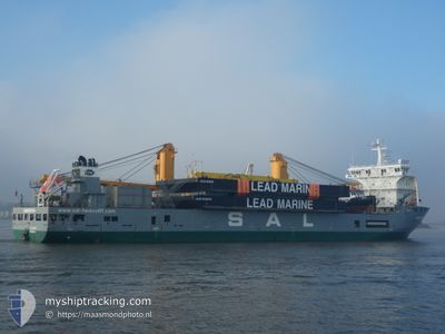
The vessel AMOENITAS (IMO: 9505510, MMSI: 305621000) is a General Cargo that was built in 2010 ( 14 years old ). It's sailing under the flag of [AG] Antigua Barbuda.
In this page you can find informations about the vessels current position, last detected port calls, and current voyage information. If the vessels is not in coverage by AIS you will find the latest position.
The current position of AMOENITAS is detected by our AIS receivers and we are not responsible for the reliability of the data. The last position was recorded while the vessel was in Coverage by the Ais receivers of our vessel tracking app.
The current draught of AMOENITAS as reported by AIS is 6.7 meters
Weather
| Temperature | 26.8°C / 80.24°F |
|---|---|
| Wind Speed | 11 knots |
| Direction | 156° SSE |
| Pressure | 1011.8 hPa |
| Humidity | 82 % |
| Cloud Coverage | 100 % |
Featured Company
Last Port Calls
| Port | Arrival | Departure | Time In Port |
|---|---|---|---|
| 2024-04-10 03:13 | 2024-04-14 06:53 | 4 d | |
| 2024-04-08 07:57 | 2024-04-09 08:45 | 1 d | |
| 2024-03-24 00:30 | 2024-03-25 04:11 | 1 d | |
| 2024-03-08 00:25 | 2024-03-12 17:30 | 4 d |
Last Trips
| Origin | Departure | Destination | Arrival | Distance | |
|---|---|---|---|---|---|
| 2024-04-09 17:45 | 2024-04-10 12:13 | 166.32 nm | |||
| 2024-03-25 12:11 | 2024-04-08 16:57 | 2583.25 nm | |||
| 2024-03-12 20:30 | 2024-03-24 08:30 | 3793.91 nm | |||
| 2024-02-24 22:02 | 2024-03-08 03:25 | 4070.22 nm |
Events
| Time | Event | Details | Position / Dest | Info |
|---|---|---|---|---|
| 2024-05-07 22:23 | Status Changed | Default Under way using engine |
-33.84976 / 17.76180
PGBG
|
Speed: 15.9 kn Course: 324.6° |
| 2024-05-07 22:17 | OUT of Coverage |
-33.87000 / 17.77880
South Atlantic Ocean
|
Speed: 15.9 kn Course: 324.6° |
|
| 2024-05-07 22:12 | Status Changed | Under way using engine Default |
-33.88602 / 17.79254
PGBG
|
Speed: 15.5 kn Course: 324° |
| 2024-05-07 22:09 | Status Changed | Default Under way using engine |
-33.89872 / 17.80359
PGBG
|
Speed: 15.6 kn Course: 324.9° |
| 2024-05-07 21:51 | Status Changed | Under way using engine Default |
-33.96394 / 17.85904
PGBG
|
Speed: 15.6 kn Course: 325° |
| 2024-05-07 21:42 | IN Coverage |
-33.96394 / 17.85904
South Atlantic Ocean
|
Speed: 15.4 kn Course: 327.2° |
|
| 2024-05-07 19:27 | Status Changed | Default Under way using engine |
-34.45814 / 18.29816
PGBG
|
Speed: 14.9 kn Course: 295.9° |
| 2024-05-07 19:15 | OUT of Coverage |
-34.48608 / 18.34682
South Atlantic Ocean
|
Speed: 14.9 kn Course: 295.9° |
|
| 2024-05-07 18:51 | Detected in Sea | South African part of the South Atlantic Ocean |
-34.52530 / 18.45089
South Atlantic Ocean
|
Speed: 14.4 kn Course: 293.8° |
| 2024-05-07 18:51 | Status Changed | Under way using engine Default |
-34.52633 / 18.45358
PGBG
|
Speed: 13.7 kn Course: 294° |