
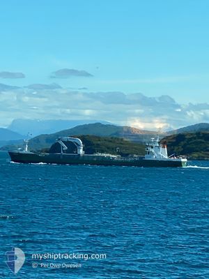
AMALIE
General Cargo
Current Trip
| Time Travelled | 1 day |
|---|---|
| Remaining Time | 10 h, 35 mins |
| Distance Travelled | 199.45 nm |
| Remaining Distance | 103.94 nm |
| AVG Speed | 10.2 Knots |
| MAX Speed | 11.8 Knots |
| AVG Wind | 15.5 knots |
| MAX Wind | 25 knots |
| MIN Temp | 2°C / 35.6°F |
| MAX Temp | 6.5°C / 43.7°F |
| Draught | 3.7 m |
| Position Received | Now |
Current Position
| Longitude | --- |
|---|---|
| Latitude | --- |
| Status | Under way using engine |
| Speed | 10.1 Knots |
| Course | 132° |
| Area | Norwegian Sea |
| Station | T-AIS |
| Position Received | Now |
Information
The current position of AMALIE is in Norwegian Sea with coordinates 62.18351° / 5.32247° as reported on 2025-03-25 02:10 by AIS to our vessel tracker app. The vessel's current speed is 10.1 Knots and is heading at the port of AVEROY. The estimated time of arrival as calculated by MyShipTracking vessel tracking app is 2025-03-25 12:45 LT
The vessel AMALIE (IMO: 9163702, MMSI: 219016713) is a General Cargo that was built in 1997 ( 28 years old ). It's sailing under the flag of [DK] Denmark.
In this page you can find informations about the vessels current position, last detected port calls, and current voyage information. If the vessels is not in coverage by AIS you will find the latest position.
The current position of AMALIE is detected by our AIS receivers and we are not responsible for the reliability of the data. The last position was recorded while the vessel was in Coverage by the Ais receivers of our vessel tracking app.
The current draught of AMALIE as reported by AIS is 3.7 meters
Weather
| Temperature | 5.7°C / 42.26°F |
|---|---|
| Wind Speed | 14 knots |
| Direction | 204° SSW |
| Pressure | 1003.9 hPa |
| Humidity | 89.8 % |
| Cloud Coverage | 100 % |


Featured Company
Last Port Calls
| Port | Arrival | Departure | Time In Port |
|---|---|---|---|
| 2025-03-23 23:46 | 2025-03-24 00:55 | 1 h | |
| 2025-03-23 16:06 | 2025-03-23 20:49 | 4 h | |
| 2025-03-23 05:51 | 2025-03-23 15:02 | 9 h | |
| 2025-03-20 18:55 | 2025-03-21 08:20 | 13 h | |
| 2025-03-20 13:14 | 2025-03-20 18:23 | 5 h | |
| 2025-03-19 15:09 | 2025-03-20 07:49 | 16 h | |
| 2025-03-16 13:46 | 2025-03-16 19:00 | 5 h | |
| 2025-03-15 08:17 | 2025-03-15 13:20 | 5 h | |
| 2025-03-14 14:41 | 2025-03-14 18:02 | 3 h | |
| 2025-03-13 20:24 | 2025-03-14 13:28 | 17 h |
Last Trips
| Origin | Departure | Destination | Arrival | Distance | |
|---|---|---|---|---|---|
| 2025-03-23 21:49 | 2025-03-24 00:46 | 28.36 nm | |||
| 2025-03-23 16:02 | 2025-03-23 17:06 | 10.66 nm | |||
| 2025-03-21 09:20 | 2025-03-23 06:51 | 345.77 nm | |||
| 2025-03-20 19:23 | 2025-03-20 19:55 | 1.93 nm | |||
| 2025-03-20 08:49 | 2025-03-20 14:14 | 5.25 nm | |||
| 2025-03-16 20:00 | 2025-03-19 16:09 | 479.84 nm | |||
| 2025-03-15 14:20 | 2025-03-16 14:46 | 205.08 nm | |||
| 2025-03-14 19:02 | 2025-03-15 09:17 | 137.83 nm | |||
| 2025-03-14 14:28 | 2025-03-14 15:41 | 10.07 nm | |||
| 2025-03-13 07:31 | 2025-03-13 21:24 | 142.44 nm |
Events
| Time | Event | Details | Position / Dest | Info |
|---|---|---|---|---|
| 2025-03-24 16:45 | Change Sea Area | Norwegian part of the Norwegian Sea Norwegian part of the North Sea |
61.00079 / 4.81356
Norwegian Sea
NO AVE
|
Speed: 11 kn Course: 53.9° |
| 2025-03-24 12:55 | START Moving | 2.37 nm, South West of AAGOTNES |
60.39010 / 4.96200
NO AVE
|
Speed: 6.5 kn Course: 346.6° |
| 2025-03-24 12:53 | Status Changed | Under way using engine Moored |
60.38723 / 4.96305
NO AVE
|
Speed: 0.3 kn Course: 6° |
| 2025-03-24 11:01 | Destination Changed | NO AVE EIDE |
60.38636 / 4.96345
NO AVE
|
Speed: Course: 3° |
| 2025-03-24 11:01 | ETA Changed | 2025/03/25 12:00 2025/03/24 08:00 |
60.38636 / 4.96345
NO AVE
|
Speed: Course: 3° |
| 2025-03-24 09:41 | Status Changed | Moored Default |
60.38635 / 4.96346
EIDE
|
Speed: Course: 2° |
| 2025-03-24 09:35 | Status Changed | Default Moored |
60.38637 / 4.96345
EIDE
|
Speed: Course: 2° |
| 2025-03-24 08:44 | Status Changed | Moored Default |
60.38636 / 4.96338
EIDE
|
Speed: Course: 1° |
| 2025-03-24 08:38 | Status Changed | Default Moored |
60.38634 / 4.96345
EIDE
|
Speed: Course: 1° |
| 2025-03-24 08:23 | Status Changed | Moored Default |
60.38631 / 4.96344
EIDE
|
Speed: Course: 1° |