

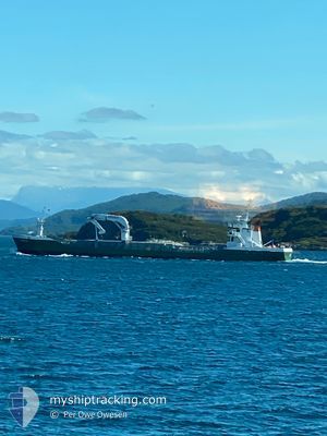
AMALIE
General Cargo

Current Trip
NOBTN
| Time Travelled | 19 h, 54 mins |
|---|---|
| Remaining Time | --- |
| Distance Travelled | 96.47 nm |
| Remaining Distance | --- |
| AVG Speed | 10.1 Noeuds |
| MAX Speed | 11.7 Noeuds |
| AVG Wind | 5.7 knots |
| MAX Wind | 7.8 knots |
| MIN Temp | -1.4°C / 29.48°F |
| MAX Temp | 0.7°C / 33.26°F |
| Tirant d eau | 3.7 m |
| Position reçue | Maintenant |
Current Position
| Longitude | --- |
|---|---|
| Latitude | --- |
| Etat | Moored |
| Vitesse | |
| Parcours | 2° |
| Zone | North Sea |
| Station | T-AIS |
| Position reçue | Maintenant |
Information
The current position of AMALIE is in North Sea with coordinates 60.38636° / 4.96344° as reported on 2025-02-18 19:20 by AIS to our vessel tracker app. The vessel's current speed is 0 Noeuds
The vessel AMALIE (IMO: 9163702, MMSI: 219016713) is a General Cargo that was built in 1997 ( 28 Age ). It's sailing under the flag of [DK] Denmark.
In this page you can find informations about the vessels current position, last detected port calls, and current voyage information. If the vessels is not in coverage by AIS you will find the latest position.
The current position of AMALIE is detected by our AIS receivers and we are not responsible for the reliability of the data. The last position was recorded while the vessel was in Coverage by the Ais receivers of our vessel tracking app.
The current draught of AMALIE as reported by AIS is 3.7 meters
Weather
| Temperature | 1.5°C / 34.7°F |
|---|---|
| Wind Speed | 8 knots |
| Direction | 145° SE |
| Pressure | 1027.9 hPa |
| Humidity | 55.6 % |
| Cloud Coverage | 6 % |


Featured Company
Last Port Calls
| Port | Arrival | Departure | Time In Port |
|---|---|---|---|
| 2025-02-17 08:35 | 2025-02-17 23:27 | 14 h | |
| 2025-02-17 03:13 | 2025-02-17 07:26 | 4 h | |
| 2025-02-16 06:48 | 2025-02-16 11:18 | 4 h | |
| 2025-02-15 00:39 | 2025-02-15 07:13 | 6 h | |
| 2025-02-14 09:13 | 2025-02-15 00:07 | 14 h | |
| 2025-02-13 04:50 | 2025-02-13 08:14 | 3 h | |
| 2025-02-12 16:43 | 2025-02-12 17:45 | 1 h | |
| 2025-02-12 05:46 | 2025-02-12 13:32 | 7 h | |
| 2025-02-11 19:46 | 2025-02-12 04:24 | 8 h | |
| 2025-02-10 21:27 | 2025-02-11 01:12 | 3 h |
Last Trips
| Origin | Departure | Destination | Arrival | Distance | |
|---|---|---|---|---|---|
| 2025-02-17 08:26 | 2025-02-17 09:35 | 12.02 nm | |||
| 2025-02-16 12:18 | 2025-02-17 04:13 | 139.57 nm | |||
| 2025-02-15 08:13 | 2025-02-16 07:48 | 202.23 nm | |||
| 2025-02-15 01:07 | 2025-02-15 01:39 | 3.88 nm | |||
| 2025-02-13 09:14 | 2025-02-14 10:13 | 214.70 nm | |||
| 2025-02-12 18:45 | 2025-02-13 05:50 | 109.36 nm | |||
| 2025-02-12 14:32 | 2025-02-12 17:43 | 31.34 nm | |||
| 2025-02-12 05:24 | 2025-02-12 06:46 | 11.98 nm | |||
| 2025-02-11 02:12 | 2025-02-11 20:46 | 139.77 nm | |||
| 2025-02-09 18:39 | 2025-02-10 22:27 | 262.78 nm |
Events
| Heure | Evenement | Détails | Position/ Destination | Info |
|---|---|---|---|---|
| 2025-02-18 14:44 | Etat Changé | Moored Under way using engine |
60.38636 / 4.96345
NOBTN
|
Vitesse: Parcours: 2° |
| 2025-02-18 13:45 | Changement de destination | NOBTN NO EDS |
60.38639 / 4.96346
NOBTN
|
Vitesse: Parcours: 2° |
| 2025-02-18 13:45 | Changement d'ETA | 2025/02/19 06:00 2025/02/18 09:00 |
60.38639 / 4.96346
NOBTN
|
Vitesse: Parcours: 2° |
| 2025-02-18 09:01 | Arret | 2.53 nm, South West of AAGOTNES |
60.38639 / 4.96329
NO EDS
|
Vitesse: Parcours: 10° |
| 2025-02-17 23:27 | PORT DE DEPART |
|
58.93299 / 5.56719
NO EDS
|
Vitesse: 9.7 kn Parcours: 316° |
| 2025-02-17 23:18 | Démarrage |
58.92501 / 5.59655
[NO] TANANGER
|
Vitesse: 3.4 kn Parcours: 287° |
|
| 2025-02-17 22:51 | Etat Changé | Under way using engine Moored |
58.92456 / 5.59869
[NO] TANANGER
|
Vitesse: Parcours: 275° |
| 2025-02-17 22:50 | Changement d'ETA | 2025/02/18 09:00 2025/02/18 08:00 |
58.92456 / 5.59875
[NO] TANANGER
|
Vitesse: Parcours: 275° |
| 2025-02-17 20:20 | Changement de destination | NO EDS NORIV |
58.92457 / 5.59868
[NO] TANANGER
|
Vitesse: Parcours: 275° |
| 2025-02-17 20:20 | Changement d'ETA | 2025/02/18 08:00 2025/02/17 14:00 |
58.92457 / 5.59868
[NO] TANANGER
|
Vitesse: Parcours: 275° |