

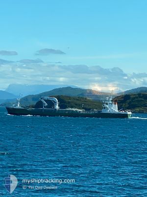
AMALIE
General Cargo

Current Trip
TANANGER
| Time Travelled | 13 h, 31 mins |
|---|---|
| Remaining Time | --- |
| Distance Travelled | 105.20 nm |
| Remaining Distance | --- |
| AVG Speed | 8 Knopen |
| MAX Speed | 9.4 Knopen |
| AVG Wind | 10.1 knots |
| MAX Wind | 23.3 knots |
| MIN Temp | 2.4°C / 36.32°F |
| MAX Temp | 6°C / 42.8°F |
| Diepgang | 3.7 M |
| Positie ontvangen | 3 m geleden |
Current Position
| Lengtegraad | --- |
|---|---|
| Breedtegraat | --- |
| Status | Moored |
| Snelheid | |
| Koers | 220° |
| Gebied | North Sea |
| Station | T-AIS |
| Positie ontvangen | 3 m geleden |
Information
The current position of AMALIE is in North Sea with coordinates 59.41220° / 5.23561° as reported on 2025-03-30 05:55 by AIS to our vessel tracker app. The vessel's current speed is 0 Knopen
The vessel AMALIE (IMO: 9163702, MMSI: 219016713) is a General Cargo that was built in 1997 ( 28 Jaar oud ). It's sailing under the flag of [DK] Denmark.
In this page you can find informations about the vessels current position, last detected port calls, and current voyage information. If the vessels is not in coverage by AIS you will find the latest position.
The current position of AMALIE is detected by our AIS receivers and we are not responsible for the reliability of the data. The last position was recorded while the vessel was in Coverage by the Ais receivers of our vessel tracking app.
The current draught of AMALIE as reported by AIS is 3.7 meters
Weather
| Temperature | 3.6°C / 38.48°F |
|---|---|
| Wind Speed | 8 knots |
| Direction | 102° ESE |
| Pressure | 995.8 hPa |
| Humidity | 92.9 % |
| Cloud Coverage | 100 % |


Featured Company
Last Port Calls
| Port | Arrival | Departure | Time In Port |
|---|---|---|---|
| 2025-03-28 18:07 | 2025-03-29 16:27 | 22 h | |
| 2025-03-27 06:37 | 2025-03-27 20:09 | 13 h | |
| 2025-03-26 14:18 | 2025-03-26 20:08 | 5 h | |
| 2025-03-26 06:56 | 2025-03-26 13:50 | 6 h | |
| 2025-03-25 19:18 | 2025-03-26 06:22 | 11 h | |
| 2025-03-25 12:23 | 2025-03-25 18:52 | 6 h | |
| 2025-03-23 23:46 | 2025-03-24 00:55 | 1 h | |
| 2025-03-23 16:06 | 2025-03-23 20:49 | 4 h | |
| 2025-03-23 05:51 | 2025-03-23 15:02 | 9 h | |
| 2025-03-20 18:55 | 2025-03-21 08:20 | 13 h |
Last Trips
| Origin | Departure | Destination | Arrival | Distance | |
|---|---|---|---|---|---|
| 2025-03-27 21:09 | 2025-03-28 19:07 | 198.87 nm | |||
| 2025-03-26 21:08 | 2025-03-27 07:37 | 5.40 nm | |||
| 2025-03-26 14:50 | 2025-03-26 15:18 | 4.16 nm | |||
| 2025-03-26 07:22 | 2025-03-26 07:56 | 1.91 nm | |||
| 2025-03-25 19:52 | 2025-03-25 20:18 | 4.12 nm | |||
| 2025-03-24 01:55 | 2025-03-25 13:23 | 302.78 nm | |||
| 2025-03-23 21:49 | 2025-03-24 00:46 | 28.36 nm | |||
| 2025-03-23 16:02 | 2025-03-23 17:06 | 10.66 nm | |||
| 2025-03-21 09:20 | 2025-03-23 06:51 | 345.77 nm | |||
| 2025-03-20 19:23 | 2025-03-20 19:55 | 1.93 nm |
Events
| Tijd | Evenement | Details | Positie / Bestemming | Info |
|---|---|---|---|---|
| 2025-03-30 05:52 | Destination Changed | TANANGER STOROY EAST |
59.41217 / 5.23549
TANANGER
|
Snelheid: Koers: 220° |
| 2025-03-30 05:52 | ETA Changed | 2025/03/30 14:00 2025/03/30 07:00 |
59.41217 / 5.23549
TANANGER
|
Snelheid: Koers: 220° |
| 2025-03-30 05:52 | Status Changed | Moored Under way using engine |
59.41215 / 5.23551
STOROY EAST
|
Snelheid: Koers: 220° |
| 2025-03-30 05:51 | Stop beweging | 0.63 nm, West of HAUGESUND |
59.41217 / 5.23551
STOROY EAST
|
Snelheid: Koers: 220° |
| 2025-03-29 16:52 | ETA Changed | 2025/03/30 07:00 2025/03/30 08:00 |
60.83505 / 5.01091
STOROY EAST
|
Snelheid: 9.2 kn Koers: 283.8° |
| 2025-03-29 16:27 | Status Changed | Under way using engine Moored |
60.79270 / 5.07862
STOROY EAST
|
Snelheid: 2.8 kn Koers: 44° |
| 2025-03-29 16:27 | Start beweging | 2.35 nm, South East of MONGSTAD |
60.79270 / 5.07862
STOROY EAST
|
Snelheid: 6.5 kn Koers: 17° |
| 2025-03-29 16:27 | Vertrekhaven |
|
60.79270 / 5.07862
STOROY EAST
|
Snelheid: 2.8 kn Koers: 44° |
| 2025-03-29 16:16 | Destination Changed | STOROY EAST NOMOB |
60.79092 / 5.07313
[NO] MONGSTAD
|
Snelheid: Koers: 153° |
| 2025-03-29 16:16 | ETA Changed | 2025/03/30 08:00 2025/03/28 18:00 |
60.79092 / 5.07313
[NO] MONGSTAD
|
Snelheid: Koers: 153° |