
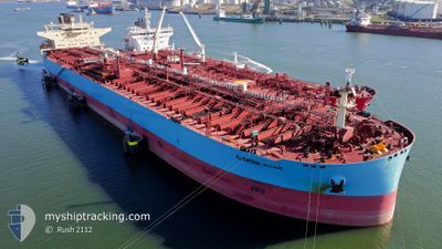
AL KHTAM
Tanker
Current Trip
EG SUZ
| Time Travelled | 8 days |
|---|---|
| Remaining Time | --- |
| Distance Travelled | 2103.58 nm |
| Remaining Distance | --- |
| AVG Speed | 10.8 Knots |
| MAX Speed | 14 Knots |
| AVG Wind | 15.3 knots |
| MAX Wind | 35 knots |
| MIN Temp | 11.2°C / 52.16°F |
| MAX Temp | 23.9°C / 75.02°F |
| Draught | 14.1 m |
| Position Received | 2 d ago |
Current Position
| Longitude | --- |
|---|---|
| Latitude | --- |
| Status | Under way using engine |
| Speed | 12.4 Knots |
| Course | 285.8° |
| Area | Mediterranean Sea - Eastern Basin |
| Station | T-AIS |
| Position Received | 2 d ago |
Info
Information
The current position of AL KHTAM is in Mediterranean Sea - Eastern Basin with coordinates 35.84186° / 17.08635° as reported on 2026-01-06 11:20 by AIS to our vessel tracker app. The vessel's current speed is 12.4 Knots
The vessel AL KHTAM (IMO: 9823534, MMSI: 636020895) is a Tanker It's sailing under the flag of [LR] Liberia.
In this page you can find informations about the vessels current position, last detected port calls, and current voyage information. If the vessels is not in coverage by AIS you will find the latest position.
The current position of AL KHTAM is detected by our AIS receivers and we are not responsible for the reliability of the data. The last position was recorded while the vessel was in Coverage by the Ais receivers of our vessel tracking app.
The current draught of AL KHTAM as reported by AIS is 14.1 meters
Weather
| Temperature | 14.5°C / 58.1°F |
|---|---|
| Wind Speed | 17 knots |
| Direction | 245° WSW |
| Pressure | 1024.4 hPa |
| Humidity | 66.6 % |
| Cloud Coverage | --- |
Featured Company
Last Port Calls
| Port | Arrival | Departure | Time In Port |
|---|---|---|---|
| 2026-01-03 09:45 | 2026-01-03 18:40 | 8 h | |
| 2025-12-30 12:29 | 2025-12-31 17:32 | 1 d | |
| 2025-12-28 07:00 | 2025-12-28 16:08 | 9 h | |
| 2025-12-23 08:06 | 2025-12-26 09:16 | 3 d | |
| 2025-12-15 12:44 | 2025-12-15 22:02 | 9 h | |
| 2025-12-02 09:11 | 2025-12-04 08:29 | 1 d | |
| 2025-11-09 12:27 | 2025-11-09 21:33 | 9 h |
Most Visited Ports (Last year)
| Port | Arrivals | |
|---|---|---|
| 7 | ||
| 4 | ||
| 4 | ||
| 2 | ||
| 1 | ||
| 1 |
Last Trips
| Origin | Departure | Destination | Arrival | Distance | |
|---|---|---|---|---|---|
| 2025-12-31 17:32 | 2026-01-03 09:45 | 516.36 nm | |||
| 2025-12-26 09:16 | 2025-12-30 12:29 | 987.64 nm | |||
| 2025-12-26 09:16 | 2025-12-28 07:00 | 382.46 nm | |||
| 2025-12-04 08:29 | 2025-12-23 08:06 | 3703.10 nm | |||
| 2025-12-04 08:29 | 2025-12-15 12:44 | 3192.89 nm | |||
| 2025-09-20 16:19 | 2025-12-02 09:11 | 4973.90 nm | |||
| 2025-09-20 16:19 | 2025-11-09 12:27 | 8434.54 nm |
Events
| Time | Event | Details | Position / Dest | Info |
|---|---|---|---|---|
| 2026-01-06 11:22 | Status Changed | Default Under way using engine |
35.84435 / 17.07619
EG SUZ
|
Speed: 12.4 kn Course: 285.8° |
| 2026-01-06 11:20 | OUT of Coverage |
35.84186 / 17.08635
Mediterranean Sea - Eastern Basin
|
Speed: 12.4 kn Course: 285.8° |
|
| 2026-01-06 11:06 | Status Changed | Under way using engine Default |
35.82831 / 17.14108
EG SUZ
|
Speed: 12.7 kn Course: 290° |
| 2026-01-06 11:01 | Status Changed | Default Under way using engine |
35.82259 / 17.16291
EG SUZ
|
Speed: 12.7 kn Course: 286.1° |
| 2026-01-06 10:58 | Status Changed | Under way using engine Default |
35.81931 / 17.17610
EG SUZ
|
Speed: 12.8 kn Course: 286° |
| 2026-01-06 10:52 | Status Changed | Default Under way using engine |
35.81412 / 17.19859
EG SUZ
|
Speed: 12.8 kn Course: 285.5° |
| 2026-01-06 10:42 | Status Changed | Under way using engine Default |
35.80350 / 17.24403
EG SUZ
|
Speed: 12.6 kn Course: 286° |
| 2026-01-06 10:35 | IN Coverage |
35.80526 / 17.23647
Mediterranean Sea - Eastern Basin
|
Speed: 12.8 kn Course: 283.2° |
|
| 2026-01-06 09:14 | Status Changed | Default Under way using engine |
35.71798 / 17.60585
EG SUZ
|
Speed: 12.5 kn Course: 287.2° |
| 2026-01-06 09:09 | OUT of Coverage |
35.71234 / 17.62917
Mediterranean Sea - Eastern Basin
|
Speed: 12.5 kn Course: 287.2° |