
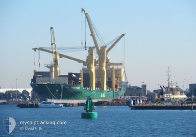
AAL HONG KONG
General Cargo
Current Trip
| Trip Time | 10 mins |
|---|---|
| Trip Distance | 0.56 nm |
| AVG Speed | --- |
| MAX Speed | --- |
| Draught | 8.9 m |
| AVG Wind | 9 knots |
| MAX Wind | 9 knots |
| MIN Temp | 17.5°C / 63.5°F |
| MAX Temp | 17.6°C / 63.68°F |
| Position Received | 4 d ago |
Current Position
| Longitude | 125.31660° |
|---|---|
| Latitude | 35.87787° |
| Status | Under way using engine |
| Speed | 16.2 Knots |
| Course | 207.2° |
| Area | Yellow Sea |
| Station | T-AIS |
| Position Received | 4 d ago |
Info
Information
The current position of AAL HONG KONG is in Yellow Sea with coordinates 35.87787° / 125.31660° as reported on 2024-04-26 02:19 by AIS to our vessel tracker app. The vessel's current speed is 16.2 Knots and is currently inside the port of TAICANG.
The vessel AAL HONG KONG (IMO: 9498468, MMSI: 209083000) is a General Cargo that was built in 2013 ( 11 years old ). It's sailing under the flag of [CY] Cyprus.
In this page you can find informations about the vessels current position, last detected port calls, and current voyage information. If the vessels is not in coverage by AIS you will find the latest position.
The current position of AAL HONG KONG is detected by our AIS receivers and we are not responsible for the reliability of the data. The last position was recorded while the vessel was in Coverage by the Ais receivers of our vessel tracking app.
The current draught of AAL HONG KONG as reported by AIS is 8.9 meters
Weather
| Temperature | 12.9°C / 55.22°F |
|---|---|
| Wind Speed | 9 knots |
| Direction | 322° NW |
| Pressure | 1015 hPa |
| Humidity | 75 % |
| Cloud Coverage | 100 % |
Featured Company
Last Port Calls
| Port | Arrival | Departure | Time In Port |
|---|---|---|---|
| 2024-04-28 05:33 | |||
| 2024-04-27 08:56 | 2024-04-28 05:23 | 20 h | |
| 2024-04-21 09:53 | 2024-04-25 17:15 | 4 d | |
| 2024-04-15 12:33 | 2024-04-20 01:00 | 4 d | |
| 2024-03-26 08:14 | 2024-03-28 06:09 | 1 d | |
| 2024-03-23 01:52 | 2024-03-24 12:35 | 1 d | |
| 2024-03-14 04:22 | 2024-03-21 06:25 | 7 d |
Last Trips
| Origin | Departure | Destination | Arrival | Distance | |
|---|---|---|---|---|---|
| 2024-04-28 13:23 | 2024-04-28 13:33 | 0.56 nm | |||
| 2024-04-26 02:15 | 2024-04-27 16:56 | 526.78 nm | |||
| 2024-04-20 09:00 | 2024-04-21 18:53 | 470.08 nm | |||
| 2024-03-28 17:09 | 2024-04-15 20:33 | 5685.89 nm | |||
| 2024-03-24 23:35 | 2024-03-26 19:14 | 653.14 nm | |||
| 2024-03-21 16:25 | 2024-03-23 12:52 | 490.10 nm |
Events
| Time | Event | Details | Position / Dest | Info |
|---|---|---|---|---|
| 2024-04-28 05:33 | STOP Moving |
31.64243 / 121.22423
[CN] TAICANG
|
Speed: Course: 134° |
|
| 2024-04-28 05:33 | PORT ARRIVAL |
|
31.64243 / 121.22423
[CN] TAICANG
|
Speed: 5 kn Course: 296° |
| 2024-04-28 05:23 | START Moving | 2.41 nm, South East of TAICANG |
31.64160 / 121.23516
CN TAG
|
Speed: 5 kn Course: 296° |
| 2024-04-28 05:23 | PORT DEPARTURE |
|
31.64160 / 121.23516
CN TAG
|
Speed: Course: 134° |
| 2024-04-27 12:26 | STOP Moving |
31.64240 / 121.22423
[CN] TAICANG
|
Speed: Course: 134° |
|
| 2024-04-27 12:22 | START Moving |
31.64426 / 121.22686
[CN] TAICANG
|
Speed: 3.3 kn Course: 202° |
|
| 2024-04-27 09:16 | STOP Moving |
31.64242 / 121.22424
[CN] TAICANG
|
Speed: Course: 134° |
|
| 2024-04-27 08:56 | PORT ARRIVAL |
|
31.64296 / 121.22522
[CN] TAICANG
|
Speed: 3.8 kn Course: 294° |
| 2024-04-26 02:23 | Status Changed | Default Under way using engine |
35.86373 / 125.30502
CN TAG
|
Speed: 16.2 kn Course: 207.2° |
| 2024-04-26 02:19 | OUT of Coverage |
35.87787 / 125.31660
Yellow Sea
CN TAG
|
Speed: 16.2 kn Course: 207.2° |