
ZAKUM
Tanker
Current Trip
| Time Travelled | --- |
|---|---|
| Remaining Time | --- |
| Distance Travelled | 8802.82 nm |
| Remaining Distance | 58.69 nm |
| AVG Speed | 12.1 Knop |
| MAX Speed | 15.8 Knop |
| AVG Wind | 8.1 knots |
| MAX Wind | 27.8 knots |
| MIN Temp | 21.5°C / 70.7°F |
| MAX Temp | 31.7°C / 89.06°F |
| Djupgående | 19.6 m |
| Position mottagen | 4 d sen |
Current Position
| Longitud | 104.21628° |
|---|---|
| Latitude | 1.26897° |
| Status | Under way using engine |
| Fart | 10.5 Knop |
| Kurs | 80.5° |
| Område | Singapore Strait |
| Station | T-AIS |
| Position mottagen | 4 d sen |
Info
Information
The current position of ZAKUM is in Singapore Strait with coordinates 1.26897° / 104.21628° as reported on 2024-05-05 15:21 by AIS to our vessel tracker app. The vessel's current speed is 10.5 Knop and is heading at the port of ZHANJIANG. The estimated time of arrival as calculated by MyShipTracking vessel tracking app is 2024-05-10 00:00 LT
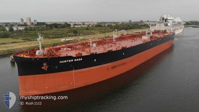
The vessel ZAKUM (IMO: 9851842, MMSI: 636020377) is a Tanker It's sailing under the flag of [LR] Liberia.
In this page you can find informations about the vessels current position, last detected port calls, and current voyage information. If the vessels is not in coverage by AIS you will find the latest position.
The current position of ZAKUM is detected by our AIS receivers and we are not responsible for the reliability of the data. The last position was recorded while the vessel was in Coverage by the Ais receivers of our vessel tracking app.
The current draught of ZAKUM as reported by AIS is 19.6 meters
Weather
| Temperature | 25.6°C / 78.08°F |
|---|---|
| Wind Speed | 16 knots |
| Direction | 94° E |
| Pressure | 1014.6 hPa |
| Humidity | 88.6 % |
| Cloud Coverage | 24 % |
Featured Company
Most Visited Ports (Last year)
| Port | Arrivals | |
|---|---|---|
| 1 | ||
| 1 | ||
| 1 | ||
| 1 | ||
| 1 | ||
| 1 |
Last Trips
| Origin | Departure | Destination | Arrival | Distance |
|---|
Events
| Tid | Event | Detaljer | Position / Dest | Information |
|---|---|---|---|---|
| 2024-05-10 00:44 | STOPPAR förflyttning |
21.24070 / 111.37460
CN ZHA
|
Fart: 0.3 kn Kurs: 93° |
|
| 2024-05-05 15:29 | Status ändrad | Default Under way using engine |
1.27148 / 104.23934
CN ZHA
|
Fart: 10.5 kn Kurs: 80.5° |
| 2024-05-05 15:21 | UTANFÖR täckningsområde |
1.26897 / 104.21628
Singapore Strait
CN ZHA
|
Fart: 10.5 kn Kurs: 80.5° |
|
| 2024-05-05 15:02 | Byter havsområde | Malaysian part of the Singapore Strait Indonesian part of the Singapore Strait |
1.26098 / 104.16139
Singapore Strait
CN ZHA
|
Fart: 10.5 kn Kurs: 74.6° |
| 2024-05-05 12:26 | Byter havsområde | Indonesian part of the Singapore Strait Singaporean part of the Singapore Strait |
1.17108 / 103.80535
Singapore Strait
CN ZHA
|
Fart: 8.2 kn Kurs: 63.3° |
| 2024-05-05 12:14 | Byter havsområde | Singaporean part of the Singapore Strait Indonesian part of the Singapore Strait |
1.15786 / 103.78335
Singapore Strait
CN ZHA
|
Fart: 7.3 kn Kurs: 48° |
| 2024-05-05 09:46 | Destination ändrad | CN ZHA CN SDG |
1.18051 / 103.43743
CN ZHA
|
Fart: 10.3 kn Kurs: 120.7° |
| 2024-05-05 09:46 | ETA ändrat | 2024/05/10 00:00 2024/05/10 08:30 |
1.18051 / 103.43743
CN ZHA
|
Fart: 10.3 kn Kurs: 120.7° |
| 2024-05-05 09:43 | Byter havsområde | Indonesian part of the Singapore Strait Indonesian part of the Malacca Strait |
1.18451 / 103.43152
Singapore Strait
CN SDG
|
Fart: 10.2 kn Kurs: 120.9° |
| 2024-05-05 09:33 | Status ändrad | Under way using engine Default |
1.20069 / 103.40726
CN SDG
|
Fart: 10.1 kn Kurs: 122° |