
ZAKUM
Tanker
Current Trip
| Time Travelled | 51 days |
|---|---|
| Remaining Time | --- |
| Distance Travelled | 9127.09 морская миля |
| Remaining Distance | --- |
| AVG Speed | 11.8 Узлы |
| MAX Speed | 15.8 Узлы |
| AVG Wind | 8.6 knots |
| MAX Wind | 27.8 knots |
| MIN Temp | 17.1°C / 62.78°F |
| MAX Temp | 31.7°C / 89.06°F |
| Осадка | 19.6 м |
| Позиция Получена | 3 d тому назад |
Current Position
| Долгота | 57.26087° |
|---|---|
| Широта | 24.75736° |
| Статус | Under way using engine |
| Скорость | 13 Узлы |
| Курс | 123.5° |
| Район | Gulf of Oman |
| Станция | T-AIS |
| Позиция Получена | 3 d тому назад |
Info
Information
The current position of ZAKUM is in Gulf of Oman with coordinates 24.75736° / 57.26087° as reported on 2024-04-24 10:16 by AIS to our vessel tracker app. The vessel's current speed is 13 Узлы and is heading at the port of SHUIDONG. The estimated time of arrival as calculated by MyShipTracking vessel tracking app is 2024-05-10 08:30 LT
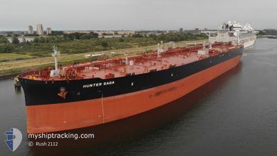
The vessel ZAKUM (IMO: 9851842, MMSI: 636020377) is a Tanker It's sailing under the flag of [LR] Liberia.
In this page you can find informations about the vessels current position, last detected port calls, and current voyage information. If the vessels is not in coverage by AIS you will find the latest position.
The current position of ZAKUM is detected by our AIS receivers and we are not responsible for the reliability of the data. The last position was recorded while the vessel was in Coverage by the Ais receivers of our vessel tracking app.
The current draught of ZAKUM as reported by AIS is 19.6 meters
Weather
| Temperature | 29.4°C / 84.92°F |
|---|---|
| Wind Speed | 6 knots |
| Direction | 348° NNW |
| Pressure | 1009.1 hPa |
| Humidity | 71.7 % |
| Cloud Coverage | 65 % |
Featured Company
Last Port Calls
| Port | Arrival | Departure | Time In Port |
|---|---|---|---|
| 2024-03-07 18:20 | |||
| 2024-02-17 06:27 | 2024-02-21 12:44 | 4 d |
Most Visited Ports (Last year)
| Port | Arrivals | |
|---|---|---|
| 1 | ||
| 1 | ||
| 1 | ||
| 1 | ||
| 1 | ||
| 1 |
Last Trips
| Origin | Departure | Destination | Arrival | Distance | |
|---|---|---|---|---|---|
| 2023-12-21 10:04 | 2024-02-17 14:27 | 12163.66 морская миля |
Events
| Время | Событие | Детали | Позиция / Направление | Информация |
|---|---|---|---|---|
| 2024-04-24 10:24 | Статус изменился | Default Under way using engine |
24.74262 / 57.28518
CN SDG
|
Скорость: 13 kn Курс: 123.5° |
| 2024-04-24 10:16 | Вне покрытия |
24.75736 / 57.26087
Gulf of Oman
CN SDG
|
Скорость: 13 kn Курс: 123.5° |
|
| 2024-04-24 08:05 | Изменение морского района | Omani part of the Gulf of Oman United Arab Emirates part of the Gulf of Oman |
25.05545 / 56.87163
Gulf of Oman
CN SDG
|
Скорость: 13.1 kn Курс: 130.8° |
| 2024-04-24 04:59 | Изменение морского района | United Arab Emirates part of the Gulf of Oman Omani part of the Gulf of Oman |
25.66650 / 56.72190
Gulf of Oman
CN SDG
|
Скорость: 12.7 kn Курс: 176.5° |
| 2024-04-24 03:47 | Изменение морского района | Omani part of the Gulf of Oman Omani part of the Persian Gulf |
25.91334 / 56.72520
Gulf of Oman
CN SDG
|
Скорость: 12.4 kn Курс: 182.6° |
| 2024-04-24 03:46 | В покрытии |
25.91334 / 56.72520
Gulf of Oman
CN SDG
|
Скорость: 12.4 kn Курс: 182.6° |
|
| 2024-04-24 03:45 | Статус изменился | Under way using engine Default |
25.91969 / 56.72569
CN SDG
|
Скорость: 12.5 kn Курс: 181° |
| 2024-04-23 21:36 | Статус изменился | Default Under way using engine |
26.22089 / 55.96487
CN SDG
|
Скорость: 10.7 kn Курс: 29.9° |
| 2024-04-23 21:29 | Вне покрытия |
26.20489 / 55.95039
Persian Gulf
CN SDG
|
Скорость: 10.7 kn Курс: 29.9° |
|
| 2024-04-23 21:13 | Обнаружено в море | Omani part of the Persian Gulf |
26.16882 / 55.91746
Persian Gulf
CN SDG
|
Скорость: 10.3 kn Курс: 32.1° |