
WIND SERVER
Offshore Construction Jack Up
Current Trip
NORDSEE OST WINDFAR
| Time Travelled | --- |
|---|---|
| Remaining Time | --- |
| Distance Travelled | 536.27 nm |
| Remaining Distance | --- |
| AVG Speed | 6.4 Knop |
| MAX Speed | 10.9 Knop |
| AVG Wind | 10.4 knots |
| MAX Wind | 23 knots |
| MIN Temp | 4.4°C / 39.92°F |
| MAX Temp | 14.4°C / 57.92°F |
| Djupgående | 5.3 m |
| Position mottagen | 1 m sen |
Current Position
| Longitud | 7.77709° |
|---|---|
| Latitude | 54.43100° |
| Status | Under way using engine |
| Fart | 5.5 Knop |
| Kurs | 321.1° |
| Område | North Sea |
| Station | T-AIS |
| Position mottagen | 1 m sen |
Info
Information
The current position of WIND SERVER is in North Sea with coordinates 54.43100° / 7.77709° as reported on 2024-05-12 11:06 by AIS to our vessel tracker app. The vessel's current speed is 5.5 Knop
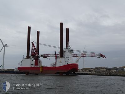
The vessel WIND SERVER (IMO: 9670793, MMSI: 219615000) is a Offshore Construction Jack Up that was built in 2014 ( 10 År gammal ). It's sailing under the flag of [DK] Denmark.
In this page you can find informations about the vessels current position, last detected port calls, and current voyage information. If the vessels is not in coverage by AIS you will find the latest position.
The current position of WIND SERVER is detected by our AIS receivers and we are not responsible for the reliability of the data. The last position was recorded while the vessel was in Coverage by the Ais receivers of our vessel tracking app.
The current draught of WIND SERVER as reported by AIS is 5.3 meters
Weather
| Temperature | 13.5°C / 56.3°F |
|---|---|
| Wind Speed | 12 knots |
| Direction | 96° E |
| Pressure | 1022.3 hPa |
| Humidity | 81.8 % |
| Cloud Coverage | 59 % |
Featured Company
Last Port Calls
Last Trips
| Origin | Departure | Destination | Arrival | Distance |
|---|
Events
| Tid | Event | Detaljer | Position / Dest | Information |
|---|---|---|---|---|
| 2024-05-12 10:42 | Djupgående ändrat | 5.3 5 |
54.38605 / 7.78648
NORDSEE OST WINDFAR
|
Fart: 6.7 kn Kurs: 357.5° |
| 2024-05-12 10:42 | Destination ändrad | NORDSEE OST WINDFAR MEERWIND OST WINDFAR |
54.38605 / 7.78648
NORDSEE OST WINDFAR
|
Fart: 6.7 kn Kurs: 357.5° |
| 2024-05-12 10:42 | ETA ändrat | 2024/05/11 14:00 |
54.38605 / 7.78648
NORDSEE OST WINDFAR
|
Fart: 6.7 kn Kurs: 357.5° |
| 2024-05-12 06:17 | Djupgående ändrat | 5 5.3 |
54.01323 / 8.23586
MEERWIND OST WINDFAR
|
Fart: 9.9 kn Kurs: 280° |
| 2024-05-12 05:41 | Destination ändrad | MEERWIND OST WINDFAR MEERWIND OST |
53.98624 / 8.41811
MEERWIND OST WINDFAR
|
Fart: 9.9 kn Kurs: 280.9° |
| 2024-05-12 05:41 | ETA ändrat | 2024/05/11 14:00 |
53.98624 / 8.41811
MEERWIND OST WINDFAR
|
Fart: 9.9 kn Kurs: 280.9° |
| 2024-05-12 05:11 | Destination ändrad | MEERWIND OST DE CUX>CUXHAVEN |
53.96918 / 8.56971
MEERWIND OST
|
Fart: 9.7 kn Kurs: 278.8° |
| 2024-05-12 04:03 | STARTAR förflyttning | 0.81 nm, North West of ALTENBRUCH |
53.84759 / 8.75571
DE CUX>CUXHAVEN
|
Fart: 3.1 kn Kurs: 334° |
| 2024-05-11 22:38 | STOPPAR förflyttning | 0.97 nm, North West of ALTENBRUCH |
53.84956 / 8.75273
DE CUX>CUXHAVEN
|
Fart: 0.3 kn Kurs: 281° |
| 2024-05-11 20:53 | Djupgående ändrat | 5.3 5 |
53.96402 / 8.56375
DE CUX>CUXHAVEN
|
Fart: 7.1 kn Kurs: 101.1° |