
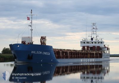
WILSON ONEGA
General Cargo
Current Trip
| Time Travelled | 4 days |
|---|---|
| Remaining Time | 1 h, 17 mins |
| Distance Travelled | 993.57 nm |
| Remaining Distance | 15.77 nm |
| AVG Speed | 9.3 Knop |
| MAX Speed | 11.6 Knop |
| AVG Wind | 12.1 knots |
| MAX Wind | 32 knots |
| MIN Temp | -17.1°C / 1.22°F |
| MAX Temp | 4.1°C / 39.38°F |
| Djupgående | 4.5 m |
| Position mottagen | Nu |
Current Position
| Longitud | --- |
|---|---|
| Latitude | --- |
| Status | Under way using engine |
| Fart | 9.4 Knop |
| Kurs | 130.4° |
| Område | North Sea |
| Station | T-AIS |
| Position mottagen | Nu |
Info
Information
The current position of WILSON ONEGA is in North Sea with coordinates 52.04038° / 3.82929° as reported on 2025-02-17 22:15 by AIS to our vessel tracker app. The vessel's current speed is 9.4 Knop and is heading at the port of ROTTERDAM. The estimated time of arrival as calculated by MyShipTracking vessel tracking app is 2025-02-18 00:33 LT
The vessel WILSON ONEGA (IMO: 9156199, MMSI: 314472000) is a General Cargo that was built in 1997 ( 28 År gammal ). It's sailing under the flag of [BB] Barbados.
In this page you can find informations about the vessels current position, last detected port calls, and current voyage information. If the vessels is not in coverage by AIS you will find the latest position.
The current position of WILSON ONEGA is detected by our AIS receivers and we are not responsible for the reliability of the data. The last position was recorded while the vessel was in Coverage by the Ais receivers of our vessel tracking app.
The current draught of WILSON ONEGA as reported by AIS is 4.5 meters
Weather
| Temperature | 1.7°C / 35.06°F |
|---|---|
| Wind Speed | 15 knots |
| Direction | 99° E |
| Pressure | 1025 hPa |
| Humidity | 54.7 % |
| Cloud Coverage | 80 % |
Featured Company
Last Port Calls
| Port | Arrival | Departure | Time In Port |
|---|---|---|---|
| 2025-02-12 06:47 | 2025-02-13 15:35 | 1 d | |
| 2025-02-06 07:59 | 2025-02-07 18:53 | 1 d | |
| 2025-02-01 07:59 | 2025-02-01 18:32 | 10 h | |
| 2025-01-29 07:01 | 2025-01-29 11:10 | 4 h | |
| 2025-01-27 17:52 | 2025-01-27 23:53 | 6 h | |
| 2025-01-26 19:47 | 2025-01-27 13:57 | 18 h | |
| 2025-01-24 11:18 | 2025-01-24 17:24 | 6 h | |
| 2025-01-23 21:54 | 2025-01-24 10:58 | 13 h | |
| 2025-01-21 06:28 | 2025-01-23 11:25 | 2 d | |
| 2025-01-20 03:05 | 2025-01-20 11:31 | 8 h |
Last Trips
| Origin | Departure | Destination | Arrival | Distance | |
|---|---|---|---|---|---|
| 2025-02-07 18:53 | 2025-02-12 06:47 | 1078.22 nm | |||
| 2025-02-01 18:32 | 2025-02-06 07:59 | 968.66 nm | |||
| 2025-01-29 11:10 | 2025-02-01 07:59 | 465.92 nm | |||
| 2025-01-27 23:53 | 2025-01-29 07:01 | 270.66 nm | |||
| 2025-01-27 13:57 | 2025-01-27 17:52 | 40.14 nm | |||
| 2025-01-24 17:24 | 2025-01-26 19:47 | 519.63 nm | |||
| 2025-01-24 10:58 | 2025-01-24 11:18 | 1.33 nm | |||
| 2025-01-23 11:25 | 2025-01-23 21:54 | 109.26 nm | |||
| 2025-01-20 11:31 | 2025-01-21 06:28 | 110.36 nm | |||
| 2025-01-14 06:14 | 2025-01-20 03:05 | 1091.97 nm |
Events
| Tid | Event | Detaljer | Position / Dest | Information |
|---|---|---|---|---|
| 2025-02-17 19:26 | Status ändrad | Under way using engine Default |
52.47261 / 3.84206
NOMQN > NLRTM
|
Fart: 8.5 kn Kurs: 190° |
| 2025-02-17 19:19 | Status ändrad | Default Under way using engine |
52.48957 / 3.84620
NOMQN > NLRTM
|
Fart: 8.2 kn Kurs: 189.1° |
| 2025-02-17 19:01 | Upptäckt i hav | Dutch part of the North Sea |
52.53087 / 3.85709
North Sea
NOMQN > NLRTM
|
Fart: 8.6 kn Kurs: 189.1° |
| 2025-02-17 19:01 | Status ändrad | Under way using engine Default |
52.53087 / 3.85709
NOMQN > NLRTM
|
Fart: 8.4 kn Kurs: 184° |
| 2025-02-17 18:48 | I täckningsområde |
52.53087 / 3.85709
North Sea
NOMQN > NLRTM
|
Fart: 8.6 kn Kurs: 189.1° |
|
| 2025-02-17 01:46 | Status ändrad | Default Under way using engine |
55.16143 / 4.96037
NOMQN > NLRTM
|
Fart: 10 kn Kurs: 179.3° |
| 2025-02-17 01:27 | UTANFÖR täckningsområde |
55.21262 / 4.96010
North Sea
NOMQN > NLRTM
|
Fart: 10 kn Kurs: 179.3° |
|
| 2025-02-17 00:50 | Byter havsområde | German part of the North Sea Danish part of the North Sea |
55.31680 / 4.96596
North Sea
NOMQN > NLRTM
|
Fart: 10 kn Kurs: 182.5° |
| 2025-02-16 17:35 | Byter havsområde | Danish part of the North Sea Norwegian part of the North Sea |
56.47977 / 4.66491
North Sea
NOMQN > NLRTM
|
Fart: 9.6 kn Kurs: 183.8° |
| 2025-02-16 15:39 | Status ändrad | Under way using engine Default |
56.79049 / 4.70027
NOMQN > NLRTM
|
Fart: 9.8 kn Kurs: 183° |