
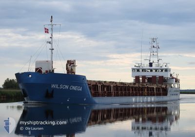
WILSON ONEGA
General Cargo
Current Trip
| Time Travelled | 4 days |
|---|---|
| Remaining Time | --- |
| Distance Travelled | 531.65 nm |
| Remaining Distance | --- |
| AVG Speed | 10.2 Knots |
| MAX Speed | 12.6 Knots |
| AVG Wind | 16.5 knots |
| MAX Wind | 28.8 knots |
| MIN Temp | 0.2°C / 32.36°F |
| MAX Temp | 11°C / 51.8°F |
| Dybgang | 3.4 m |
| Position Modtaget | 21 h, 7 m siden |
Current Position
| Longitude | --- |
|---|---|
| Latitude | --- |
| Status | Under way using engine |
| Fart | 10.7 Knots |
| Kurs | 145.5° |
| Område | Celtic Sea |
| Station | T-AIS |
| Position Modtaget | 21 h, 7 m siden |
Info
Information
The current position of WILSON ONEGA is in Celtic Sea with coordinates 50.93732° / -9.03908° as reported on 2026-01-09 21:18 by AIS to our vessel tracker app. The vessel's current speed is 10.7 Knots and is heading at the port of BILBAO. The estimated time of arrival as calculated by MyShipTracking vessel tracking app is 2026-01-12 00:00 LT
The vessel WILSON ONEGA (IMO: 9156199, MMSI: 314472000) is a General Cargo that was built in 1997 ( 29 år gamle ). It's sailing under the flag of [BB] Barbados.
In this page you can find informations about the vessels current position, last detected port calls, and current voyage information. If the vessels is not in coverage by AIS you will find the latest position.
The current position of WILSON ONEGA is detected by our AIS receivers and we are not responsible for the reliability of the data. The last position was recorded while the vessel was in Coverage by the Ais receivers of our vessel tracking app.
The current draught of WILSON ONEGA as reported by AIS is 3.4 meters
Weather
| Temperature | 11°C / 51.8°F |
|---|---|
| Wind Speed | 11 knots |
| Direction | 214° SW |
| Pressure | 1021.6 hPa |
| Humidity | 71.8 % |
| Cloud Coverage | 88 % |
Featured Company
Last Port Calls
| Port | Arrival | Departure | Time In Port |
|---|---|---|---|
| 2026-01-03 00:46 | 2026-01-05 18:41 | 2 d | |
| 2025-12-25 16:46 | 2025-12-29 22:20 | 4 d | |
| 2025-12-19 13:52 | 2025-12-23 15:28 | 4 d | |
| 2025-12-14 14:20 | 2025-12-15 10:20 | 20 h | |
| 2025-12-10 06:31 | 2025-12-10 22:19 | 15 h | |
| 2025-12-03 09:09 | 2025-12-05 05:42 | 1 d | |
| 2025-11-28 08:55 | 2025-12-02 18:20 | 4 d | |
| 2025-11-24 22:24 | 2025-11-25 21:03 | 22 h | |
| 2025-11-17 10:44 | 2025-11-19 13:40 | 2 d | |
| 2025-11-13 01:56 | 2025-11-14 16:16 | 1 d |
Last Trips
| Origin | Departure | Destination | Arrival | Distance | |
|---|---|---|---|---|---|
| 2025-12-29 22:20 | 2026-01-03 00:46 | 994.38 nm | |||
| 2025-12-23 15:28 | 2025-12-25 16:46 | 416.73 nm | |||
| 2025-12-15 10:20 | 2025-12-19 13:52 | 914.01 nm | |||
| 2025-12-10 22:19 | 2025-12-14 14:20 | 689.43 nm | |||
| 2025-12-05 05:42 | 2025-12-10 06:31 | 996.33 nm | |||
| 2025-12-02 18:20 | 2025-12-03 09:09 | 162.70 nm | |||
| 2025-11-25 21:03 | 2025-11-28 08:55 | 568.25 nm | |||
| 2025-11-19 13:40 | 2025-11-24 22:24 | 812.41 nm | |||
| 2025-11-14 16:16 | 2025-11-17 10:44 | 613.14 nm | |||
| 2025-11-12 10:12 | 2025-11-13 01:56 | 112.95 nm |
Events
| Tid | Hændelsen | Detaljer | Position / Dest | Info |
|---|---|---|---|---|
| 2026-01-09 21:21 | Status er ændret | Default Under way using engine |
50.92833 / -9.03167
GB BEL > ES BIO
|
Fart: 10.7 kn Kurs: 145.5° |
| 2026-01-09 21:18 | Udenfor Dækning |
50.93732 / -9.03908
Celtic Sea
GB BEL > ES BIO
|
Fart: 10.7 kn Kurs: 145.5° |
|
| 2026-01-09 07:51 | Status er ændret | Under way using engine Default |
51.90060 / -7.36169
GB BEL > ES BIO
|
Fart: 10 kn Kurs: 245° |
| 2026-01-09 07:45 | Indenfor Dækning |
51.90002 / -7.36379
Celtic Sea
GB BEL > ES BIO
|
Fart: 7.4 kn Kurs: 246.7° |
|
| 2026-01-09 04:33 | Status er ændret | Default Under way using engine |
52.08833 / -6.47667
GB BEL > ES BIO
|
Fart: 11.5 kn Kurs: 244° |
| 2026-01-09 04:24 | Udenfor Dækning |
52.10174 / -6.43767
Celtic Sea
GB BEL > ES BIO
|
Fart: 11.5 kn Kurs: 244° |
|
| 2026-01-09 03:53 | Ændre havområde | Irish part of the Celtic Sea Irish part of the Irish Sea and St. George's Channel |
52.16134 / -6.30592
Celtic Sea
GB BEL > ES BIO
|
Fart: 12 kn Kurs: 222.7° |
| 2026-01-09 01:28 | Status er ændret | Under way using engine Default |
52.57567 / -6.08495
GB BEL > ES BIO
|
Fart: 9.9 kn Kurs: 188° |
| 2026-01-09 01:23 | Status er ændret | Default Under way using engine |
52.59169 / -6.08197
GB BEL > ES BIO
|
Fart: 9.9 kn Kurs: 186.9° |
| 2026-01-09 01:22 | Status er ændret | Under way using engine Default |
52.59265 / -6.08178
GB BEL > ES BIO
|
Fart: 9.8 kn Kurs: 186° |