
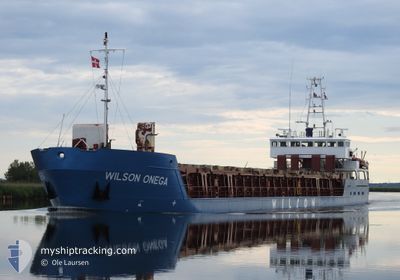
WILSON ONEGA
General Cargo
Current Trip
GBKYL >
| Time Travelled | 4 days |
|---|---|
| Remaining Time | --- |
| Distance Travelled | 914.39 морская миля |
| Remaining Distance | --- |
| AVG Speed | 10 Узлы |
| MAX Speed | 10 Узлы |
| AVG Wind | 11.8 knots |
| MAX Wind | 19.7 knots |
| MIN Temp | 4.7°C / 40.46°F |
| MAX Temp | 11.2°C / 52.16°F |
| Осадка | 3.2 м |
| Позиция Получена | 1 h, 39 m тому назад |
Current Position
| Долгота | -2.78042° |
|---|---|
| Широта | 58.55587° |
| Статус | Under way using engine |
| Скорость | 11.7 Узлы |
| Курс | 126.7° |
| Район | North Sea |
| Станция | T-AIS |
| Позиция Получена | 1 h, 39 m тому назад |
Info
Information
The current position of WILSON ONEGA is in North Sea with coordinates 58.55587° / -2.78042° as reported on 2024-04-25 09:52 by AIS to our vessel tracker app. The vessel's current speed is 11.7 Узлы
The vessel WILSON ONEGA (IMO: 9156199, MMSI: 314472000) is a General Cargo that was built in 1997 ( 27 лет ). It's sailing under the flag of [BB] Barbados.
In this page you can find informations about the vessels current position, last detected port calls, and current voyage information. If the vessels is not in coverage by AIS you will find the latest position.
The current position of WILSON ONEGA is detected by our AIS receivers and we are not responsible for the reliability of the data. The last position was recorded while the vessel was in Coverage by the Ais receivers of our vessel tracking app.
The current draught of WILSON ONEGA as reported by AIS is 3.2 meters
Weather
| Temperature | 6.1°C / 42.98°F |
|---|---|
| Wind Speed | 12 knots |
| Direction | 35° NE |
| Pressure | 1005.7 hPa |
| Humidity | 64.1 % |
| Cloud Coverage | 41 % |
Featured Company
Last Port Calls
| Port | Arrival | Departure | Time In Port |
|---|---|---|---|
| 2024-04-18 19:20 | 2024-04-20 13:05 | 1 d | |
| 2024-04-13 07:10 | 2024-04-16 13:17 | 3 d | |
| 2024-04-06 14:12 | 2024-04-08 14:25 | 2 d | |
| 2024-04-05 06:52 | 2024-04-06 05:19 | 22 h | |
| 2024-04-02 05:13 | 2024-04-03 17:21 | 1 d | |
| 2024-03-27 21:47 | 2024-04-02 04:53 | 5 d | |
| 2024-03-25 06:55 | 2024-03-26 18:19 | 1 d | |
| 2024-03-24 18:42 | 2024-03-25 06:48 | 12 h | |
| 2024-03-19 08:46 | 2024-03-19 20:52 | 12 h | |
| 2024-03-17 17:14 | 2024-03-19 08:37 | 1 d |
Last Trips
| Origin | Departure | Destination | Arrival | Distance | |
|---|---|---|---|---|---|
| 2024-04-16 14:17 | 2024-04-18 21:20 | 569.38 морская миля | |||
| 2024-04-08 16:25 | 2024-04-13 08:10 | 992.55 морская миля | |||
| 2024-04-06 07:19 | 2024-04-06 16:12 | 68.36 морская миля | |||
| 2024-04-03 19:21 | 2024-04-05 08:52 | 350.97 морская миля | |||
| 2024-04-02 06:53 | 2024-04-02 07:13 | 1.48 морская миля | |||
| 2024-03-26 18:19 | 2024-03-27 22:47 | 243.55 морская миля | |||
| 2024-03-25 06:48 | 2024-03-25 06:55 | 0.46 морская миля | |||
| 2024-03-19 21:52 | 2024-03-24 18:42 | 665.07 морская миля | |||
| 2024-03-19 09:37 | 2024-03-19 09:46 | 0.70 морская миля | |||
| 2024-03-17 08:01 | 2024-03-17 18:14 | 104.18 морская миля |
Events
| Время | Событие | Детали | Позиция / Направление | Информация |
|---|---|---|---|---|
| 2024-04-25 09:58 | Статус изменился | Default Under way using engine |
58.54337 / -2.75339
GBKYL >
|
Скорость: 11.7 kn Курс: 126.7° |
| 2024-04-25 09:52 | Вне покрытия |
58.55587 / -2.78042
North Sea
GBKYL >
|
Скорость: 11.7 kn Курс: 126.7° |
|
| 2024-04-25 08:14 | Обнаружено в море | United Kingdom part of the North Sea |
58.73182 / -3.39865
North Sea
GBKYL >
|
Скорость: 11.7 kn Курс: 92.6° |
| 2024-04-25 06:37 | ETA изменился | 2024/04/25 21:00 2024/04/25 16:00 |
58.76733 / -3.94468
GBKYL >
|
Скорость: 9.6 kn Курс: 96° |
| 2024-04-25 05:29 | Изменение морского района | United Kingdom part of the North Atlantic Ocean United Kingdom part of the Inner Seas off the West Coast of Scotland |
58.79004 / -4.29180
North Atlantic Ocean
GBKYL >
|
Скорость: 9.3 kn Курс: 98.2° |
| 2024-04-25 05:26 | Статус изменился | Under way using engine Default |
58.79121 / -4.30569
GBKYL >
|
Скорость: 9 kn Курс: 100° |
| 2024-04-25 05:26 | В покрытии |
58.79004 / -4.29180
North Atlantic Ocean
GBKYL >
|
Скорость: 9.3 kn Курс: 98.2° |
|
| 2024-04-24 22:30 | Статус изменился | Default Under way using engine |
58.21944 / -5.52843
GBKYL >
|
Скорость: 9.5 kn Курс: 25.5° |
| 2024-04-24 22:24 | Статус изменился | Under way using engine Default |
58.20389 / -5.54278
GBKYL >
|
Скорость: 9.3 kn Курс: 26° |
| 2024-04-24 22:24 | Вне покрытия |
58.20389 / -5.54278
Inner Seas off the West Coast of Scotland
GBKYL >
|
Скорость: 9.5 kn Курс: 25.5° |