

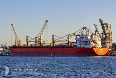
WARRIOR
Cargo

Current Trip
| Time Travelled | 2 days |
|---|---|
| Remaining Time | --- |
| Distance Travelled | 324.16 nm |
| Remaining Distance | --- |
| AVG Speed | 7.1 Knop |
| MAX Speed | 13.9 Knop |
| AVG Wind | 9.2 knots |
| MAX Wind | 17 knots |
| MIN Temp | 11.2°C / 52.16°F |
| MAX Temp | 21.2°C / 70.16°F |
| Djupgående | 8.2 m |
| Position mottagen | 2 m sen |
Current Position
| Longitud | --- |
|---|---|
| Latitude | --- |
| Status | At anchor |
| Fart | |
| Kurs | 190° |
| Område | Strait of Gibraltar |
| Station | T-AIS |
| Position mottagen | 2 m sen |
Information
The current position of WARRIOR is in Strait of Gibraltar with coordinates 36.16266° / -5.37987° as reported on 2025-03-28 14:04 by AIS to our vessel tracker app. The vessel's current speed is 0 Knop
The vessel WARRIOR (IMO: 9605865, MMSI: 311036300) is a Cargo It's sailing under the flag of [BS] Bahamas.
In this page you can find informations about the vessels current position, last detected port calls, and current voyage information. If the vessels is not in coverage by AIS you will find the latest position.
The current position of WARRIOR is detected by our AIS receivers and we are not responsible for the reliability of the data. The last position was recorded while the vessel was in Coverage by the Ais receivers of our vessel tracking app.
The current draught of WARRIOR as reported by AIS is 8.2 meters
Weather
| Temperature | 21.2°C / 70.16°F |
|---|---|
| Wind Speed | 7 knots |
| Direction | 275° W |
| Pressure | 1016.1 hPa |
| Humidity | 47.3 % |
| Cloud Coverage | --- |


Featured Company
Last Port Calls
| Port | Arrival | Departure | Time In Port |
|---|---|---|---|
| 2025-03-21 17:53 | 2025-03-26 02:05 | 4 d | |
| 2025-02-05 13:48 | 2025-02-06 21:33 | 1 d | |
| 2025-01-15 10:17 | 2025-01-16 18:44 | 1 d |
Most Visited Ports (Last year)
| Port | Arrivals | |
|---|---|---|
| 6 | ||
| 5 | ||
| 3 | ||
| 1 | ||
| 1 | ||
| 1 |
Last Trips
| Origin | Departure | Destination | Arrival | Distance | |
|---|---|---|---|---|---|
| 2025-02-06 21:33 | 2025-03-21 17:53 | 4028.93 nm | |||
| 2025-01-16 18:44 | 2025-02-05 13:48 | 2674.96 nm | |||
| 2024-12-27 00:40 | 2025-01-15 10:17 | 4254.70 nm |
Events
| Tid | Event | Detaljer | Position / Dest | Information |
|---|---|---|---|---|
| 2025-03-28 13:37 | Status ändrad | At anchor Default |
36.16243 / -5.37940
MA NDR
|
Fart: Kurs: 208° |
| 2025-03-28 13:36 | ETA ändrat | 2025/03/29 06:00 2025/03/29 08:00 |
36.16249 / -5.37927
MA NDR
|
Fart: Kurs: 208° |
| 2025-03-28 13:34 | Status ändrad | Default At anchor |
36.16243 / -5.37936
MA NDR
|
Fart: Kurs: 208° |
| 2025-03-28 12:10 | Destination ändrad | MA NDR ES ALG |
36.16263 / -5.37984
MA NDR
|
Fart: Kurs: 190° |
| 2025-03-28 12:10 | ETA ändrat | 2025/03/29 08:00 2025/03/27 06:00 |
36.16263 / -5.37984
MA NDR
|
Fart: Kurs: 190° |
| 2025-03-28 09:31 | STOPPAR förflyttning | 0.74 nm, South of CAMPAMENTO |
36.15869 / -5.37940
ES ALG
|
Fart: 0.2 kn Kurs: 335° |
| 2025-03-28 09:19 | Status ändrad | At anchor Under way using engine |
36.15906 / -5.38100
ES ALG
|
Fart: 0.5 kn Kurs: 2° |
| 2025-03-28 08:56 | Byter havsområde | Spanish part of the Strait of Gibraltar Gibraltarian part of the Strait of Gibraltar |
36.14584 / -5.39580
Strait of Gibraltar
|
Fart: 4.9 kn Kurs: 26° |
| 2025-03-28 08:53 | Byter havsområde | Gibraltarian part of the Strait of Gibraltar Spanish part of the Strait of Gibraltar |
36.14214 / -5.39789
Strait of Gibraltar
|
Fart: 4.9 kn Kurs: 15.9° |
| 2025-03-28 08:16 | STARTAR förflyttning | 2.11 nm, South of ALGECIRAS |
36.10216 / -5.41183
ES ALG
|
Fart: 3.2 kn Kurs: 34° |