

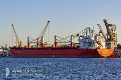
WARRIOR
Cargo

Current Trip
| Time Travelled | 4 h, 59 mins |
|---|---|
| Remaining Time | --- |
| Distance Travelled | 34.52 nm |
| Remaining Distance | --- |
| AVG Speed | 8.8 Knopen |
| MAX Speed | 9.6 Knopen |
| AVG Wind | 10.7 knots |
| MAX Wind | 11 knots |
| MIN Temp | 13.3°C / 55.94°F |
| MAX Temp | 15.7°C / 60.26°F |
| Diepgang | 12.5 M |
| Positie ontvangen | 28 d geleden |
Current Position
| Lengtegraad | --- |
|---|---|
| Breedtegraat | --- |
| Status | At anchor |
| Snelheid | 0.2 Knopen |
| Koers | --- |
| Gebied | North Atlantic Ocean |
| Station | T-AIS |
| Positie ontvangen | 28 d geleden |
Information
The current position of WARRIOR is in North Atlantic Ocean with coordinates 33.13506° / -8.73222° as reported on 2025-02-25 21:20 by AIS to our vessel tracker app. The vessel's current speed is 0.2 Knopen
The vessel WARRIOR (IMO: 9605865, MMSI: 311036300) is a Cargo It's sailing under the flag of [BS] Bahamas.
In this page you can find informations about the vessels current position, last detected port calls, and current voyage information. If the vessels is not in coverage by AIS you will find the latest position.
The current position of WARRIOR is detected by our AIS receivers and we are not responsible for the reliability of the data. The last position was recorded while the vessel was in Coverage by the Ais receivers of our vessel tracking app.
The current draught of WARRIOR as reported by AIS is 12.5 meters
Weather
| Temperature | 15.5°C / 59.9°F |
|---|---|
| Wind Speed | 10 knots |
| Direction | 52° NE |
| Pressure | 1021.4 hPa |
| Humidity | 70.5 % |
| Cloud Coverage | --- |


Featured Company
Last Port Calls
| Port | Arrival | Departure | Time In Port |
|---|---|---|---|
| 2025-03-21 17:53 | 2025-03-26 02:05 | 4 d | |
| 2025-02-05 13:48 | 2025-02-06 21:33 | 1 d | |
| 2025-01-15 10:17 | 2025-01-16 18:44 | 1 d |
Most Visited Ports (Last year)
| Port | Arrivals | |
|---|---|---|
| 6 | ||
| 6 | ||
| 3 | ||
| 1 | ||
| 1 | ||
| 1 |
Last Trips
| Origin | Departure | Destination | Arrival | Distance | |
|---|---|---|---|---|---|
| 2025-02-06 21:33 | 2025-03-21 17:53 | 4028.93 nm | |||
| 2025-01-16 18:44 | 2025-02-05 13:48 | 2674.96 nm | |||
| 2024-12-27 00:40 | 2025-01-15 10:17 | 4254.70 nm |
Events
| Tijd | Evenement | Details | Positie / Bestemming | Info |
|---|---|---|---|---|
| 2025-03-26 02:05 | Vertrekhaven |
|
33.11917 / -8.66836
MA JFL
|
Snelheid: 8.6 kn Koers: 231° |
| 2025-03-26 01:44 | Start beweging |
33.13203 / -8.62868
[MA] JORF LASFAR
|
Snelheid: 4.7 kn Koers: 256° |
|
| 2025-03-21 18:20 | Stop beweging |
33.13332 / -8.62458
[MA] JORF LASFAR
|
Snelheid: 0.2 kn Koers: 122° |
|
| 2025-03-21 17:53 | Aankomsthaven |
|
33.12372 / -8.64143
[MA] JORF LASFAR
|
Snelheid: 6.3 kn Koers: 64° |
| 2025-03-21 16:44 | Start beweging | 5.7 nm, West of JORF LASFAR |
33.14296 / -8.74500
MA JFL
|
Snelheid: 3.6 kn Koers: 65° |
| 2025-03-18 10:26 | Stop beweging | 5.56 nm, West of JORF LASFAR |
33.14093 / -8.74254
MA JFL
|
Snelheid: 0.2 kn Koers: 265° |
| 2025-03-18 07:50 | Start beweging | 7.25 nm, West of JORF LASFAR |
33.12823 / -8.77710
MA JFL
|
Snelheid: 4.1 kn Koers: 261° |
| 2025-03-18 04:28 | Stop beweging | 9.91 nm, West of JORF LASFAR |
33.11455 / -8.82916
MA JFL
|
Snelheid: 0.3 kn Koers: 240° |
| 2025-03-17 14:32 | Start beweging | 6.04 nm, West of JORF LASFAR |
33.13747 / -8.75266
MA JFL
|
Snelheid: 3.8 kn Koers: 228° |