

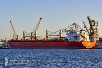
WARRIOR
Cargo

Current Trip
| Time Travelled | 1 day |
|---|---|
| Remaining Time | 4 h, 43 mins |
| Distance Travelled | 291.11 nm |
| Remaining Distance | 27.61 nm |
| AVG Speed | 8.5 Knots |
| MAX Speed | 13.9 Knots |
| AVG Wind | 9.5 knots |
| MAX Wind | 13 knots |
| MIN Temp | 12°C / 53.6°F |
| MAX Temp | 17.3°C / 63.14°F |
| Dybgang | 8.2 m |
| Position Modtaget | Nu |
Current Position
| Longitude | --- |
|---|---|
| Latitude | --- |
| Status | Under way using engine |
| Fart | 3.8 Knots |
| Kurs | 192° |
| Område | Alboran Sea |
| Station | T-AIS |
| Position Modtaget | Nu |
Information
The current position of WARRIOR is in Alboran Sea with coordinates 36.22761° / -4.96216° as reported on 2025-03-27 13:25 by AIS to our vessel tracker app. The vessel's current speed is 3.8 Knots and is heading at the port of ALGECIRAS. The estimated time of arrival as calculated by MyShipTracking vessel tracking app is 2025-03-27 19:09 LT
The vessel WARRIOR (IMO: 9605865, MMSI: 311036300) is a Cargo It's sailing under the flag of [BS] Bahamas.
In this page you can find informations about the vessels current position, last detected port calls, and current voyage information. If the vessels is not in coverage by AIS you will find the latest position.
The current position of WARRIOR is detected by our AIS receivers and we are not responsible for the reliability of the data. The last position was recorded while the vessel was in Coverage by the Ais receivers of our vessel tracking app.
The current draught of WARRIOR as reported by AIS is 8.2 meters
Weather
| Temperature | 17.3°C / 63.14°F |
|---|---|
| Wind Speed | 13 knots |
| Direction | 230° SW |
| Pressure | 1016 hPa |
| Humidity | 71.8 % |
| Cloud Coverage | 63 % |


Featured Company
Last Port Calls
| Port | Arrival | Departure | Time In Port |
|---|---|---|---|
| 2025-03-21 17:53 | 2025-03-26 02:05 | 4 d | |
| 2025-02-05 13:48 | 2025-02-06 21:33 | 1 d | |
| 2025-01-15 10:17 | 2025-01-16 18:44 | 1 d |
Most Visited Ports (Last year)
| Port | Arrivals | |
|---|---|---|
| 6 | ||
| 6 | ||
| 3 | ||
| 1 | ||
| 1 | ||
| 1 |
Last Trips
| Origin | Departure | Destination | Arrival | Distance | |
|---|---|---|---|---|---|
| 2025-02-06 21:33 | 2025-03-21 17:53 | 4028.93 nm | |||
| 2025-01-16 18:44 | 2025-02-05 13:48 | 2674.96 nm | |||
| 2024-12-27 00:40 | 2025-01-15 10:17 | 4254.70 nm |
Events
| Tid | Hændelsen | Detaljer | Position / Dest | Info |
|---|---|---|---|---|
| 2025-03-27 06:58 | Ændre havområde | Spanish part of the Alboran Sea Gibraltarian part of the Alboran Sea |
36.10840 / -4.97408
Alboran Sea
ES ALG
|
Fart: 8.6 kn Kurs: 35.2° |
| 2025-03-27 06:32 | Ændre havområde | Gibraltarian part of the Alboran Sea Spanish part of the Alboran Sea |
36.06270 / -5.03235
Alboran Sea
ES ALG
|
Fart: 9.4 kn Kurs: 52.1° |
| 2025-03-27 05:17 | Ændre havområde | Spanish part of the Alboran Sea Spanish part of the Strait of Gibraltar |
35.99056 / -5.31563
Alboran Sea
ES ALG
|
Fart: 13.6 kn Kurs: 79.8° |
| 2025-03-27 05:05 | Ændre havområde | Spanish part of the Strait of Gibraltar Moroccan part of the Strait of Gibraltar |
35.98116 / -5.37187
Strait of Gibraltar
ES ALG
|
Fart: 13.9 kn Kurs: 75° |
| 2025-03-27 03:04 | Ændre havområde | Moroccan part of the Strait of Gibraltar Moroccan part of the North Atlantic Ocean |
35.90260 / -5.87300
Strait of Gibraltar
ES ALG
|
Fart: 11.2 kn Kurs: 89.1° |
| 2025-03-27 03:04 | Status er ændret | Under way using engine Default |
35.90260 / -5.87300
ES ALG
|
Fart: 11.1 kn Kurs: 89° |
| 2025-03-27 02:56 | Indenfor Dækning |
35.90260 / -5.87300
Strait of Gibraltar
ES ALG
|
Fart: 11.2 kn Kurs: 89.1° |
|
| 2025-03-26 23:51 | Status er ændret | Default Under way using engine |
35.74581 / -6.40180
ES ALG
|
Fart: 8.5 kn Kurs: 11° |
| 2025-03-26 23:50 | Status er ændret | Under way using engine Default |
35.74388 / -6.40233
ES ALG
|
Fart: 8.4 kn Kurs: 6° |
| 2025-03-26 23:50 | Udenfor Dækning |
35.74388 / -6.40233
North Atlantic Ocean
ES ALG
|
Fart: 8.5 kn Kurs: 11° |