

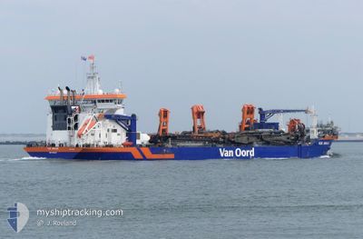
VOX AMALIA
Dredging or underwater ops

Current Trip
| Time Travelled | 15 days |
|---|---|
| Remaining Time | --- |
| Distance Travelled | 1193.37 nm |
| Remaining Distance | --- |
| AVG Speed | 12.1 Knop |
| MAX Speed | 16.2 Knop |
| AVG Wind | 10.5 knots |
| MAX Wind | 29 knots |
| MIN Temp | 4.6°C / 40.28°F |
| MAX Temp | 22.7°C / 72.86°F |
| Djupgående | 6.7 m |
| Position mottagen | 2 m sen |
Current Position
| Longitud | --- |
|---|---|
| Latitude | --- |
| Status | At anchor |
| Fart | 0.8 Knop |
| Kurs | 32° |
| Område | Black Sea |
| Station | T-AIS |
| Position mottagen | 2 m sen |
Information
The current position of VOX AMALIA is in Black Sea with coordinates 44.11282° / 28.79701° as reported on 2025-03-18 00:22 by AIS to our vessel tracker app. The vessel's current speed is 0.8 Knop
The vessel VOX AMALIA (IMO: 9768588, MMSI: 244050240) is a Dredging or underwater ops It's sailing under the flag of [NL] Netherlands.
In this page you can find informations about the vessels current position, last detected port calls, and current voyage information. If the vessels is not in coverage by AIS you will find the latest position.
The current position of VOX AMALIA is detected by our AIS receivers and we are not responsible for the reliability of the data. The last position was recorded while the vessel was in Coverage by the Ais receivers of our vessel tracking app.
The current draught of VOX AMALIA as reported by AIS is 6.7 meters
Weather
| Temperature | 4.6°C / 40.28°F |
|---|---|
| Wind Speed | 25 knots |
| Direction | 1° N |
| Pressure | 1015.2 hPa |
| Humidity | 77.6 % |
| Cloud Coverage | 100 % |


Featured Company
Last Port Calls
| Port | Arrival | Departure | Time In Port |
|---|---|---|---|
| 2025-01-23 17:57 | 2025-03-02 18:36 |
Most Visited Ports (Last year)
| Port | Arrivals | |
|---|---|---|
| 847 | ||
| 11 | ||
| 2 | ||
| 1 | ||
| 1 | ||
| 1 |
Last Trips
| Origin | Departure | Destination | Arrival | Distance | |
|---|---|---|---|---|---|
| 2024-12-20 13:32 | 2025-01-23 17:57 | 379.73 nm |
Events
| Tid | Event | Detaljer | Position / Dest | Information |
|---|---|---|---|---|
| 2025-03-17 12:07 | Status ändrad | At anchor Default |
44.11614 / 28.79543
ROCND
|
Fart: 0.1 kn Kurs: 87° |
| 2025-03-17 12:04 | Status ändrad | Default At anchor |
44.11618 / 28.79544
ROCND
|
Fart: Kurs: 91° |
| 2025-03-17 07:55 | Status ändrad | At anchor Default |
44.11706 / 28.79582
ROCND
|
Fart: Kurs: 133° |
| 2025-03-17 07:52 | Status ändrad | Default At anchor |
44.11707 / 28.79582
ROCND
|
Fart: Kurs: 131° |
| 2025-03-17 07:23 | Status ändrad | At anchor Under way using engine |
44.11719 / 28.79592
ROCND
|
Fart: Kurs: 155° |
| 2025-03-17 05:33 | STOPPAR förflyttning | 5.45 nm, East of CONSTANTA |
44.11548 / 28.79699
ROCND
|
Fart: 0.3 kn Kurs: 117° |
| 2025-03-17 04:53 | ETA ändrat | 2025/03/17 06:00 2025/03/17 04:00 |
44.05049 / 28.81943
ROCND
|
Fart: 10.6 kn Kurs: 343.4° |
| 2025-03-17 04:25 | Byter havsområde | Romanian part of the Black Sea Turkish part of the Black Sea |
43.96880 / 28.84634
Black Sea
ROCND
|
Fart: 11 kn Kurs: 349° |
| 2025-03-17 04:25 | Status ändrad | Under way using engine Default |
43.96880 / 28.84634
ROCND
|
Fart: 11 kn Kurs: 349° |
| 2025-03-17 04:22 | I täckningsområde |
43.96880 / 28.84634
Black Sea
ROCND
|
Fart: 11 kn Kurs: 349° |