

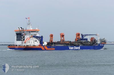
VOX AMALIA
Dredging or underwater ops

Current Trip
| Time Travelled | 14 days |
|---|---|
| Remaining Time | 53 mins |
| Distance Travelled | 1182.03 nm |
| Remaining Distance | 12.19 nm |
| AVG Speed | 12.2 Noeuds |
| MAX Speed | 16.2 Noeuds |
| AVG Wind | 10.4 knots |
| MAX Wind | 29 knots |
| MIN Temp | 7.2°C / 44.96°F |
| MAX Temp | 22.7°C / 72.86°F |
| Tirant d eau | 6.7 m |
| Position reçue | 2 m depuis |
Current Position
| Longitude | --- |
|---|---|
| Latitude | --- |
| Etat | Under way using engine |
| Vitesse | 11 Noeuds |
| Parcours | 349° |
| Zone | Black Sea |
| Station | T-AIS |
| Position reçue | 2 m depuis |
Information
The current position of VOX AMALIA is in Black Sea with coordinates 43.96880° / 28.84634° as reported on 2025-03-17 04:25 by AIS to our vessel tracker app. The vessel's current speed is 11 Noeuds and is heading at the port of CONSTANTA. The estimated time of arrival as calculated by MyShipTracking vessel tracking app is 2025-03-17 07:20 LT
The vessel VOX AMALIA (IMO: 9768588, MMSI: 244050240) is a Dredging or underwater ops It's sailing under the flag of [NL] Netherlands.
In this page you can find informations about the vessels current position, last detected port calls, and current voyage information. If the vessels is not in coverage by AIS you will find the latest position.
The current position of VOX AMALIA is detected by our AIS receivers and we are not responsible for the reliability of the data. The last position was recorded while the vessel was in Coverage by the Ais receivers of our vessel tracking app.
The current draught of VOX AMALIA as reported by AIS is 6.7 meters
Weather
| Temperature | 7.2°C / 44.96°F |
|---|---|
| Wind Speed | 4 knots |
| Direction | 100° E |
| Pressure | 1009.5 hPa |
| Humidity | 86.2 % |
| Cloud Coverage | 15 % |


Featured Company
Last Port Calls
| Port | Arrival | Departure | Time In Port |
|---|---|---|---|
| 2025-01-23 17:57 | 2025-03-02 18:36 |
Most Visited Ports (Last year)
| Port | Arrivals | |
|---|---|---|
| 847 | ||
| 11 | ||
| 2 | ||
| 1 | ||
| 1 | ||
| 1 |
Last Trips
| Origin | Departure | Destination | Arrival | Distance | |
|---|---|---|---|---|---|
| 2024-12-20 13:32 | 2025-01-23 17:57 | 379.73 nm |
Events
| Heure | Evenement | Détails | Position/ Destination | Info |
|---|---|---|---|---|
| 2025-03-17 04:25 | Changement de zone | Romanian part of the Black Sea Turkish part of the Black Sea |
43.96880 / 28.84634
Black Sea
ROCND
|
Vitesse: 11 kn Parcours: 349° |
| 2025-03-17 04:25 | Etat Changé | Under way using engine Default |
43.96880 / 28.84634
ROCND
|
Vitesse: 11 kn Parcours: 349° |
| 2025-03-17 04:22 | Dans la zone couverte |
43.96880 / 28.84634
Black Sea
ROCND
|
Vitesse: 11 kn Parcours: 349° |
|
| 2025-03-16 13:40 | Etat Changé | Default Under way using engine |
41.51815 / 29.23215
ROCND
|
Vitesse: 9.1 kn Parcours: 355° |
| 2025-03-16 13:28 | Hors de la zone couverte |
41.48860 / 29.23500
Black Sea
ROCND
|
Vitesse: 9.1 kn Parcours: 355° |
|
| 2025-03-16 11:44 | Changement de zone | Turkish part of the Black Sea Turkish part of the Sea of Marmara |
41.23388 / 29.15173
Black Sea
ROCND
|
Vitesse: 9.5 kn Parcours: 42.2° |
| 2025-03-16 08:15 | Démarrage | 9.48 nm, South of YESILKOY |
40.79800 / 28.84387
ROCND
|
Vitesse: 3.3 kn Parcours: 72° |
| 2025-03-15 23:03 | Arret | 9.41 nm, South of YESILKOY |
40.79904 / 28.84178
ROCND
|
Vitesse: Parcours: 117° |
| 2025-03-15 21:59 | Démarrage | 1 nm, South of BAKIRKOY |
40.95675 / 28.88195
ROCND
|
Vitesse: 6.1 kn Parcours: 110.3° |
| 2025-03-15 21:54 | Etat Changé | Under way using engine At anchor |
40.95759 / 28.87703
ROCND
|
Vitesse: 0.5 kn Parcours: 54° |