
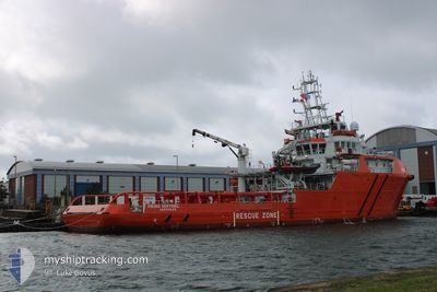
VIKING SENTINEL
Other Type
Current Trip
FALMOUTH
| Time Travelled | 1 day |
|---|---|
| Remaining Time | --- |
| Distance Travelled | 55.32 nm |
| Remaining Distance | --- |
| AVG Speed | 7.6 Knop |
| MAX Speed | 11.2 Knop |
| AVG Wind | 12.8 knots |
| MAX Wind | 16.9 knots |
| MIN Temp | 13.8°C / 56.84°F |
| MAX Temp | 20.3°C / 68.54°F |
| Djupgående | 4.8 m |
| Position mottagen | 57 m sen |
Current Position
| Longitud | -4.62293° |
|---|---|
| Latitude | 50.28926° |
| Status | At anchor |
| Fart | 0.4 Knop |
| Kurs | 3° |
| Område | English Channel |
| Station | T-AIS |
| Position mottagen | 57 m sen |
Info
Information
The current position of VIKING SENTINEL is in English Channel with coordinates 50.28926° / -4.62293° as reported on 2024-09-19 21:02 by AIS to our vessel tracker app. The vessel's current speed is 0.4 Knop
The vessel VIKING SENTINEL (IMO: 9720718, MMSI: 232042695) is a Other Type It's sailing under the flag of [GB] United Kingdom.
In this page you can find informations about the vessels current position, last detected port calls, and current voyage information. If the vessels is not in coverage by AIS you will find the latest position.
The current position of VIKING SENTINEL is detected by our AIS receivers and we are not responsible for the reliability of the data. The last position was recorded while the vessel was in Coverage by the Ais receivers of our vessel tracking app.
The current draught of VIKING SENTINEL as reported by AIS is 4.8 meters
Weather
| Temperature | 18.4°C / 65.12°F |
|---|---|
| Wind Speed | 15 knots |
| Direction | 54° NE |
| Pressure | 1020.8 hPa |
| Humidity | 74.7 % |
| Cloud Coverage | 6 % |
Featured Company
Last Port Calls
| Port | Arrival | Departure | Time In Port |
|---|---|---|---|
| 2024-09-17 16:40 | 2024-09-18 16:45 | 1 d | |
| 2024-08-20 17:49 | 2024-08-21 18:07 | 1 d | |
| 2024-07-23 16:56 | 2024-07-25 18:48 | 2 d |
Most Visited Ports (Last year)
| Port | Arrivals | |
|---|---|---|
| 9 | ||
| 2 | ||
| 1 | ||
| 1 | ||
| 1 |
Last Trips
| Origin | Departure | Destination | Arrival | Distance | |
|---|---|---|---|---|---|
| 2024-08-21 19:07 | 2024-09-17 17:40 | 1482.62 nm | |||
| 2024-07-25 19:48 | 2024-08-20 18:49 | 1981.15 nm | |||
| 2024-06-26 18:18 | 2024-07-23 17:56 | 2025.33 nm |
Events
| Tid | Event | Detaljer | Position / Dest | Information |
|---|---|---|---|---|
| 2024-09-19 17:19 | Status ändrad | At anchor Under way using engine |
50.29030 / -4.62126
FALMOUTH
|
Fart: 0.4 kn Kurs: 219° |
| 2024-09-19 17:18 | STOPPAR förflyttning | 2.66 nm, South of FOWEY |
50.29020 / -4.62134
FALMOUTH
|
Fart: 0.3 kn Kurs: 255° |
| 2024-09-19 11:38 | STARTAR förflyttning | 3.2 nm, North East of SAINT MAWES |
50.18062 / -4.93924
FALMOUTH
|
Fart: 5.5 kn Kurs: 180.5° |
| 2024-09-19 11:32 | Status ändrad | Under way using engine At anchor |
50.18246 / -4.93744
FALMOUTH
|
Fart: 0.6 kn Kurs: 134° |
| 2024-09-19 06:52 | I täckningsområde |
50.18223 / -4.93767
English Channel
|
Fart: Kurs: 134.4° |
|
| 2024-09-18 22:51 | UTANFÖR täckningsområde |
50.18256 / -4.93754
English Channel
|
Fart: Kurs: 17.2° |
|
| 2024-09-18 18:23 | Djupgående ändrat | 4.8 4.9 |
50.18300 / -4.93721
FALMOUTH
|
Fart: 0.1 kn Kurs: 107° |
| 2024-09-18 18:03 | Status ändrad | At anchor Under way using engine |
50.18261 / -4.93574
FALMOUTH
|
Fart: 0.6 kn Kurs: 141° |
| 2024-09-18 17:57 | STOPPAR förflyttning | 3.36 nm, North East of SAINT MAWES |
50.18156 / -4.93542
FALMOUTH
|
Fart: 0.2 kn Kurs: 249° |
| 2024-09-18 17:01 | Status ändrad | Under way using engine Moored |
50.13343 / -5.02114
FALMOUTH
|
Fart: 8.2 kn Kurs: 167.1° |