
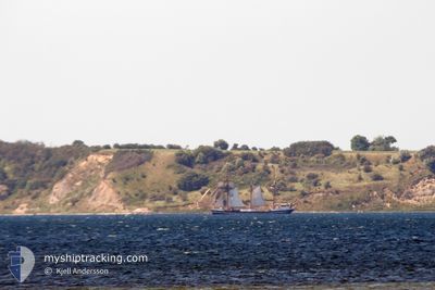
THOR HEYERDAHL
Passengers Ship
Current Trip
| Time Travelled | 1 day |
|---|---|
| Remaining Time | --- |
| Distance Travelled | 68.72 nm |
| Remaining Distance | --- |
| AVG Speed | 5.5 Knop |
| MAX Speed | 8.5 Knop |
| AVG Wind | 16.9 knots |
| MAX Wind | 23 knots |
| MIN Temp | 12.4°C / 54.32°F |
| MAX Temp | 16°C / 60.8°F |
| Djupgående | 3 m |
| Position mottagen | 2 m sen |
Current Position
| Longitud | 10.18090° |
|---|---|
| Latitude | 55.07547° |
| Status | At anchor |
| Fart | 0.7 Knop |
| Kurs | 66° |
| Område | Kattegat |
| Station | T-AIS |
| Position mottagen | 2 m sen |
Info
Information
The current position of THOR HEYERDAHL is in Kattegat with coordinates 55.07547° / 10.18090° as reported on 2024-05-22 09:54 by AIS to our vessel tracker app. The vessel's current speed is 0.7 Knop
The vessel THOR HEYERDAHL (IMO: 5221491, MMSI: 211232340) is a Passengers Ship that was built in 1931 ( 93 År gammal ). It's sailing under the flag of [DE] Germany.
In this page you can find informations about the vessels current position, last detected port calls, and current voyage information. If the vessels is not in coverage by AIS you will find the latest position.
The current position of THOR HEYERDAHL is detected by our AIS receivers and we are not responsible for the reliability of the data. The last position was recorded while the vessel was in Coverage by the Ais receivers of our vessel tracking app.
The current draught of THOR HEYERDAHL as reported by AIS is 3 meters
Weather
| Temperature | 14.3°C / 57.74°F |
|---|---|
| Wind Speed | 22 knots |
| Direction | 85° E |
| Pressure | 1009.3 hPa |
| Humidity | 87.6 % |
| Cloud Coverage | 100 % |
Featured Company
Last Port Calls
| Port | Arrival | Departure | Time In Port |
|---|---|---|---|
| 2024-05-20 10:39 | 2024-05-20 20:02 | 9 h | |
| 2024-05-16 15:28 | 2024-05-17 19:01 | 1 d | |
| 2024-05-15 15:01 | 2024-05-15 20:00 | 4 h | |
| 2024-05-14 13:56 | 2024-05-14 16:47 | 2 h | |
| 2024-05-13 10:07 | 2024-05-13 18:37 | 8 h | |
| 2024-05-09 09:05 | 2024-05-09 17:59 | 8 h | |
| 2024-05-06 16:28 | 2024-05-07 12:05 | 19 h | |
| 2024-04-20 09:21 | 2024-05-03 20:16 | 13 d | |
| 2024-04-18 15:35 | 2024-04-18 20:12 | 4 h | |
| 2024-04-15 20:22 | 2024-04-18 06:36 | 2 d |
Most Visited Ports (Last year)
| Port | Arrivals | |
|---|---|---|
| 44 | ||
| 3 | ||
| 3 | ||
| 2 | ||
| 2 | ||
| 2 |
Last Trips
| Origin | Departure | Destination | Arrival | Distance | |
|---|---|---|---|---|---|
| 2024-05-17 19:01 | 2024-05-20 10:39 | 70.90 nm | |||
| 2024-05-15 20:00 | 2024-05-16 15:28 | 60.27 nm | |||
| 2024-05-14 16:47 | 2024-05-15 15:01 | 59.39 nm | |||
| 2024-05-13 18:37 | 2024-05-14 13:56 | 1.27 nm | |||
| 2024-05-09 17:59 | 2024-05-13 10:07 | 81.88 nm | |||
| 2024-05-07 12:05 | 2024-05-09 09:05 | 84.48 nm | |||
| 2024-05-03 20:16 | 2024-05-06 16:28 | 67.09 nm | |||
| 2024-04-18 20:12 | 2024-04-20 09:21 | 2.51 nm | |||
| 2024-04-18 06:36 | 2024-04-18 15:35 | 50.03 nm | |||
| 2024-04-15 11:09 | 2024-04-15 20:22 | 55.42 nm |
Events
| Tid | Event | Detaljer | Position / Dest | Information |
|---|---|---|---|---|
| 2024-05-21 21:10 | Status ändrad | At anchor Under way using engine |
55.07563 / 10.17902
KIEL
|
Fart: 0.1 kn Kurs: 79° |
| 2024-05-21 21:09 | STOPPAR förflyttning | 2.25 nm, South West of FAABORG |
55.07568 / 10.17901
KIEL
|
Fart: 0.3 kn Kurs: 88° |
| 2024-05-21 19:30 | Status ändrad | Under way using engine Under way sailing |
55.06435 / 10.04596
KIEL
|
Fart: 3.6 kn Kurs: 28° |
| 2024-05-21 17:08 | Byter havsområde | Danish part of the Kattegat Danish part of the Baltic Sea |
54.81326 / 10.31048
Kattegat
KIEL
|
Fart: 7 kn Kurs: 338.2° |
| 2024-05-21 16:01 | STARTAR förflyttning | 8.63 nm, South West of MARSTAL |
54.74705 / 10.36232
KIEL
|
Fart: 3.4 kn Kurs: 152° |
| 2024-05-21 15:58 | STOPPAR förflyttning | 8.55 nm, South West of MARSTAL |
54.74898 / 10.36197
KIEL
|
Fart: 0.3 kn Kurs: 139° |
| 2024-05-21 15:14 | STARTAR förflyttning | 8.36 nm, South West of MARSTAL |
54.74265 / 10.38458
KIEL
|
Fart: 3.1 kn Kurs: 338° |
| 2024-05-21 15:11 | STOPPAR förflyttning | 8.4 nm, South West of MARSTAL |
54.74117 / 10.38663
KIEL
|
Fart: 0.3 kn Kurs: 340° |
| 2024-05-21 14:14 | Byter havsområde | Danish part of the Baltic Sea Danish part of the Kattegat |
54.81501 / 10.36652
Baltic Sea
KIEL
|
Fart: 5.2 kn Kurs: 177.5° |
| 2024-05-21 13:58 | STARTAR förflyttning | 3.92 nm, South West of AEROSKOBING |
54.83482 / 10.35914
KIEL
|
Fart: 3.1 kn Kurs: 146° |