
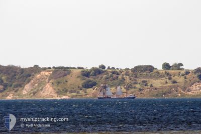
THOR HEYERDAHL
Passengers Ship
Current Trip
| Time Travelled | 8 h, 35 mins |
|---|---|
| Remaining Time | --- |
| Distance Travelled | 20.35 nm |
| Remaining Distance | --- |
| AVG Speed | 5 Knopen |
| MAX Speed | 5.8 Knopen |
| AVG Wind | 8.5 knots |
| MAX Wind | 10 knots |
| MIN Temp | 10.4°C / 50.72°F |
| MAX Temp | 13.9°C / 57.02°F |
| Diepgang | 3 M |
| Positie ontvangen | Nu |
Current Position
| Lengtegraad | 10.27462° |
|---|---|
| Breedtegraat | 54.68871° |
| Status | Under way sailing |
| Snelheid | 1.2 Knopen |
| Koers | 357° |
| Gebied | Baltic Sea |
| Station | T-AIS |
| Positie ontvangen | Nu |
Info
Information
The current position of THOR HEYERDAHL is in Baltic Sea with coordinates 54.68871° / 10.27462° as reported on 2024-05-04 02:51 by AIS to our vessel tracker app. The vessel's current speed is 1.2 Knopen
The vessel THOR HEYERDAHL (IMO: 5221491, MMSI: 211232340) is a Passengers Ship that was built in 1931 ( 93 Jaar oud ). It's sailing under the flag of [DE] Germany.
In this page you can find informations about the vessels current position, last detected port calls, and current voyage information. If the vessels is not in coverage by AIS you will find the latest position.
The current position of THOR HEYERDAHL is detected by our AIS receivers and we are not responsible for the reliability of the data. The last position was recorded while the vessel was in Coverage by the Ais receivers of our vessel tracking app.
The current draught of THOR HEYERDAHL as reported by AIS is 3 meters
Weather
| Temperature | 10.5°C / 50.9°F |
|---|---|
| Wind Speed | 7 knots |
| Direction | 259° W |
| Pressure | 1014.2 hPa |
| Humidity | 91.1 % |
| Cloud Coverage | 92 % |
Featured Company
Last Port Calls
| Port | Arrival | Departure | Time In Port |
|---|---|---|---|
| 2024-04-20 07:21 | 2024-05-03 18:16 | 13 d | |
| 2024-04-18 13:35 | 2024-04-18 18:12 | 4 h | |
| 2024-04-15 18:22 | 2024-04-18 04:36 | 2 d | |
| 2024-04-10 06:09 | 2024-04-15 09:09 | 5 d |
Most Visited Ports (Last year)
| Port | Arrivals | |
|---|---|---|
| 42 | ||
| 4 | ||
| 3 | ||
| 2 | ||
| 2 | ||
| 2 |
Last Trips
| Origin | Departure | Destination | Arrival | Distance | |
|---|---|---|---|---|---|
| 2024-04-18 20:12 | 2024-04-20 09:21 | 2.51 nm | |||
| 2024-04-18 06:36 | 2024-04-18 15:35 | 50.03 nm | |||
| 2024-04-15 11:09 | 2024-04-15 20:22 | 55.42 nm | |||
| 2024-02-14 14:10 | 2024-04-10 08:09 | 3648.37 nm |
Events
| Tijd | Evenement | Details | Positie / Bestemming | Info |
|---|---|---|---|---|
| 2024-05-04 00:04 | Start beweging | 8.34 nm, East of DAMP |
54.61149 / 10.26119
KIEL
|
Snelheid: 3.1 kn Koers: 354° |
| 2024-05-03 22:37 | Stop beweging | 7.4 nm, East of DAMP |
54.57545 / 10.23936
KIEL
|
Snelheid: 0.3 kn Koers: 47° |
| 2024-05-03 19:36 | Status Changed | Under way sailing Under way using engine |
54.47160 / 10.24282
KIEL
|
Snelheid: 3.2 kn Koers: 351° |
| 2024-05-03 19:29 | Wijzig zee gebeid | German part of the Baltic Sea German part of the North Sea |
54.46508 / 10.24243
Baltic Sea
KIEL
|
Snelheid: 3.4 kn Koers: 0.5° |
| 2024-05-03 18:16 | Vertrekhaven |
|
54.36378 / 10.17544
KIEL
|
Snelheid: 4.9 kn Koers: 11° |
| 2024-05-03 17:41 | Start beweging |
54.32948 / 10.17643
[DE] KIEL
|
Snelheid: 3.1 kn Koers: 297° |
|
| 2024-05-03 17:32 | Status Changed | Under way using engine Moored |
54.32860 / 10.17898
[DE] KIEL
|
Snelheid: Koers: 287° |
| 2024-05-03 12:52 | ETA Changed | 2024/05/09 14:00 2025/04/22 14:00 |
54.32860 / 10.17895
[DE] KIEL
|
Snelheid: Koers: 288° |
| 2024-05-03 11:39 | Status Changed | Moored Under way using engine |
54.32859 / 10.17897
[DE] KIEL
|
Snelheid: Koers: 290° |
| 2024-05-03 11:22 | Stop beweging |
54.32903 / 10.18048
[DE] KIEL
|
Snelheid: 0.3 kn Koers: 182° |