
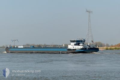
THEODELA C
Tanker
Current Trip
| Time Travelled | 21 h, 33 mins |
|---|---|
| Remaining Time | 7 h, 23 mins |
| Distance Travelled | 222.46 nm |
| Remaining Distance | 97.23 nm |
| AVG Speed | 11.5 Knop |
| MAX Speed | 12.9 Knop |
| AVG Wind | 3.8 knots |
| MAX Wind | 7 knots |
| MIN Temp | 11.8°C / 53.24°F |
| MAX Temp | 25.2°C / 77.36°F |
| Djupgående | 1.5 m |
| Position mottagen | 31 m sen |
Current Position
| Longitud | 6.59844° |
|---|---|
| Latitude | 51.58875° |
| Status | Under way using engine |
| Fart | 11.7 Knop |
| Kurs | 359.7° |
| Område | North Sea |
| Station | T-AIS |
| Position mottagen | 31 m sen |
Info
Information
The current position of THEODELA C is in North Sea with coordinates 51.58875° / 6.59844° as reported on 2024-04-30 21:46 by AIS to our vessel tracker app. The vessel's current speed is 11.7 Knop and is heading at the port of MOERDIJK. The estimated time of arrival as calculated by MyShipTracking vessel tracking app is 2024-05-01 05:40 LT
The vessel THEODELA C (MMSI: 205420690) is a Tanker It's sailing under the flag of [BE] Belgium.
In this page you can find informations about the vessels current position, last detected port calls, and current voyage information. If the vessels is not in coverage by AIS you will find the latest position.
The current position of THEODELA C is detected by our AIS receivers and we are not responsible for the reliability of the data. The last position was recorded while the vessel was in Coverage by the Ais receivers of our vessel tracking app.
The current draught of THEODELA C as reported by AIS is 1.5 meters
Weather
| Temperature | 16.3°C / 61.34°F |
|---|---|
| Wind Speed | 7 knots |
| Direction | 3° N |
| Pressure | 1011 hPa |
| Humidity | 81.8 % |
| Cloud Coverage | 100 % |
Featured Company
Last Port Calls
| Port | Arrival | Departure | Time In Port |
|---|---|---|---|
| 2024-04-29 09:42 | 2024-04-30 00:44 | 15 h | |
| 2024-04-21 11:49 | 2024-04-26 14:25 | 5 d | |
| 2024-04-21 11:05 | 2024-04-21 11:36 | 31 m | |
| 2024-04-18 15:45 | 2024-04-19 15:35 | 23 h | |
| 2024-04-16 07:28 | 2024-04-16 08:23 | 54 m | |
| 2024-04-15 19:16 | 2024-04-16 04:25 | 9 h | |
| 2024-04-15 08:09 | 2024-04-15 09:13 | 1 h | |
| 2024-04-14 18:40 | 2024-04-15 04:09 | 9 h | |
| 2024-04-14 16:37 | 2024-04-14 16:47 | 10 m | |
| 2024-04-08 18:17 | 2024-04-14 12:01 | 5 d |
Last Trips
| Origin | Departure | Destination | Arrival | Distance | |
|---|---|---|---|---|---|
| 2024-04-26 16:25 | 2024-04-29 11:42 | 323.26 nm | |||
| 2024-04-21 13:36 | 2024-04-21 13:49 | 2.27 nm | |||
| 2024-04-19 17:35 | 2024-04-21 13:05 | 317.16 nm | |||
| 2024-04-16 10:23 | 2024-04-18 17:45 | 188.50 nm | |||
| 2024-04-16 06:25 | 2024-04-16 09:28 | 14.17 nm | |||
| 2024-04-15 11:13 | 2024-04-15 21:16 | 47.94 nm | |||
| 2024-04-15 06:09 | 2024-04-15 10:09 | 21.38 nm | |||
| 2024-04-14 18:47 | 2024-04-14 20:40 | 9.36 nm | |||
| 2024-04-14 14:01 | 2024-04-14 18:37 | 31.92 nm | |||
| 2024-04-08 20:05 | 2024-04-08 20:17 | 2.03 nm |
Events
| Tid | Event | Detaljer | Position / Dest | Information |
|---|---|---|---|---|
| 2024-04-30 21:49 | Status ändrad | Default Under way using engine |
51.59667 / 6.59667
MOERDIJK
|
Fart: 11.7 kn Kurs: 359.7° |
| 2024-04-30 13:21 | Status ändrad | Under way using engine Default |
50.50330 / 7.31198
MOERDIJK
|
Fart: 12 kn Kurs: 331° |
| 2024-04-30 13:21 | I täckningsområde |
50.50779 / 7.30674
North Sea
MOERDIJK
|
Fart: 12 kn Kurs: 324° |
|
| 2024-04-30 08:49 | UTANFÖR täckningsområde |
49.97796 / 7.96271
North Sea
MOERDIJK
|
Fart: 10.6 kn Kurs: 255.3° |
|
| 2024-04-30 06:52 | Status ändrad | Under way using engine Default |
49.90828 / 8.35444
MOERDIJK
|
Fart: 10 kn Kurs: 279° |
| 2024-04-30 06:07 | Status ändrad | Default Under way using engine |
49.79833 / 8.40333
MOERDIJK
|
Fart: 10.5 kn Kurs: 343.1° |
| 2024-04-30 05:20 | Status ändrad | Under way using engine Default |
49.71849 / 8.43110
MOERDIJK
|
Fart: 9 kn Kurs: 344° |
| 2024-04-30 05:20 | I täckningsområde |
49.71849 / 8.43110
North Sea
MOERDIJK
|
Fart: 11.1 kn Kurs: 57.7° |
|
| 2024-04-30 04:40 | Status ändrad | Default Under way using engine |
49.63500 / 8.37667
MOERDIJK
|
Fart: 9.9 kn Kurs: 333.3° |
| 2024-04-30 04:04 | UTANFÖR täckningsområde |
49.54824 / 8.41889
North Sea
MOERDIJK
|
Fart: 9.9 kn Kurs: 333.3° |