
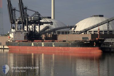
TANG LAND
Bulk Carrier
Current Trip
EMBA TR
| Time Travelled | 6 days |
|---|---|
| Remaining Time | --- |
| Distance Travelled | 1315.36 nm |
| Remaining Distance | --- |
| AVG Speed | 9.7 Knop |
| MAX Speed | 11.8 Knop |
| AVG Wind | 14.2 knots |
| MAX Wind | 27.7 knots |
| MIN Temp | 5°C / 41°F |
| MAX Temp | 15.4°C / 59.72°F |
| Djupgående | 14.1 m |
| Position mottagen | 3 d sen |
Current Position
| Longitud | 8.95657° |
|---|---|
| Latitude | 67.45282° |
| Status | Under way using engine |
| Fart | 9.2 Knop |
| Kurs | 216.7° |
| Område | Norwegian Sea |
| Station | T-AIS |
| Position mottagen | 3 d sen |
Info
Information
The current position of TANG LAND is in Norwegian Sea with coordinates 67.45282° / 8.95657° as reported on 2024-06-02 23:24 by AIS to our vessel tracker app. The vessel's current speed is 9.2 Knop
The vessel TANG LAND (IMO: 9233595, MMSI: 352001788) is a Bulk Carrier that was built in 2001 ( 23 År gammal ). It's sailing under the flag of [PA] Panama.
In this page you can find informations about the vessels current position, last detected port calls, and current voyage information. If the vessels is not in coverage by AIS you will find the latest position.
The current position of TANG LAND is detected by our AIS receivers and we are not responsible for the reliability of the data. The last position was recorded while the vessel was in Coverage by the Ais receivers of our vessel tracking app.
The current draught of TANG LAND as reported by AIS is 14.1 meters
Weather
| Temperature | 8.7°C / 47.66°F |
|---|---|
| Wind Speed | 24 knots |
| Direction | 272° W |
| Pressure | 1005.9 hPa |
| Humidity | 71.1 % |
| Cloud Coverage | 100 % |
Featured Company
Last Port Calls
| Port | Arrival | Departure | Time In Port |
|---|---|---|---|
| 2024-05-27 22:59 | 2024-05-31 01:17 | 3 d | |
| 2024-05-09 04:56 | 2024-05-09 14:21 | 9 h | |
| 2024-04-14 10:22 | 2024-04-16 15:59 | 2 d |
Most Visited Ports (Last year)
| Port | Arrivals | |
|---|---|---|
| 3 | ||
| 3 | ||
| 2 | ||
| 1 | ||
| 1 | ||
| 1 |
Events
| Tid | Event | Detaljer | Position / Dest | Information |
|---|---|---|---|---|
| 2024-06-02 23:32 | Status ändrad | Default Under way using engine |
67.43586 / 8.92720
EMBA TR
|
Fart: 9.2 kn Kurs: 216.7° |
| 2024-06-02 23:24 | UTANFÖR täckningsområde |
67.45282 / 8.95657
Norwegian Sea
EMBA TR
|
Fart: 9.2 kn Kurs: 216.7° |
|
| 2024-06-02 14:48 | Status ändrad | Under way using engine Default |
68.48262 / 10.88176
EMBA TR
|
Fart: 9.6 kn Kurs: 232° |
| 2024-06-02 14:34 | Status ändrad | Default Under way using engine |
68.50435 / 10.95712
EMBA TR
|
Fart: 9.9 kn Kurs: 231.3° |
| 2024-06-01 05:19 | Byter havsområde | Norwegian part of the Norwegian Sea Norwegian part of the Barentsz Sea |
71.67141 / 24.68970
Norwegian Sea
EMBA TR
|
Fart: 11.6 kn Kurs: 259.9° |
| 2024-05-31 13:24 | Byter havsområde | Norwegian part of the Barentsz Sea Russian part of the Barentsz Sea |
70.50043 / 32.36736
Barentsz Sea
EMBA TR
|
Fart: 11 kn Kurs: 332.7° |
| 2024-05-31 11:18 | Destination ändrad | EMBA TR ISKENDERUN TR |
70.18410 / 32.99519
EMBA TR
|
Fart: 10.8 kn Kurs: 326.2° |
| 2024-05-31 10:32 | I täckningsområde |
70.07788 / 33.22119
Barentsz Sea
ISKENDERUN TR
|
Fart: 10.6 kn Kurs: 330.8° |
|
| 2024-05-31 03:29 | UTANFÖR täckningsområde |
69.06570 / 33.16361
Barentsz Sea
ISKENDERUN TR
|
Fart: 7.7 kn Kurs: 75.3° |
|
| 2024-05-31 03:13 | STARTAR förflyttning | 5.5 nm, North of MURMANSK |
69.06220 / 33.08677
ISKENDERUN TR
|
Fart: 3.1 kn Kurs: 86° |