
SZARE SZEREGI
Cargo
Current Trip
USBCK
| Time Travelled | 3 h, 25 mins |
|---|---|
| Remaining Time | --- |
| Distance Travelled | 10.38 nm |
| Remaining Distance | --- |
| AVG Speed | 10.7 Knop |
| MAX Speed | 13.1 Knop |
| AVG Wind | 16.9 knots |
| MAX Wind | 18.2 knots |
| MIN Temp | 20.4°C / 68.72°F |
| MAX Temp | 20.8°C / 69.44°F |
| Djupgående | 7.2 m |
| Position mottagen | 2 h, 24 m sen |
Current Position
| Longitud | --- |
|---|---|
| Latitude | --- |
| Status | Under way using engine |
| Fart | 13.2 Knop |
| Kurs | 94.7° |
| Område | North Atlantic Ocean |
| Station | T-AIS |
| Position mottagen | 2 h, 24 m sen |
Info
Information
The current position of SZARE SZEREGI is in North Atlantic Ocean with coordinates 28.35127° / -80.38543° as reported on 2025-03-17 23:26 by AIS to our vessel tracker app. The vessel's current speed is 13.2 Knop
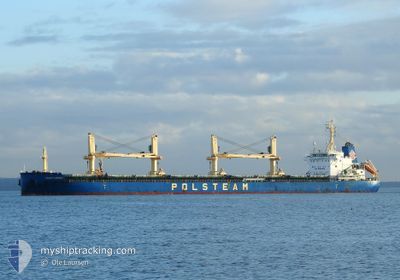
The vessel SZARE SZEREGI (IMO: 9708057, MMSI: 636017072) is a Cargo It's sailing under the flag of [LR] Liberia.
In this page you can find informations about the vessels current position, last detected port calls, and current voyage information. If the vessels is not in coverage by AIS you will find the latest position.
The current position of SZARE SZEREGI is detected by our AIS receivers and we are not responsible for the reliability of the data. The last position was recorded while the vessel was in Coverage by the Ais receivers of our vessel tracking app.
The current draught of SZARE SZEREGI as reported by AIS is 7.2 meters
Weather
| Temperature | 20.5°C / 68.9°F |
|---|---|
| Wind Speed | 20 knots |
| Direction | 305° NW |
| Pressure | 1018.8 hPa |
| Humidity | 36.3 % |
| Cloud Coverage | --- |
Featured Company
Last Port Calls
| Port | Arrival | Departure | Time In Port |
|---|---|---|---|
| 2025-03-16 02:39 | 2025-03-17 18:25 | 1 d | |
| 2025-03-08 05:22 | 2025-03-12 17:34 | 4 d | |
| 2025-02-09 07:31 | 2025-02-12 06:14 | 2 d | |
| 2025-02-02 13:53 | 2025-02-07 03:35 | 4 d | |
| 2025-01-28 10:12 | 2025-01-31 13:22 | 3 d | |
| 2025-01-02 07:02 | 2025-01-06 20:33 | 4 d |
Most Visited Ports (Last year)
| Port | Arrivals | |
|---|---|---|
| 4 | ||
| 2 | ||
| 2 | ||
| 2 | ||
| 2 | ||
| 1 |
Last Trips
| Origin | Departure | Destination | Arrival | Distance | |
|---|---|---|---|---|---|
| 2025-03-12 17:34 | 2025-03-16 02:39 | 785.54 nm | |||
| 2025-02-12 06:14 | 2025-03-08 05:22 | 4669.91 nm | |||
| 2025-02-07 03:35 | 2025-02-09 07:31 | 509.82 nm | |||
| 2025-01-31 13:22 | 2025-02-02 13:53 | 208.53 nm | |||
| 2025-01-06 20:33 | 2025-01-28 10:12 | 4309.95 nm | |||
| 2024-12-31 17:08 | 2025-01-02 07:02 | 298.98 nm |
Events
| Tid | Event | Detaljer | Position / Dest | Information |
|---|---|---|---|---|
| 2025-03-17 23:27 | Status ändrad | Default Under way using engine |
28.35071 / -80.37849
USBCK
|
Fart: 13.2 kn Kurs: 94.7° |
| 2025-03-17 23:26 | UTANFÖR täckningsområde |
28.35127 / -80.38543
North Atlantic Ocean
USBCK
|
Fart: 13.2 kn Kurs: 94.7° |
|
| 2025-03-17 22:25 | AVGÅTT HAMN |
|
28.40987 / -80.58656
USBCK
|
Fart: 8.6 kn Kurs: 91° |
| 2025-03-17 22:18 | STARTAR förflyttning |
28.40998 / -80.60261
[US] CAPE CANAVERAL
|
Fart: 3.3 kn Kurs: 88° |
|
| 2025-03-17 22:15 | Status ändrad | Under way using engine Moored |
28.40978 / -80.60453
[US] CAPE CANAVERAL
|
Fart: 0.9 kn Kurs: 85° |
| 2025-03-17 21:50 | Djupgående ändrat | 7.2 8.3 |
28.40910 / -80.60540
[US] CAPE CANAVERAL
|
Fart: Kurs: 89° |
| 2025-03-17 21:50 | Destination ändrad | USBCK USPCV |
28.40910 / -80.60540
[US] CAPE CANAVERAL
|
Fart: Kurs: 89° |
| 2025-03-17 21:50 | ETA ändrat | 2025/03/18 22:00 2025/03/15 16:00 |
28.40910 / -80.60540
[US] CAPE CANAVERAL
|
Fart: Kurs: 89° |
| 2025-03-17 20:05 | Status ändrad | Moored Default |
28.40910 / -80.60538
[US] CAPE CANAVERAL
|
Fart: Kurs: 89° |
| 2025-03-17 20:02 | Status ändrad | Default Moored |
28.40911 / -80.60538
[US] CAPE CANAVERAL
|
Fart: Kurs: 89° |