
SZARE SZEREGI
Cargo
Current Trip
| Trip Time | 3 days |
|---|---|
| Trip Distance | 581.18 nm |
| AVG Speed | 8.7 Knots |
| MAX Speed | 14 Knots |
| Draught | 7.2 m |
| AVG Wind | 13.4 knots |
| MAX Wind | 26 knots |
| MIN Temp | 6.1°C / 42.98°F |
| MAX Temp | 18.4°C / 65.12°F |
| Position Received | 3 d ago |
Current Position
| Longitude | -58.46242° |
|---|---|
| Latitude | -33.67135° |
| Status | Under way using engine |
| Speed | 9.3 Knots |
| Course | 329° |
| Area | Rio de La Plata |
| Station | T-AIS |
| Position Received | 3 d ago |
Info
Information
The current position of SZARE SZEREGI is in Rio de La Plata with coordinates -33.67135° / -58.46242° as reported on 2024-07-02 12:28 by AIS to our vessel tracker app. The vessel's current speed is 9.3 Knots and is currently inside the port of CONCEPTION D URUGUAY.
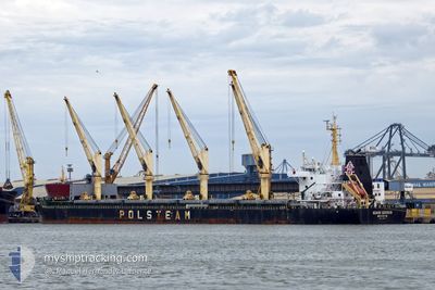
The vessel SZARE SZEREGI (IMO: 9708057, MMSI: 636017072) is a Cargo It's sailing under the flag of [LR] Liberia.
In this page you can find informations about the vessels current position, last detected port calls, and current voyage information. If the vessels is not in coverage by AIS you will find the latest position.
The current position of SZARE SZEREGI is detected by our AIS receivers and we are not responsible for the reliability of the data. The last position was recorded while the vessel was in Coverage by the Ais receivers of our vessel tracking app.
The current draught of SZARE SZEREGI as reported by AIS is 7.2 meters
Weather
| Temperature | 0.2°C / 32.36°F |
|---|---|
| Wind Speed | 2 knots |
| Direction | 126° SE |
| Pressure | 1028.7 hPa |
| Humidity | 56.7 % |
| Cloud Coverage | --- |
Featured Company
Last Port Calls
| Port | Arrival | Departure | Time In Port |
|---|---|---|---|
| 2024-07-03 11:05 | |||
| 2024-06-25 19:38 | 2024-06-29 20:43 | 4 d | |
| 2024-05-22 05:09 | 2024-05-26 21:59 | 4 d | |
| 2024-05-12 20:27 | 2024-05-16 23:41 | 4 d |
Most Visited Ports (Last year)
| Port | Arrivals | |
|---|---|---|
| 3 | ||
| 2 | ||
| 2 | ||
| 2 | ||
| 2 | ||
| 2 |
Last Trips
| Origin | Departure | Destination | Arrival | Distance | |
|---|---|---|---|---|---|
| 2024-06-29 17:43 | 2024-07-03 08:05 | 581.18 nm | |||
| 2024-05-27 00:59 | 2024-06-25 16:38 | 7045.83 nm | |||
| 2024-05-17 00:41 | 2024-05-22 08:09 | 1093.60 nm | |||
| 2024-04-27 12:59 | 2024-05-12 21:27 | 4112.50 nm |
Events
| Time | Event | Details | Position / Dest | Info |
|---|---|---|---|---|
| 2024-07-03 11:45 | STOP Moving |
-32.48594 / -58.22110
[AR] CONCEPTION D URUGUAY
|
Speed: Course: 5° |
|
| 2024-07-03 11:05 | PORT ARRIVAL |
|
-32.47765 / -58.21840
[AR] CONCEPTION D URUGUAY
|
Speed: 3.8 kn Course: 199° |
| 2024-07-03 10:44 | START Moving | 1.76 nm, North East of CONCEPTION D URUGUAY |
-32.45519 / -58.20562
ARCOU
|
Speed: 4.1 kn Course: 168° |
| 2024-07-02 12:35 | Status Changed | Default Under way using engine |
-33.65424 / -58.47292
ARCOU
|
Speed: 9.3 kn Course: 329° |
| 2024-07-02 12:28 | Status Changed | Under way using engine Default |
-33.67135 / -58.46242
ARCOU
|
Speed: 9.7 kn Course: 316° |
| 2024-07-02 12:28 | OUT of Coverage |
-33.67135 / -58.46242
Rio de La Plata
|
Speed: 9.3 kn Course: 329° |
|
| 2024-07-02 12:11 | Status Changed | Default Under way using engine |
-33.71453 / -58.43557
ARCOU
|
Speed: 11.6 kn Course: 2.5° |
| 2024-07-02 11:58 | Status Changed | Under way using engine Default |
-33.75426 / -58.43747
ARCOU
|
Speed: 11.5 kn Course: 5° |
| 2024-07-02 11:19 | Status Changed | Default Under way using engine |
-33.88149 / -58.42886
ARCOU
|
Speed: 11.4 kn Course: 351.4° |
| 2024-07-02 11:13 | Change Sea Area | Uruguayan part of the Rio de La Plata Argentinean part of the Rio de La Plata |
-33.89782 / -58.42708
Rio de La Plata
|
Speed: 11.4 kn Course: 351.4° |