
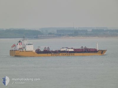
STOLT SURF
Oil/Chemical Tanker
Current Trip
MYPKG
| Time Travelled | 25 days |
|---|---|
| Remaining Time | --- |
| Distance Travelled | 7761.17 nm |
| Remaining Distance | --- |
| AVG Speed | 12.8 Knop |
| MAX Speed | 15.2 Knop |
| AVG Wind | 14.5 knots |
| MAX Wind | 31 knots |
| MIN Temp | 19.3°C / 66.74°F |
| MAX Temp | 29°C / 84.2°F |
| Djupgående | 8.5 m |
| Position mottagen | 7 d sen |
Current Position
| Longitud | --- |
|---|---|
| Latitude | --- |
| Status | Under way using engine |
| Fart | 12.4 Knop |
| Kurs | 326.9° |
| Område | South Atlantic Ocean |
| Station | T-AIS |
| Position mottagen | 7 d sen |
Info
Information
The current position of STOLT SURF is in South Atlantic Ocean with coordinates -33.85363° / 17.61691° as reported on 2025-02-10 23:36 by AIS to our vessel tracker app. The vessel's current speed is 12.4 Knop
The vessel STOLT SURF (IMO: 9168623, MMSI: 319545000) is a Oil/Chemical Tanker that was built in 2000 ( 25 År gammal ). It's sailing under the flag of [KY] Cayman Is.
In this page you can find informations about the vessels current position, last detected port calls, and current voyage information. If the vessels is not in coverage by AIS you will find the latest position.
The current position of STOLT SURF is detected by our AIS receivers and we are not responsible for the reliability of the data. The last position was recorded while the vessel was in Coverage by the Ais receivers of our vessel tracking app.
The current draught of STOLT SURF as reported by AIS is 8.5 meters
Weather
| Temperature | 26.1°C / 78.98°F |
|---|---|
| Wind Speed | 8 knots |
| Direction | 151° SSE |
| Pressure | 1010.1 hPa |
| Humidity | 81.3 % |
| Cloud Coverage | 100 % |
Featured Company
Most Visited Ports (Last year)
| Port | Arrivals | |
|---|---|---|
| 5 | ||
| 2 | ||
| 2 | ||
| 2 | ||
| 2 | ||
| 2 |
Last Trips
| Origin | Departure | Destination | Arrival | Distance | |
|---|---|---|---|---|---|
| 2025-01-19 19:25 | 2025-01-21 15:31 | 134.24 nm | |||
| 2025-01-15 21:04 | 2025-01-19 07:53 | 444.91 nm | |||
| 2025-01-07 09:24 | 2025-01-14 11:28 | 2189.73 nm | |||
| 2024-12-28 12:21 | 2025-01-06 12:12 | 825.92 nm | |||
| 2024-11-02 15:10 | 2024-12-27 06:10 | 15333.59 nm |
Events
| Tid | Event | Detaljer | Position / Dest | Information |
|---|---|---|---|---|
| 2025-02-10 23:42 | Status ändrad | Default Under way using engine |
-33.83442 / 17.60353
MYPKG
|
Fart: 12.4 kn Kurs: 326.9° |
| 2025-02-10 23:36 | UTANFÖR täckningsområde |
-33.85363 / 17.61691
South Atlantic Ocean
|
Fart: 12.4 kn Kurs: 326.9° |
|
| 2025-02-10 23:31 | Status ändrad | Under way using engine Default |
-33.86651 / 17.62588
MYPKG
|
Fart: 12.3 kn Kurs: 331° |
| 2025-02-10 23:11 | I täckningsområde |
-33.86651 / 17.62588
South Atlantic Ocean
|
Fart: 12.3 kn Kurs: 329.7° |
|
| 2025-02-10 21:21 | Status ändrad | Default Under way using engine |
-34.21486 / 17.98897
MYPKG
|
Fart: 14.3 kn Kurs: 312.2° |
| 2025-02-10 21:19 | UTANFÖR täckningsområde |
-34.22004 / 17.99566
South Atlantic Ocean
|
Fart: 14.3 kn Kurs: 312.2° |
|
| 2025-02-10 21:10 | Status ändrad | Under way using engine Default |
-34.24643 / 18.02834
MYPKG
|
Fart: 14.3 kn Kurs: 314° |
| 2025-02-10 21:07 | Status ändrad | Default Under way using engine |
-34.25268 / 18.03598
MYPKG
|
Fart: 14.5 kn Kurs: 312.8° |
| 2025-02-10 20:52 | Byter havsområde | South African part of the South Atlantic Ocean Malaysian part of the Malacca Strait |
-34.29552 / 18.08666
South Atlantic Ocean
|
Fart: 14.2 kn Kurs: 315.2° |
| 2025-02-10 20:50 | Status ändrad | Under way using engine Default |
-34.30166 / 18.09405
MYPKG
|
Fart: 14.3 kn Kurs: 321° |