
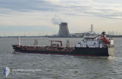
STOLT OSPREY
Oil/Chemical Tanker
Current Trip
NL RTM
| Time Travelled | 15 h, 47 mins |
|---|---|
| Remaining Time | --- |
| Distance Travelled | 220.72 nm |
| Remaining Distance | --- |
| AVG Speed | 13.8 Knop |
| MAX Speed | 16.2 Knop |
| AVG Wind | 11.6 knots |
| MAX Wind | 19.6 knots |
| MIN Temp | 11.3°C / 52.34°F |
| MAX Temp | 16.9°C / 62.42°F |
| Djupgående | 5.7 m |
| Position mottagen | 4 h, 12 m sen |
Current Position
| Longitud | -5.71756° |
|---|---|
| Latitude | 52.16271° |
| Status | Under way using engine |
| Fart | 13.5 Knop |
| Kurs | 199.3° |
| Område | Irish Sea and St. George's Channel |
| Station | T-AIS |
| Position mottagen | 4 h, 12 m sen |
Info
Information
The current position of STOLT OSPREY is in Irish Sea and St. George's Channel with coordinates 52.16271° / -5.71756° as reported on 2024-05-15 02:42 by AIS to our vessel tracker app. The vessel's current speed is 13.5 Knop
The vessel STOLT OSPREY (IMO: 9147461, MMSI: 235112065) is a Oil/Chemical Tanker that was built in 1998 ( 26 År gammal ). It's sailing under the flag of [GB] United Kingdom.
In this page you can find informations about the vessels current position, last detected port calls, and current voyage information. If the vessels is not in coverage by AIS you will find the latest position.
The current position of STOLT OSPREY is detected by our AIS receivers and we are not responsible for the reliability of the data. The last position was recorded while the vessel was in Coverage by the Ais receivers of our vessel tracking app.
The current draught of STOLT OSPREY as reported by AIS is 5.7 meters
Weather
| Temperature | 12.5°C / 54.5°F |
|---|---|
| Wind Speed | 19 knots |
| Direction | 110° ESE |
| Pressure | 997.7 hPa |
| Humidity | 85 % |
| Cloud Coverage | 32 % |
Featured Company
Last Port Calls
| Port | Arrival | Departure | Time In Port |
|---|---|---|---|
| 2024-05-14 14:37 | 2024-05-14 15:07 | 30 m | |
| 2024-05-14 13:59 | 2024-05-14 14:15 | 15 m | |
| 2024-05-13 15:30 | 2024-05-13 15:59 | 29 m | |
| 2024-05-13 14:42 | 2024-05-13 15:11 | 28 m | |
| 2024-05-11 07:35 | 2024-05-12 19:20 | 1 d | |
| 2024-05-05 15:35 | 2024-05-09 10:09 | 3 d | |
| 2024-05-02 12:02 | 2024-05-03 12:35 | 1 d | |
| 2024-05-02 10:32 | 2024-05-02 10:46 | 14 m | |
| 2024-04-30 05:01 | 2024-05-01 02:23 | 21 h | |
| 2024-04-27 05:57 | 2024-04-27 21:48 | 15 h |
Last Trips
| Origin | Departure | Destination | Arrival | Distance | |
|---|---|---|---|---|---|
| 2024-05-14 15:15 | 2024-05-14 15:37 | 1.93 nm | |||
| 2024-05-13 16:59 | 2024-05-14 14:59 | 0.94 nm | |||
| 2024-05-13 16:11 | 2024-05-13 16:30 | 1.47 nm | |||
| 2024-05-12 20:20 | 2024-05-13 15:42 | 275.94 nm | |||
| 2024-05-09 12:09 | 2024-05-11 08:35 | 578.22 nm | |||
| 2024-05-03 14:35 | 2024-05-05 17:35 | 219.07 nm | |||
| 2024-05-02 12:46 | 2024-05-02 14:02 | 8.29 nm | |||
| 2024-05-01 04:23 | 2024-05-02 12:32 | 345.79 nm | |||
| 2024-04-27 23:48 | 2024-04-30 07:01 | 303.05 nm | |||
| 2024-04-26 08:10 | 2024-04-27 07:57 | 111.66 nm |
Events
| Tid | Event | Detaljer | Position / Dest | Information |
|---|---|---|---|---|
| 2024-05-15 02:56 | Status ändrad | Default Under way using engine |
52.11500 / -5.74667
NL RTM
|
Fart: 13.5 kn Kurs: 199.3° |
| 2024-05-15 02:42 | UTANFÖR täckningsområde |
52.16271 / -5.71756
Irish Sea and St. George's Channel
|
Fart: 13.5 kn Kurs: 199.3° |
|
| 2024-05-15 02:16 | Byter havsområde | United Kingdom part of the Irish Sea and St. George's Channel Irish part of the Irish Sea and St. George's Channel |
52.25352 / -5.66375
Irish Sea and St. George's Channel
|
Fart: 13.1 kn Kurs: 200.2° |
| 2024-05-15 01:40 | Status ändrad | Under way using engine Default |
52.37335 / -5.59071
NL RTM
|
Fart: 12.8 kn Kurs: 198° |
| 2024-05-15 01:38 | Status ändrad | Default Under way using engine |
52.38174 / -5.58616
NL RTM
|
Fart: 12.8 kn Kurs: 200.1° |
| 2024-05-15 01:33 | Byter havsområde | Irish part of the Irish Sea and St. George's Channel United Kingdom part of the Irish Sea and St. George's Channel |
52.39585 / -5.57852
Irish Sea and St. George's Channel
|
Fart: 12.8 kn Kurs: 200.1° |
| 2024-05-15 01:33 | Status ändrad | Under way using engine Default |
52.39585 / -5.57852
NL RTM
|
Fart: 12.7 kn Kurs: 198° |
| 2024-05-15 01:18 | I täckningsområde |
52.39585 / -5.57852
Irish Sea and St. George's Channel
|
Fart: 12.8 kn Kurs: 200.1° |
|
| 2024-05-14 23:46 | Status ändrad | Default Under way using engine |
52.74974 / -5.36775
NL RTM
|
Fart: 13 kn Kurs: 206.8° |
| 2024-05-14 23:42 | UTANFÖR täckningsområde |
52.76527 / -5.35445
Irish Sea and St. George's Channel
|
Fart: 13 kn Kurs: 206.8° |