
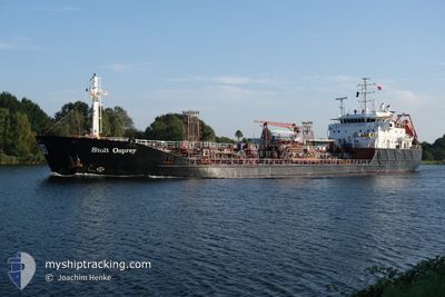
STOLT OSPREY
Oil/Chemical Tanker
Current Trip
| Time Travelled | 1 day |
|---|---|
| Remaining Time | 1 day |
| Distance Travelled | 335.43 nm |
| Remaining Distance | 442.19 nm |
| AVG Speed | 12.4 Noeuds |
| MAX Speed | 15.3 Noeuds |
| AVG Wind | 10.6 knots |
| MAX Wind | 14.7 knots |
| MIN Temp | 10.4°C / 50.72°F |
| MAX Temp | 11.8°C / 53.24°F |
| Tirant d eau | 5.3 m |
| Position reçue | Maintenant |
Current Position
| Longitude | --- |
|---|---|
| Latitude | --- |
| Etat | Under way using engine |
| Vitesse | 11.9 Noeuds |
| Parcours | 180.1° |
| Zone | Celtic Sea |
| Station | T-AIS |
| Position reçue | Maintenant |
Info
Information
The current position of STOLT OSPREY is in Celtic Sea with coordinates 50.66960° / -6.00609° as reported on 2024-12-27 00:28 by AIS to our vessel tracker app. The vessel's current speed is 11.9 Noeuds and is heading at the port of ROTTERDAM. The estimated time of arrival as calculated by MyShipTracking vessel tracking app is 2024-12-28 12:14 LT
The vessel STOLT OSPREY (IMO: 9147461, MMSI: 235112065) is a Oil/Chemical Tanker that was built in 1998 ( 26 Age ). It's sailing under the flag of [GB] United Kingdom.
In this page you can find informations about the vessels current position, last detected port calls, and current voyage information. If the vessels is not in coverage by AIS you will find the latest position.
The current position of STOLT OSPREY is detected by our AIS receivers and we are not responsible for the reliability of the data. The last position was recorded while the vessel was in Coverage by the Ais receivers of our vessel tracking app.
The current draught of STOLT OSPREY as reported by AIS is 5.3 meters
Weather
| Temperature | 10.7°C / 51.26°F |
|---|---|
| Wind Speed | 6 knots |
| Direction | 165° SSE |
| Pressure | 1033.2 hPa |
| Humidity | 90.8 % |
| Cloud Coverage | 100 % |
Featured Company
Last Port Calls
| Port | Arrival | Departure | Time In Port |
|---|---|---|---|
| 2024-12-24 16:43 | 2024-12-25 20:47 | 1 d | |
| 2024-12-20 02:14 | 2024-12-20 20:44 | 18 h | |
| 2024-12-18 11:56 | 2024-12-19 05:35 | 17 h | |
| 2024-12-16 10:47 | 2024-12-17 08:30 | 21 h | |
| 2024-12-14 10:09 | 2024-12-15 16:17 | 1 d | |
| 2024-12-12 01:20 | 2024-12-12 23:56 | 22 h | |
| 2024-12-07 13:21 | 2024-12-11 22:17 | 4 d | |
| 2024-12-05 16:50 | 2024-12-07 11:28 | 1 d | |
| 2024-12-02 05:07 | 2024-12-04 08:32 | 2 d | |
| 2024-11-30 09:56 | 2024-12-01 03:59 | 18 h |
Most Visited Ports (Last year)
| Port | Arrivals | |
|---|---|---|
| 15 | ||
| 12 | ||
| 12 | ||
| 9 | ||
| 9 | ||
| 7 |
Last Trips
| Origin | Departure | Destination | Arrival | Distance | |
|---|---|---|---|---|---|
| 2024-12-20 21:44 | 2024-12-24 16:43 | 1059.41 nm | |||
| 2024-12-19 06:35 | 2024-12-20 03:14 | 3.36 nm | |||
| 2024-12-17 09:30 | 2024-12-18 12:56 | 345.85 nm | |||
| 2024-12-15 16:17 | 2024-12-16 11:47 | 169.89 nm | |||
| 2024-12-13 00:56 | 2024-12-14 10:09 | 207.68 nm | |||
| 2024-12-11 23:17 | 2024-12-12 02:20 | 25.95 nm | |||
| 2024-12-07 12:28 | 2024-12-07 14:21 | 25.34 nm | |||
| 2024-12-04 09:32 | 2024-12-05 17:50 | 364.04 nm | |||
| 2024-12-01 04:59 | 2024-12-02 06:07 | 5.62 nm | |||
| 2024-11-29 12:30 | 2024-11-30 10:56 | 286.22 nm |
Events
| Heure | Evenement | Détails | Position/ Destination | Info |
|---|---|---|---|---|
| 2024-12-26 22:20 | Etat Changé | Under way using engine Default |
51.10269 / -6.03721
ROTTERDAM
|
Vitesse: 12.6 kn Parcours: 176° |
| 2024-12-26 22:19 | Etat Changé | Default Under way using engine |
51.10911 / -6.03801
ROTTERDAM
|
Vitesse: 12.7 kn Parcours: 174.8° |
| 2024-12-26 22:09 | Etat Changé | Under way using engine Default |
51.14327 / -6.04216
ROTTERDAM
|
Vitesse: 12.6 kn Parcours: 177° |
| 2024-12-26 22:07 | Etat Changé | Default Under way using engine |
51.15023 / -6.04300
ROTTERDAM
|
Vitesse: 12.6 kn Parcours: 177.4° |
| 2024-12-26 21:54 | Changement de zone | United Kingdom part of the Celtic Sea Irish part of the Irish Sea and St. George's Channel |
51.19380 / -6.04817
Celtic Sea
ROTTERDAM
|
Vitesse: 12.7 kn Parcours: 175.6° |
| 2024-12-26 21:54 | Etat Changé | Under way using engine Default |
51.19660 / -6.04852
ROTTERDAM
|
Vitesse: 12.6 kn Parcours: 177° |
| 2024-12-26 21:43 | Dans la zone couverte |
51.19380 / -6.04817
Celtic Sea
ROTTERDAM
|
Vitesse: 12.7 kn Parcours: 175.6° |
|
| 2024-12-26 14:43 | Etat Changé | Default Under way using engine |
52.55667 / -5.65101
ROTTERDAM
|
Vitesse: 11.3 kn Parcours: 194° |
| 2024-12-26 14:43 | Etat Changé | Under way using engine Default |
52.55713 / -5.65081
ROTTERDAM
|
Vitesse: 11.6 kn Parcours: 193° |
| 2024-12-26 14:43 | Hors de la zone couverte |
52.55713 / -5.65081
Irish Sea and St. George's Channel
ROTTERDAM
|
Vitesse: 11.3 kn Parcours: 194° |