

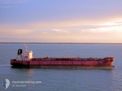
STI MEMPHIS
Tanker

Current Trip
| Time Travelled | 18 days |
|---|---|
| Remaining Time | --- |
| Distance Travelled | 2475.95 nm |
| Remaining Distance | --- |
| AVG Speed | 12.5 Knop |
| MAX Speed | 14.3 Knop |
| AVG Wind | 11.4 knots |
| MAX Wind | 18.5 knots |
| MIN Temp | 26.3°C / 79.34°F |
| MAX Temp | 29.3°C / 84.74°F |
| Djupgående | 12.4 m |
| Position mottagen | 1 d sen |
Current Position
| Longitud | --- |
|---|---|
| Latitude | --- |
| Status | At anchor |
| Fart | 0.1 Knop |
| Kurs | 309° |
| Område | Gulf of Guinea |
| Station | T-AIS |
| Position mottagen | 1 d sen |
Information
The current position of STI MEMPHIS is in Gulf of Guinea with coordinates 5.21519° / -4.05169° as reported on 2025-03-17 06:22 by AIS to our vessel tracker app. The vessel's current speed is 0.1 Knop
The vessel STI MEMPHIS (IMO: 9681156, MMSI: 538006010) is a Tanker It's sailing under the flag of [MH] Marshall Is.
In this page you can find informations about the vessels current position, last detected port calls, and current voyage information. If the vessels is not in coverage by AIS you will find the latest position.
The current position of STI MEMPHIS is detected by our AIS receivers and we are not responsible for the reliability of the data. The last position was recorded while the vessel was in Coverage by the Ais receivers of our vessel tracking app.
The current draught of STI MEMPHIS as reported by AIS is 12.4 meters
Weather
| Temperature | 28°C / 82.4°F |
|---|---|
| Wind Speed | 12 knots |
| Direction | 209° SSW |
| Pressure | 1009.2 hPa |
| Humidity | 82.8 % |
| Cloud Coverage | 69 % |


Featured Company
Last Port Calls
Last Trips
| Origin | Departure | Destination | Arrival | Distance | |
|---|---|---|---|---|---|
| 2025-01-19 12:25 | 2025-02-25 08:30 | 8694.43 nm | |||
| 2025-01-19 10:20 | 2025-01-19 11:28 | 4.42 nm | |||
| 2025-01-14 07:31 | 2025-01-14 08:17 | 5.46 nm | |||
| 2025-01-09 17:51 | 2025-01-14 06:37 | 1311.99 nm | |||
| 2024-12-31 18:52 | 2025-01-08 01:01 | 601.90 nm |
Events
| Tid | Event | Detaljer | Position / Dest | Information |
|---|---|---|---|---|
| 2025-03-17 06:25 | Status ändrad | Default At anchor |
5.21518 / -4.05173
CIABJ
|
Fart: 0.1 kn Kurs: 309° |
| 2025-03-17 06:22 | UTANFÖR täckningsområde |
5.21519 / -4.05169
Gulf of Guinea
|
Fart: 0.1 kn Kurs: 8.4° |
|
| 2025-03-17 06:19 | Status ändrad | At anchor Default |
5.21518 / -4.05169
CIABJ
|
Fart: Kurs: 314° |
| 2025-03-17 05:58 | Status ändrad | Default At anchor |
5.21494 / -4.05185
CIABJ
|
Fart: 0.1 kn Kurs: 331° |
| 2025-03-17 05:49 | Status ändrad | At anchor Default |
5.21490 / -4.05208
CIABJ
|
Fart: 0.1 kn Kurs: 336° |
| 2025-03-17 05:46 | Status ändrad | Default At anchor |
5.21490 / -4.05216
CIABJ
|
Fart: 0.1 kn Kurs: 338° |
| 2025-03-17 05:37 | Status ändrad | At anchor Default |
5.21483 / -4.05235
CIABJ
|
Fart: 0.1 kn Kurs: 346° |
| 2025-03-17 05:31 | Status ändrad | Default At anchor |
5.21479 / -4.05249
CIABJ
|
Fart: 0.1 kn Kurs: 353° |
| 2025-03-17 05:25 | Status ändrad | At anchor Default |
5.21483 / -4.05262
CIABJ
|
Fart: Kurs: 351° |
| 2025-03-17 04:58 | Status ändrad | Default At anchor |
5.21475 / -4.05276
CIABJ
|
Fart: 0.1 kn Kurs: 356° |