

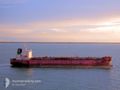
STI MEMPHIS
Tanker

Current Trip
| Time Travelled | 29 days |
|---|---|
| Remaining Time | --- |
| Distance Travelled | 2892.30 nm |
| Remaining Distance | --- |
| AVG Speed | 12.6 Knots |
| MAX Speed | 15.8 Knots |
| AVG Wind | 11.4 knots |
| MAX Wind | 18.5 knots |
| MIN Temp | 25.9°C / 78.62°F |
| MAX Temp | 29.3°C / 84.74°F |
| Dybgang | 12.4 m |
| Position Modtaget | 12 d siden |
Current Position
| Longitude | --- |
|---|---|
| Latitude | --- |
| Status | At anchor |
| Fart | 0.1 Knots |
| Kurs | 309° |
| Område | Gulf of Guinea |
| Station | T-AIS |
| Position Modtaget | 12 d siden |
Information
The current position of STI MEMPHIS is in Gulf of Guinea with coordinates 5.21519° / -4.05169° as reported on 2025-03-17 06:22 by AIS to our vessel tracker app. The vessel's current speed is 0.1 Knots
The vessel STI MEMPHIS (IMO: 9681156, MMSI: 538006010) is a Tanker It's sailing under the flag of [MH] Marshall Is.
In this page you can find informations about the vessels current position, last detected port calls, and current voyage information. If the vessels is not in coverage by AIS you will find the latest position.
The current position of STI MEMPHIS is detected by our AIS receivers and we are not responsible for the reliability of the data. The last position was recorded while the vessel was in Coverage by the Ais receivers of our vessel tracking app.
The current draught of STI MEMPHIS as reported by AIS is 12.4 meters
Weather
| Temperature | 28.2°C / 82.76°F |
|---|---|
| Wind Speed | 10 knots |
| Direction | 217° SW |
| Pressure | 1010.5 hPa |
| Humidity | 78.1 % |
| Cloud Coverage | 81 % |


Featured Company
Last Port Calls
Last Trips
| Origin | Departure | Destination | Arrival | Distance | |
|---|---|---|---|---|---|
| 2025-01-19 12:25 | 2025-02-25 08:30 | 8694.43 nm | |||
| 2025-01-19 10:20 | 2025-01-19 11:28 | 4.42 nm | |||
| 2025-01-14 07:31 | 2025-01-14 08:17 | 5.46 nm | |||
| 2025-01-09 17:51 | 2025-01-14 06:37 | 1311.99 nm | |||
| 2024-12-31 18:52 | 2025-01-08 01:01 | 601.90 nm |
Events
| Tid | Hændelsen | Detaljer | Position / Dest | Info |
|---|---|---|---|---|
| 2025-03-27 17:16 | STOP Sejllads | 4.86 nm, South of LOME |
6.05690 / 1.29823
CIABJ
|
Fart: 0.2 kn Kurs: 226° |
| 2025-03-27 16:06 | START Sejllads | 2.13 nm, South East of LOME |
6.11335 / 1.31327
CIABJ
|
Fart: 3.3 kn Kurs: 147° |
| 2025-03-27 14:42 | STOP Sejllads | 3.82 nm, East of LOME |
6.11804 / 1.34797
CIABJ
|
Fart: 0.2 kn Kurs: 224° |