
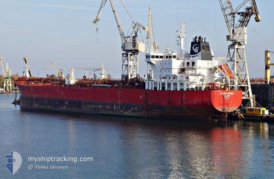
STI BATTERSEA
Tanker
Current Trip
| Time Travelled | 10 h, 48 mins |
|---|---|
| Remaining Time | 2 days |
| Distance Travelled | 128.76 nm |
| Remaining Distance | 980.42 nm |
| AVG Speed | 11.3 Knop |
| MAX Speed | 13 Knop |
| AVG Wind | 11.9 knots |
| MAX Wind | 17 knots |
| MIN Temp | 13.9°C / 57.02°F |
| MAX Temp | 15.8°C / 60.44°F |
| Djupgående | 11.7 m |
| Position mottagen | 7 h, 7 m sen |
Current Position
| Longitud | -2.96229° |
|---|---|
| Latitude | 46.88163° |
| Status | Under way using engine |
| Fart | 12.9 Knop |
| Kurs | 236.7° |
| Område | Bay of Biscay |
| Station | T-AIS |
| Position mottagen | 7 h, 7 m sen |
Info
Information
The current position of STI BATTERSEA is in Bay of Biscay with coordinates 46.88163° / -2.96229° as reported on 2024-05-23 19:28 by AIS to our vessel tracker app. The vessel's current speed is 12.9 Knop and is heading at the port of TANGER MED. The estimated time of arrival as calculated by MyShipTracking vessel tracking app is 2024-05-27 03:13 LT
The vessel STI BATTERSEA (IMO: 9691723, MMSI: 538005403) is a Tanker It's sailing under the flag of [MH] Marshall Is.
In this page you can find informations about the vessels current position, last detected port calls, and current voyage information. If the vessels is not in coverage by AIS you will find the latest position.
The current position of STI BATTERSEA is detected by our AIS receivers and we are not responsible for the reliability of the data. The last position was recorded while the vessel was in Coverage by the Ais receivers of our vessel tracking app.
The current draught of STI BATTERSEA as reported by AIS is 11.7 meters
Weather
| Temperature | 14°C / 57.2°F |
|---|---|
| Wind Speed | 14 knots |
| Direction | 16° NNE |
| Pressure | 1019.5 hPa |
| Humidity | 75.8 % |
| Cloud Coverage | 19 % |
Featured Company
Most Visited Ports (Last year)
| Port | Arrivals | |
|---|---|---|
| 6 | ||
| 3 | ||
| 2 | ||
| 2 | ||
| 2 | ||
| 2 |
Last Trips
| Origin | Departure | Destination | Arrival | Distance | |
|---|---|---|---|---|---|
| 2024-04-25 15:09 | 2024-05-21 15:19 | 3567.67 nm | |||
| 2024-03-28 00:57 | 2024-04-23 14:18 | 2918.25 nm | |||
| 2024-03-28 00:57 | 2024-04-21 11:04 | 2866.45 nm | |||
| 2024-03-03 03:40 | 2024-03-26 11:10 | 1845.86 nm | |||
| 2024-02-19 08:24 | 2024-03-02 02:16 | 1906.80 nm |
Events
| Tid | Event | Detaljer | Position / Dest | Information |
|---|---|---|---|---|
| 2024-05-23 19:38 | Status ändrad | Default Under way using engine |
46.86167 / -3.00500
MA PTM
|
Fart: 12.9 kn Kurs: 236.7° |
| 2024-05-23 19:28 | UTANFÖR täckningsområde |
46.88163 / -2.96229
Bay of Biscay
MA PTM
|
Fart: 12.9 kn Kurs: 236.7° |
|
| 2024-05-23 17:36 | Djupgående ändrat | 11.7 11.9 |
47.06912 / -2.45152
MA PTM
|
Fart: 12.6 kn Kurs: 231.4° |
| 2024-05-23 17:36 | ETA ändrat | 2024/05/27 01:00 2024/05/26 23:00 |
47.06912 / -2.45152
MA PTM
|
Fart: 12.6 kn Kurs: 231.4° |
| 2024-05-23 15:48 | AVGÅTT HAMN |
|
47.30105 / -2.12679
MA PTM
|
Fart: 6.6 kn Kurs: 250° |
| 2024-05-23 15:38 | STARTAR förflyttning |
47.30481 / -2.10497
[FR] DONGES
|
Fart: 3.1 kn Kurs: 259° |
|
| 2024-05-23 15:13 | Status ändrad | Under way using engine Moored |
47.30574 / -2.09709
[FR] DONGES
|
Fart: Kurs: 268° |
| 2024-05-23 15:11 | Status ändrad | Moored Default |
47.30575 / -2.09710
[FR] DONGES
|
Fart: Kurs: 268° |
| 2024-05-23 14:53 | Status ändrad | Default Moored |
47.30574 / -2.09705
[FR] DONGES
|
Fart: Kurs: 268° |
| 2024-05-23 14:47 | Status ändrad | Moored Default |
47.30574 / -2.09707
[FR] DONGES
|
Fart: Kurs: 268° |