
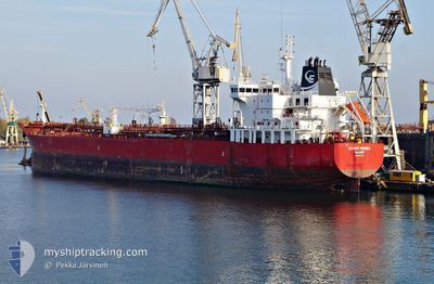
STI BATTERSEA
Tanker
Current Trip
| Time Travelled | 20 days |
|---|---|
| Remaining Time | 1 day |
| Distance Travelled | 3182.23 nm |
| Remaining Distance | 378.74 nm |
| AVG Speed | 10 Knots |
| MAX Speed | 15.2 Knots |
| AVG Wind | 12.7 knots |
| MAX Wind | 28.9 knots |
| MIN Temp | 8.4°C / 47.12°F |
| MAX Temp | 31°C / 87.8°F |
| Dybgang | 7.2 m |
| Position Modtaget | 1 h, 21 m siden |
Current Position
| Longitude | -9.51256° |
|---|---|
| Latitude | 43.63571° |
| Status | Under way using engine |
| Fart | 12 Knots |
| Kurs | 55.9° |
| Område | North Atlantic Ocean |
| Station | T-AIS |
| Position Modtaget | 1 h, 21 m siden |
Info
Information
The current position of STI BATTERSEA is in North Atlantic Ocean with coordinates 43.63571° / -9.51256° as reported on 2024-05-16 09:32 by AIS to our vessel tracker app. The vessel's current speed is 12 Knots and is heading at the port of DONGES. The estimated time of arrival as calculated by MyShipTracking vessel tracking app is 2024-05-17 22:06 LT
The vessel STI BATTERSEA (IMO: 9691723, MMSI: 538005403) is a Tanker It's sailing under the flag of [MH] Marshall Is.
In this page you can find informations about the vessels current position, last detected port calls, and current voyage information. If the vessels is not in coverage by AIS you will find the latest position.
The current position of STI BATTERSEA is detected by our AIS receivers and we are not responsible for the reliability of the data. The last position was recorded while the vessel was in Coverage by the Ais receivers of our vessel tracking app.
The current draught of STI BATTERSEA as reported by AIS is 7.2 meters
Weather
| Temperature | 13.3°C / 55.94°F |
|---|---|
| Wind Speed | 18 knots |
| Direction | 260° W |
| Pressure | 1008.1 hPa |
| Humidity | 75 % |
| Cloud Coverage | 100 % |
Featured Company
Last Trips
Events
| Tid | Hændelsen | Detaljer | Position / Dest | Info |
|---|---|---|---|---|
| 2024-05-16 09:38 | Status er ændret | Default Under way using engine |
43.65167 / -9.49833
FR DON
|
Fart: 12 kn Kurs: 55.9° |
| 2024-05-16 09:32 | Udenfor Dækning |
43.63571 / -9.51256
North Atlantic Ocean
FR DON
|
Fart: 12 kn Kurs: 55.9° |
|
| 2024-05-16 09:16 | Ændre havområde | Spanish part of the North Atlantic Ocean Portuguese part of the North Atlantic Ocean |
43.60488 / -9.57049
North Atlantic Ocean
FR DON
|
Fart: 11.9 kn Kurs: 52.3° |
| 2024-05-16 09:16 | Indenfor Dækning |
43.60488 / -9.57049
North Atlantic Ocean
FR DON
|
Fart: 11.9 kn Kurs: 52.3° |
|
| 2024-05-16 09:14 | Status er ændret | Under way using engine Default |
43.59978 / -9.58067
FR DON
|
Fart: 12 kn Kurs: 55° |
| 2024-05-15 10:59 | Status er ændret | Default Under way using engine |
39.87107 / -9.94344
FR DON
|
Fart: 10.4 kn Kurs: 356.4° |
| 2024-05-15 10:53 | Status er ændret | Under way using engine Default |
39.85387 / -9.94244
FR DON
|
Fart: 10.8 kn Kurs: 356° |
| 2024-05-15 10:53 | Udenfor Dækning |
39.85387 / -9.94244
North Atlantic Ocean
FR DON
|
Fart: 10.4 kn Kurs: 356.4° |
|
| 2024-05-15 10:50 | Status er ændret | Default Under way using engine |
39.84693 / -9.94191
FR DON
|
Fart: 10.6 kn Kurs: 357.6° |
| 2024-05-15 10:39 | Status er ændret | Under way using engine Default |
39.81402 / -9.93930
FR DON
|
Fart: 9.7 kn Kurs: 357° |