
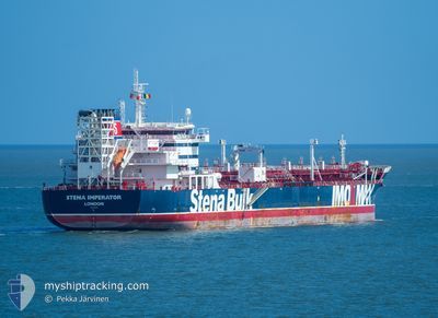
STENA IMPERATOR
Tanker
Current Trip
| Time Travelled | 6 days |
|---|---|
| Remaining Time | --- |
| Distance Travelled | 910.14 nm |
| Remaining Distance | --- |
| AVG Speed | 12.4 Knop |
| MAX Speed | 14.2 Knop |
| AVG Wind | 6.4 knots |
| MAX Wind | 18 knots |
| MIN Temp | 24.3°C / 75.74°F |
| MAX Temp | 30.1°C / 86.18°F |
| Djupgående | 11.6 m |
| Position mottagen | 2024-03-09 06:32 |
Current Position
| Longitud | -79.45643° |
|---|---|
| Latitude | 8.60694° |
| Status | Under way using engine |
| Fart | 11.8 Knop |
| Kurs | 178.3° |
| Område | North Pacific Ocean |
| Station | T-AIS |
| Position mottagen | 2024-03-09 06:32 |
Info
Information
The current position of STENA IMPERATOR is in North Pacific Ocean with coordinates 8.60694° / -79.45643° as reported on 2024-03-09 06:32 by AIS to our vessel tracker app. The vessel's current speed is 11.8 Knop and is heading at the port of CALLAO.
The vessel STENA IMPERATOR (IMO: 9797383, MMSI: 232007939) is a Tanker It's sailing under the flag of [GB] United Kingdom.
In this page you can find informations about the vessels current position, last detected port calls, and current voyage information. If the vessels is not in coverage by AIS you will find the latest position.
The current position of STENA IMPERATOR is detected by our AIS receivers and we are not responsible for the reliability of the data. The last position was recorded while the vessel was in Coverage by the Ais receivers of our vessel tracking app.
The current draught of STENA IMPERATOR as reported by AIS is 11.6 meters
Weather
| Temperature | 28.8°C / 83.84°F |
|---|---|
| Wind Speed | 5 knots |
| Direction | 81° E |
| Pressure | 1010.5 hPa |
| Humidity | 69.8 % |
| Cloud Coverage | 100 % |
Featured Company
Last Port Calls
| Port | Arrival | Departure | Time In Port |
|---|---|---|---|
| 2024-05-02 05:40 | 2024-05-02 23:12 | 17 h | |
| 2024-04-29 00:12 | 2024-04-30 04:20 | 1 d |
Most Visited Ports (Last year)
| Port | Arrivals | |
|---|---|---|
| 2 | ||
| 2 | ||
| 1 | ||
| 1 | ||
| 1 | ||
| 1 |
Last Trips
| Origin | Departure | Destination | Arrival | Distance | |
|---|---|---|---|---|---|
| 2024-04-30 12:20 | 2024-05-02 13:40 | 568.80 nm | |||
| 2024-02-18 13:37 | 2024-04-29 08:12 | 14948.73 nm |
Events
| Tid | Event | Detaljer | Position / Dest | Information |
|---|---|---|---|---|
| 2024-05-04 04:55 | STOPPAR förflyttning | 14.78 nm, North West of TACLOBAN |
11.40833 / 124.80666
PE CLL
|
Fart: Kurs: -1° |
| 2024-05-02 23:12 | AVGÅTT HAMN |
|
8.49874 / 124.67383
PE CLL
|
Fart: 4.3 kn Kurs: 43° |
| 2024-05-02 23:09 | STARTAR förflyttning |
8.49401 / 124.67069
[PH] CAGAYAN DE ORO
|
Fart: 4.3 kn Kurs: 43° |
|
| 2024-05-02 05:49 | STOPPAR förflyttning |
8.49230 / 124.66396
[PH] CAGAYAN DE ORO
|
Fart: 0.2 kn Kurs: 140° |
|
| 2024-05-02 05:40 | ANLÄNDER HAMN |
|
8.49272 / 124.66462
[PH] CAGAYAN DE ORO
|
Fart: 0.7 kn Kurs: 149° |
| 2024-04-30 04:24 | STARTAR förflyttning | 0.17 nm, South of DAVAO |
7.11141 / 125.66139
PE CLL
|
Fart: 3.7 kn Kurs: 205° |
| 2024-04-30 04:20 | AVGÅTT HAMN |
|
7.11397 / 125.66222
PE CLL
|
Fart: 1.2 kn Kurs: 193° |