
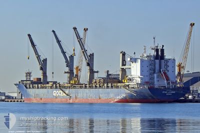
STAR LIVORNO
Cargo/Container Ship
Current Trip
| Time Travelled | 18 days |
|---|---|
| Remaining Time | 1 day |
| Distance Travelled | 5014.49 nm |
| Remaining Distance | 570.94 nm |
| AVG Speed | 11.5 Knop |
| MAX Speed | 17.1 Knop |
| AVG Wind | 13.3 knots |
| MAX Wind | 21.8 knots |
| MIN Temp | 3.2°C / 37.76°F |
| MAX Temp | 27.8°C / 82.04°F |
| Djupgående | 7.4 m |
| Position mottagen | 2 h, 59 m sen |
Current Position
| Longitud | --- |
|---|---|
| Latitude | --- |
| Status | Under way using engine |
| Fart | 11.7 Knop |
| Kurs | 218.6° |
| Område | South Atlantic Ocean |
| Station | T-AIS |
| Position mottagen | 2 h, 59 m sen |
Info
Information
The current position of STAR LIVORNO is in South Atlantic Ocean with coordinates -25.42198° / -44.50451° as reported on 2025-02-17 06:36 by AIS to our vessel tracker app. The vessel's current speed is 11.7 Knop and is heading at the port of RIO GRANDE. The estimated time of arrival as calculated by MyShipTracking vessel tracking app is 2025-02-19 08:58 LT
The vessel STAR LIVORNO (IMO: 9593907, MMSI: 258009000) is a Cargo/Container Ship that was built in 2013 ( 12 År gammal ). It's sailing under the flag of [NO] Norway.
In this page you can find informations about the vessels current position, last detected port calls, and current voyage information. If the vessels is not in coverage by AIS you will find the latest position.
The current position of STAR LIVORNO is detected by our AIS receivers and we are not responsible for the reliability of the data. The last position was recorded while the vessel was in Coverage by the Ais receivers of our vessel tracking app.
The current draught of STAR LIVORNO as reported by AIS is 7.4 meters
Weather
| Temperature | 27°C / 80.6°F |
|---|---|
| Wind Speed | 12 knots |
| Direction | 29° NNE |
| Pressure | 1010.7 hPa |
| Humidity | 87.6 % |
| Cloud Coverage | 91 % |
Featured Company
Last Port Calls
| Port | Arrival | Departure | Time In Port |
|---|---|---|---|
| 2025-01-16 13:06 | 2025-01-30 00:08 | 13 d | |
| 2025-01-07 07:31 | 2025-01-09 15:28 | 2 d | |
| 2024-12-31 13:51 | 2025-01-05 22:15 | 5 d | |
| 2024-12-28 05:08 | 2024-12-30 07:26 | 2 d |
Last Trips
| Origin | Departure | Destination | Arrival | Distance | |
|---|---|---|---|---|---|
| 2025-01-09 09:28 | 2025-01-16 08:06 | 1751.35 nm | |||
| 2025-01-05 16:15 | 2025-01-07 01:31 | 438.17 nm | |||
| 2024-12-30 01:26 | 2024-12-31 07:51 | 324.29 nm | |||
| 2024-11-25 16:58 | 2024-12-27 23:08 | 12110.14 nm |
Events
| Tid | Event | Detaljer | Position / Dest | Information |
|---|---|---|---|---|
| 2025-02-17 06:39 | Status ändrad | Default Under way using engine |
-25.43085 / -44.51267
BRRIG
|
Fart: 11.7 kn Kurs: 218.6° |
| 2025-02-17 06:36 | UTANFÖR täckningsområde |
-25.42198 / -44.50451
South Atlantic Ocean
BRRIG
|
Fart: 11.7 kn Kurs: 218.6° |
|
| 2025-02-17 06:05 | Status ändrad | Under way using engine Default |
-25.34551 / -44.43146
BRRIG
|
Fart: 11.6 kn Kurs: 223° |
| 2025-02-17 05:16 | Status ändrad | Default Under way using engine |
-25.22639 / -44.31490
BRRIG
|
Fart: 11.5 kn Kurs: 221.6° |
| 2025-02-17 04:36 | Status ändrad | Under way using engine Default |
-25.13406 / -44.21498
BRRIG
|
Fart: 11.9 kn Kurs: 232° |
| 2025-02-17 04:25 | Status ändrad | Default Under way using engine |
-25.11189 / -44.18536
BRRIG
|
Fart: 11.7 kn Kurs: 230.8° |
| 2025-02-17 03:56 | Status ändrad | Under way using engine Default |
-25.04840 / -44.10325
BRRIG
|
Fart: 11.9 kn Kurs: 229° |
| 2025-02-17 03:43 | I täckningsområde |
-25.04840 / -44.10325
South Atlantic Ocean
BRRIG
|
Fart: 11.8 kn Kurs: 229.1° |
|
| 2025-02-17 01:42 | Status ändrad | Default Under way using engine |
-24.76234 / -43.72896
BRRIG
|
Fart: 12 kn Kurs: 227.9° |
| 2025-02-17 01:31 | UTANFÖR täckningsområde |
-24.73806 / -43.69876
South Atlantic Ocean
BRRIG
|
Fart: 12 kn Kurs: 227.9° |