
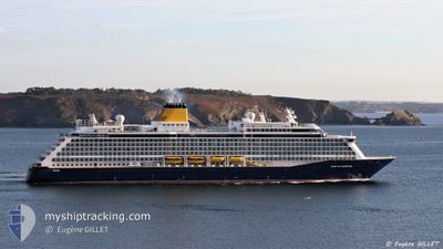
SPIRIT OF ADVENTURE
Not available
Current Trip
| Time Travelled | 1 day |
|---|---|
| Remaining Time | 12 h, 50 mins |
| Distance Travelled | 357.68 nm |
| Remaining Distance | 180.21 nm |
| AVG Speed | 15.2 Knop |
| MAX Speed | 17.7 Knop |
| AVG Wind | 5.3 knots |
| MAX Wind | 12.6 knots |
| MIN Temp | 10.2°C / 50.36°F |
| MAX Temp | 14.4°C / 57.92°F |
| Djupgående | 7.3 m |
| Position mottagen | 40 m sen |
Current Position
| Longitud | -0.88866° |
|---|---|
| Latitude | 56.32256° |
| Status | Under way using engine |
| Fart | 13.7 Knop |
| Kurs | 336.1° |
| Område | North Sea |
| Station | T-AIS |
| Position mottagen | 40 m sen |
Info
Information
The current position of SPIRIT OF ADVENTURE is in North Sea with coordinates 56.32256° / -0.88866° as reported on 2024-05-10 17:02 by AIS to our vessel tracker app. The vessel's current speed is 13.7 Knop and is heading at the port of KIRKWALL. The estimated time of arrival as calculated by MyShipTracking vessel tracking app is 2024-05-11 06:33 LT
The vessel SPIRIT OF ADVENTURE (IMO: 9818084, MMSI: 232026551) is a Not available It's sailing under the flag of [GB] United Kingdom.
In this page you can find informations about the vessels current position, last detected port calls, and current voyage information. If the vessels is not in coverage by AIS you will find the latest position.
The current position of SPIRIT OF ADVENTURE is detected by our AIS receivers and we are not responsible for the reliability of the data. The last position was recorded while the vessel was in Coverage by the Ais receivers of our vessel tracking app.
The current draught of SPIRIT OF ADVENTURE as reported by AIS is 7.3 meters
Weather
| Temperature | 10.7°C / 51.26°F |
|---|---|
| Wind Speed | 11 knots |
| Direction | 173° S |
| Pressure | 1021.5 hPa |
| Humidity | 92 % |
| Cloud Coverage | 23 % |
Featured Company
Last Port Calls
| Port | Arrival | Departure | Time In Port |
|---|---|---|---|
| 2024-05-09 05:59 | 2024-05-09 16:28 | 10 h | |
| 2024-05-05 05:38 | 2024-05-05 15:28 | 9 h | |
| 2024-05-02 05:27 | 2024-05-02 15:15 | 9 h | |
| 2024-04-30 05:01 | 2024-04-30 14:26 | 9 h | |
| 2024-04-28 17:20 | 2024-04-29 14:15 | 20 h | |
| 2024-04-27 04:33 | 2024-04-27 14:30 | 9 h | |
| 2024-04-25 15:31 | 2024-04-26 14:52 | 23 h | |
| 2024-04-24 05:32 | 2024-04-24 15:34 | 10 h | |
| 2024-04-21 05:29 | 2024-04-21 15:53 | 10 h | |
| 2024-04-17 05:43 | 2024-04-17 16:36 | 10 h |
Last Trips
| Origin | Departure | Destination | Arrival | Distance | |
|---|---|---|---|---|---|
| 2024-05-05 17:28 | 2024-05-09 06:59 | 1368.35 nm | |||
| 2024-05-02 17:15 | 2024-05-05 07:38 | 1002.23 nm | |||
| 2024-04-30 17:26 | 2024-05-02 07:27 | 492.61 nm | |||
| 2024-04-29 17:15 | 2024-04-30 08:01 | 179.56 nm | |||
| 2024-04-27 17:30 | 2024-04-28 20:20 | 254.47 nm | |||
| 2024-04-26 17:52 | 2024-04-27 07:33 | 119.41 nm | |||
| 2024-04-24 17:34 | 2024-04-25 18:31 | 387.05 nm | |||
| 2024-04-21 17:53 | 2024-04-24 07:32 | 1001.88 nm | |||
| 2024-04-17 17:36 | 2024-04-21 07:29 | 1233.61 nm | |||
| 2024-04-09 17:15 | 2024-04-17 06:43 | 2137.34 nm |
Events
| Tid | Event | Detaljer | Position / Dest | Information |
|---|---|---|---|---|
| 2024-05-10 17:11 | Status ändrad | Default Under way using engine |
56.35329 / -.91270
GB DVR>GB KWL
|
Fart: 13.7 kn Kurs: 336.1° |
| 2024-05-10 16:56 | Status ändrad | Under way using engine Default |
56.29985 / -.87413
GB DVR>GB KWL
|
Fart: 13.6 kn Kurs: 342° |
| 2024-05-10 16:42 | Status ändrad | Default Under way using engine |
56.25125 / -.84655
GB DVR>GB KWL
|
Fart: 13.6 kn Kurs: 343.3° |
| 2024-05-10 16:40 | Status ändrad | Under way using engine Default |
56.24329 / -.84207
GB DVR>GB KWL
|
Fart: 13.7 kn Kurs: 342° |
| 2024-05-10 16:28 | I täckningsområde |
56.24329 / -.84207
North Sea
|
Fart: 13.6 kn Kurs: 343.3° |
|
| 2024-05-10 15:30 | Status ändrad | Default Under way using engine |
55.99060 / -.69955
GB DVR>GB KWL
|
Fart: 12.9 kn Kurs: 343.2° |
| 2024-05-10 15:26 | UTANFÖR täckningsområde |
55.97854 / -.69277
North Sea
|
Fart: 12.9 kn Kurs: 343.2° |
|
| 2024-05-10 14:28 | Status ändrad | Under way using engine Default |
55.77682 / -.57968
GB DVR>GB KWL
|
Fart: 13.2 kn Kurs: 342° |
| 2024-05-10 14:22 | Status ändrad | Default Under way using engine |
55.75582 / -.56797
GB DVR>GB KWL
|
Fart: 13.2 kn Kurs: 342.8° |
| 2024-05-10 14:19 | Status ändrad | Under way using engine Default |
55.74600 / -.56247
GB DVR>GB KWL
|
Fart: 13.3 kn Kurs: 342° |