
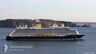
SPIRIT OF ADVENTURE
Not available
Current Trip
| Time Travelled | 1 day |
|---|---|
| Remaining Time | 10 h, 25 mins |
| Distance Travelled | 468.96 nm |
| Remaining Distance | 140.34 nm |
| AVG Speed | 11.5 Knots |
| MAX Speed | 18.6 Knots |
| AVG Wind | 28.8 knots |
| MAX Wind | 35.3 knots |
| MIN Temp | 9.5°C / 49.1°F |
| MAX Temp | 15.3°C / 59.54°F |
| Draught | 7.3 m |
| Position Received | 25 m ago |
Current Position
| Longitude | --- |
|---|---|
| Latitude | --- |
| Status | Under way using engine |
| Speed | 12 Knots |
| Course | 80° |
| Area | English Channel |
| Station | T-AIS |
| Position Received | 25 m ago |
Info
Information
The current position of SPIRIT OF ADVENTURE is in English Channel with coordinates 49.18754° / -3.22808° as reported on 2025-12-06 04:15 by AIS to our vessel tracker app. The vessel's current speed is 12 Knots and is heading at the port of PORTSMOUTH. The estimated time of arrival as calculated by MyShipTracking vessel tracking app is 2025-12-06 15:06 LT
The vessel SPIRIT OF ADVENTURE (IMO: 9818084, MMSI: 232026551) is a Not available It's sailing under the flag of [GB] United Kingdom.
In this page you can find informations about the vessels current position, last detected port calls, and current voyage information. If the vessels is not in coverage by AIS you will find the latest position.
The current position of SPIRIT OF ADVENTURE is detected by our AIS receivers and we are not responsible for the reliability of the data. The last position was recorded while the vessel was in Coverage by the Ais receivers of our vessel tracking app.
The current draught of SPIRIT OF ADVENTURE as reported by AIS is 7.3 meters
Weather
| Temperature | 12.6°C / 54.68°F |
|---|---|
| Wind Speed | 33 knots |
| Direction | 250° WSW |
| Pressure | 998.3 hPa |
| Humidity | 77.2 % |
| Cloud Coverage | 46 % |
Featured Company
Last Port Calls
| Port | Arrival | Departure | Time In Port |
|---|---|---|---|
| 2025-12-03 16:41 | 2025-12-04 17:08 | 1 d | |
| 2025-11-30 07:14 | 2025-11-30 17:36 | 10 h | |
| 2025-11-29 06:10 | 2025-11-29 23:02 | 16 h | |
| 2025-11-28 07:07 | 2025-11-28 19:11 | 12 h | |
| 2025-11-27 08:19 | 2025-11-27 22:43 | 14 h | |
| 2025-11-26 07:34 | 2025-11-26 17:13 | 9 h | |
| 2025-11-22 06:32 | 2025-11-22 17:36 | 11 h | |
| 2025-11-20 08:14 | 2025-11-20 16:20 | 8 h | |
| 2025-11-17 07:14 | 2025-11-17 17:08 | 9 h | |
| 2025-11-16 07:17 | 2025-11-16 17:20 | 10 h |
Last Trips
| Origin | Departure | Destination | Arrival | Distance | |
|---|---|---|---|---|---|
| 2025-11-30 17:36 | 2025-12-03 16:41 | 1039.06 nm | |||
| 2025-11-29 23:02 | 2025-11-30 07:14 | 79.47 nm | |||
| 2025-11-28 19:11 | 2025-11-29 06:10 | 91.55 nm | |||
| 2025-11-27 22:43 | 2025-11-28 07:07 | 78.95 nm | |||
| 2025-11-26 17:13 | 2025-11-27 08:19 | 242.79 nm | |||
| 2025-11-22 17:36 | 2025-11-26 07:34 | 1339.13 nm | |||
| 2025-11-20 16:20 | 2025-11-22 06:32 | 569.15 nm | |||
| 2025-11-17 17:08 | 2025-11-20 08:14 | 951.55 nm | |||
| 2025-11-16 17:20 | 2025-11-17 07:14 | 162.22 nm | |||
| 2025-11-15 17:06 | 2025-11-16 07:17 | 128.26 nm |
Events
| Time | Event | Details | Position / Dest | Info |
|---|---|---|---|---|
| 2025-12-06 04:19 | Status Changed | Default Under way using engine |
49.19433 / -3.21421
ES LCG>GB PME
|
Speed: 12 kn Course: 80° |
| 2025-12-06 04:15 | Status Changed | Under way using engine Default |
49.18754 / -3.22808
ES LCG>GB PME
|
Speed: 12.8 kn Course: 106° |
| 2025-12-06 04:15 | IN Coverage |
49.18754 / -3.22808
English Channel
ES LCG>GB PME
|
Speed: 12 kn Course: 80° |
|
| 2025-12-06 02:14 | Status Changed | Default Under way using engine |
49.12111 / -3.71373
ES LCG>GB PME
|
Speed: 12.3 kn Course: 73.6° |
| 2025-12-06 02:04 | OUT of Coverage |
49.09700 / -3.74336
English Channel
ES LCG>GB PME
|
Speed: 12.3 kn Course: 73.6° |
|
| 2025-12-05 20:20 | Change Sea Area | French part of the English Channel French part of the Celtic Sea |
48.90963 / -4.74048
English Channel
ES LCG>GB PME
|
Speed: 10.4 kn Course: 83.1° |
| 2025-12-05 19:56 | Change Sea Area | French part of the Celtic Sea Spanish part of the North Atlantic Ocean |
48.88492 / -4.83171
Celtic Sea
ES LCG>GB PME
|
Speed: 11.1 kn Course: 39.6° |
| 2025-12-05 19:56 | Status Changed | Under way using engine Default |
48.88492 / -4.83171
ES LCG>GB PME
|
Speed: 11 kn Course: 38° |
| 2025-12-05 19:50 | IN Coverage |
48.88492 / -4.83171
Celtic Sea
ES LCG>GB PME
|
Speed: 11.1 kn Course: 39.6° |
|
| 2025-12-04 17:25 | OUT of Coverage |
43.57061 / -8.42722
North Atlantic Ocean
ES LCG>GB PME
|
Speed: 12 kn Course: 7° |