
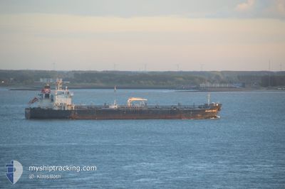
SEAWAYS GRACE
Oil/Chemical Tanker
Current Trip
| Time Travelled | 5 days |
|---|---|
| Remaining Time | --- |
| Distance Travelled | 1779.18 nm |
| Remaining Distance | --- |
| AVG Speed | 13 Knop |
| MAX Speed | 15.2 Knop |
| AVG Wind | 13.3 knots |
| MAX Wind | 19.9 knots |
| MIN Temp | 12.4°C / 54.32°F |
| MAX Temp | 19.8°C / 67.64°F |
| Djupgående | 11.6 m |
| Position mottagen | 8 h, 52 m sen |
Current Position
| Longitud | -30.57340° |
|---|---|
| Latitude | 38.88975° |
| Status | Under way using engine |
| Fart | 13.4 Knop |
| Kurs | 235.8° |
| Område | North Atlantic Ocean |
| Station | T-AIS |
| Position mottagen | 8 h, 52 m sen |
Info
Information
The current position of SEAWAYS GRACE is in North Atlantic Ocean with coordinates 38.88975° / -30.57340° as reported on 2024-06-07 03:23 by AIS to our vessel tracker app. The vessel's current speed is 13.4 Knop and is heading at the port of SAN JUAN. The estimated time of arrival as calculated by MyShipTracking vessel tracking app is 2024-06-14 08:00 LT
The vessel SEAWAYS GRACE (IMO: 9337511, MMSI: 477047900) is a Oil/Chemical Tanker that was built in 2008 ( 16 År gammal ). It's sailing under the flag of [HK] Hong Kong.
In this page you can find informations about the vessels current position, last detected port calls, and current voyage information. If the vessels is not in coverage by AIS you will find the latest position.
The current position of SEAWAYS GRACE is detected by our AIS receivers and we are not responsible for the reliability of the data. The last position was recorded while the vessel was in Coverage by the Ais receivers of our vessel tracking app.
The current draught of SEAWAYS GRACE as reported by AIS is 11.6 meters
Weather
| Temperature | 19.7°C / 67.46°F |
|---|---|
| Wind Speed | 20 knots |
| Direction | 146° SE |
| Pressure | 1019.3 hPa |
| Humidity | 81.7 % |
| Cloud Coverage | 100 % |
Featured Company
Last Port Calls
| Port | Arrival | Departure | Time In Port |
|---|---|---|---|
| 2024-05-18 09:39 | 2024-06-01 21:57 | 14 d | |
| 2024-05-13 21:30 | 2024-05-16 15:48 | 2 d | |
| 2024-04-30 03:41 | 2024-04-30 12:44 | 9 h | |
| 2024-04-25 19:35 | 2024-04-27 03:59 | 1 d | |
| 2024-04-06 18:03 | 2024-04-08 11:43 | 1 d | |
| 2024-04-03 05:00 |
Most Visited Ports (Last year)
| Port | Arrivals | |
|---|---|---|
| 2 | ||
| 2 | ||
| 2 | ||
| 1 | ||
| 1 | ||
| 1 |
Last Trips
| Origin | Departure | Destination | Arrival | Distance | |
|---|---|---|---|---|---|
| 2024-05-16 17:48 | 2024-05-18 11:39 | 151.33 nm | |||
| 2024-04-27 06:59 | 2024-05-13 23:30 | 4060.56 nm | |||
| 2024-04-27 06:59 | 2024-04-30 05:41 | 590.15 nm | |||
| 2024-04-08 14:43 | 2024-04-25 22:35 | 879.88 nm | |||
| 2024-04-03 08:00 | 2024-04-06 21:03 | 198.30 nm |
Events
| Tid | Event | Detaljer | Position / Dest | Information |
|---|---|---|---|---|
| 2024-06-07 03:30 | Status ändrad | Default Under way using engine |
38.87400 / -30.60360
PRSJU
|
Fart: 13.4 kn Kurs: 235.8° |
| 2024-06-07 03:23 | Status ändrad | Under way using engine Default |
38.88975 / -30.57340
PRSJU
|
Fart: 13.7 kn Kurs: 238° |
| 2024-06-07 03:23 | UTANFÖR täckningsområde |
38.88975 / -30.57340
North Atlantic Ocean
PRSJU
|
Fart: 13.4 kn Kurs: 235.8° |
|
| 2024-06-07 03:02 | Status ändrad | Default Under way using engine |
38.92947 / -30.48807
PRSJU
|
Fart: 13.7 kn Kurs: 239.2° |
| 2024-06-07 00:50 | ETA ändrat | 2024/06/14 08:00 2024/06/14 17:00 |
39.20022 / -29.95570
PRSJU
|
Fart: 13.9 kn Kurs: 242° |
| 2024-06-06 18:52 | Upptäckt i hav | Portuguese (Azores) part of the North Atlantic Ocean |
39.91789 / -28.45151
North Atlantic Ocean
PRSJU
|
Fart: 13.7 kn Kurs: 239.9° |
| 2024-06-06 18:52 | I täckningsområde |
39.91789 / -28.45151
North Atlantic Ocean
PRSJU
|
Fart: 13.7 kn Kurs: 239.9° |
|
| 2024-06-03 10:33 | Status ändrad | Default Under way using engine |
49.38888 / -6.93866
PRSJU
|
Fart: 12.7 kn Kurs: 256.9° |
| 2024-06-03 10:28 | Status ändrad | Under way using engine Default |
49.39258 / -6.91303
PRSJU
|
Fart: 12.7 kn Kurs: 257° |
| 2024-06-03 10:28 | UTANFÖR täckningsområde |
49.39258 / -6.91303
Celtic Sea
PRSJU
|
Fart: 12.7 kn Kurs: 256.9° |