
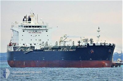
SEA NAVIGATOR
Tanker
Current Trip
USBPT>PAMNL
| Time Travelled | 2 days |
|---|---|
| Remaining Time | --- |
| Distance Travelled | 756.63 nm |
| Remaining Distance | --- |
| AVG Speed | 9.9 Knop |
| MAX Speed | 14 Knop |
| AVG Wind | 12.1 knots |
| MAX Wind | 22 knots |
| MIN Temp | 21.1°C / 69.98°F |
| MAX Temp | 28.5°C / 83.3°F |
| Djupgående | 11.9 m |
| Position mottagen | 2 d sen |
Current Position
| Longitud | -93.67903° |
|---|---|
| Latitude | 29.14097° |
| Status | Under way using engine |
| Fart | 13.5 Knop |
| Kurs | 177.6° |
| Område | Gulf of Mexico |
| Station | T-AIS |
| Position mottagen | 2 d sen |
Info
Information
The current position of SEA NAVIGATOR is in Gulf of Mexico with coordinates 29.14097° / -93.67903° as reported on 2024-05-11 11:13 by AIS to our vessel tracker app. The vessel's current speed is 13.5 Knop
The vessel SEA NAVIGATOR (IMO: 9724594, MMSI: 538010130) is a Tanker It's sailing under the flag of [MH] Marshall Is.
In this page you can find informations about the vessels current position, last detected port calls, and current voyage information. If the vessels is not in coverage by AIS you will find the latest position.
The current position of SEA NAVIGATOR is detected by our AIS receivers and we are not responsible for the reliability of the data. The last position was recorded while the vessel was in Coverage by the Ais receivers of our vessel tracking app.
The current draught of SEA NAVIGATOR as reported by AIS is 11.9 meters
Weather
| Temperature | 28.5°C / 83.3°F |
|---|---|
| Wind Speed | 16 knots |
| Direction | 126° SE |
| Pressure | 1011.3 hPa |
| Humidity | 85.1 % |
| Cloud Coverage | 22 % |
Featured Company
Last Trips
| Origin | Departure | Destination | Arrival | Distance | |
|---|---|---|---|---|---|
| 2024-05-01 23:06 | 2024-05-08 00:40 | 1671.61 nm | |||
| 2024-04-24 05:51 | 2024-04-30 07:41 | 1670.58 nm | |||
| 2024-03-14 07:24 | 2024-04-22 02:08 | 6526.37 nm | |||
| 2024-03-02 22:53 | 2024-03-10 20:28 | 468.06 nm | |||
| 2024-02-26 23:17 | 2024-03-01 04:50 | 561.31 nm |
Events
| Tid | Event | Detaljer | Position / Dest | Information |
|---|---|---|---|---|
| 2024-05-11 11:16 | Status ändrad | Default Under way using engine |
29.13099 / -93.67464
USBPT>PAMNL
|
Fart: 13.5 kn Kurs: 177.6° |
| 2024-05-11 11:13 | UTANFÖR täckningsområde |
29.14097 / -93.67903
Gulf of Mexico
USBPT>PAMNL
|
Fart: 13.5 kn Kurs: 177.6° |
|
| 2024-05-11 10:25 | Djupgående ändrat | 11.9 12.2 |
29.31061 / -93.67624
USBPT>PAMNL
|
Fart: 12.9 kn Kurs: 181.5° |
| 2024-05-11 10:01 | ETA ändrat | 2024/05/16 11:00 2024/05/16 06:00 |
29.39426 / -93.67355
USBPT>PAMNL
|
Fart: 11.3 kn Kurs: 182.1° |
| 2024-05-11 04:14 | AVGÅTT HAMN |
|
30.05856 / -94.03195
USBPT>PAMNL
|
Fart: 9.5 kn Kurs: 139° |
| 2024-05-11 04:04 | STARTAR förflyttning |
30.07071 / -94.05269
[US] BEAUMONT
|
Fart: 4.3 kn Kurs: 130° |
|
| 2024-05-11 03:12 | Status ändrad | Under way using engine Moored |
30.07180 / -94.05677
[US] BEAUMONT
|
Fart: Kurs: 180° |
| 2024-05-11 01:08 | Status ändrad | Moored Under way using engine |
30.07177 / -94.05681
[US] BEAUMONT
|
Fart: Kurs: 180° |
| 2024-05-11 00:54 | Status ändrad | Under way using engine Moored |
30.07178 / -94.05683
[US] BEAUMONT
|
Fart: Kurs: 180° |
| 2024-05-11 00:54 | ETA ändrat | 2024/05/16 06:00 2024/05/16 18:00 |
30.07179 / -94.05683
[US] BEAUMONT
|
Fart: Kurs: 180° |