
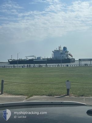
SEA NAVIGATOR
Tanker
Current Trip
PE MLQ
| Time Travelled | 17 days |
|---|---|
| Remaining Time | --- |
| Distance Travelled | 3755.24 nm |
| Remaining Distance | --- |
| AVG Speed | 11.5 Noeuds |
| MAX Speed | 15 Noeuds |
| AVG Wind | 9.7 knots |
| MAX Wind | 18.8 knots |
| MIN Temp | 17.8°C / 64.04°F |
| MAX Temp | 27.6°C / 81.68°F |
| Tirant d eau | 11.8 m |
| Position reçue | 9 d depuis |
Current Position
| Longitude | --- |
|---|---|
| Latitude | --- |
| Etat | Under way using engine |
| Vitesse | 6.4 Noeuds |
| Parcours | 121.9° |
| Zone | North Pacific Ocean |
| Station | T-AIS |
| Position reçue | 9 d depuis |
Info
Information
The current position of SEA NAVIGATOR is in North Pacific Ocean with coordinates 8.88179° / -79.51559° as reported on 2025-01-06 02:16 by AIS to our vessel tracker app. The vessel's current speed is 6.4 Noeuds
The vessel SEA NAVIGATOR (IMO: 9724594, MMSI: 538010130) is a Tanker It's sailing under the flag of [MH] Marshall Is.
In this page you can find informations about the vessels current position, last detected port calls, and current voyage information. If the vessels is not in coverage by AIS you will find the latest position.
The current position of SEA NAVIGATOR is detected by our AIS receivers and we are not responsible for the reliability of the data. The last position was recorded while the vessel was in Coverage by the Ais receivers of our vessel tracking app.
The current draught of SEA NAVIGATOR as reported by AIS is 11.8 meters
Weather
| Temperature | 20.7°C / 69.26°F |
|---|---|
| Wind Speed | 8 knots |
| Direction | 163° SSE |
| Pressure | 1012.7 hPa |
| Humidity | 90.5 % |
| Cloud Coverage | 4 % |
Featured Company
Last Port Calls
| Port | Arrival | Departure | Time In Port |
|---|---|---|---|
| 2024-12-27 22:06 | 2024-12-28 10:11 | 12 h | |
| 2024-12-25 06:15 | 2024-12-27 10:16 | 2 d | |
| 2024-11-20 22:01 | 2024-11-24 21:53 | 3 d | |
| 2024-11-20 21:34 | 2024-11-20 21:42 | 7 m | |
| 2024-11-18 04:10 | 2024-11-20 11:50 | 2 d | |
| 2024-11-10 11:00 | 2024-11-12 03:52 | 1 d | |
| 2024-11-02 16:18 | 2024-11-04 19:25 | 2 d |
Most Visited Ports (Last year)
| Port | Arrivals | |
|---|---|---|
| 6 | ||
| 5 | ||
| 3 | ||
| 3 | ||
| 2 | ||
| 1 |
Last Trips
| Origin | Departure | Destination | Arrival | Distance | |
|---|---|---|---|---|---|
| 2024-12-27 10:16 | 2024-12-27 22:06 | 139.10 nm | |||
| 2024-11-24 21:53 | 2024-12-25 06:15 | 6998.84 nm | |||
| 2024-11-20 21:42 | 2024-11-20 22:01 | 1.39 nm | |||
| 2024-11-20 11:50 | 2024-11-20 21:34 | 91.87 nm | |||
| 2024-11-12 03:52 | 2024-11-18 04:10 | 1555.24 nm | |||
| 2024-11-04 19:25 | 2024-11-10 11:00 | 1665.25 nm | |||
| 2024-10-16 10:01 | 2024-11-02 16:18 | 3260.70 nm |
Events
| Heure | Evenement | Détails | Position/ Destination | Info |
|---|---|---|---|---|
| 2025-01-12 11:30 | Arret | 6.69 nm, South East of MATARANI |
-17.04509 / -72.00163
PE MLQ
|
Vitesse: 0.1 kn Parcours: 187° |
| 2025-01-12 09:29 | Démarrage | 1.29 nm, North West of MATARANI |
-16.98731 / -72.12685
PE MLQ
|
Vitesse: 3.1 kn Parcours: 205° |
| 2025-01-12 05:22 | Arret | 1.48 nm, North West of MATARANI |
-16.98377 / -72.12843
PE MLQ
|
Vitesse: 0.1 kn Parcours: 85° |
| 2025-01-06 02:23 | Etat Changé | Default Under way using engine |
8.87962 / -79.50661
PE MLQ
|
Vitesse: 6.4 kn Parcours: 121.9° |
| 2025-01-06 02:16 | Changement de zone | Panamanian part of the North Pacific Ocean Panamanian part of the Caribbean Sea |
8.88179 / -79.51559
North Pacific Ocean
PE MLQ
|
Vitesse: 6.4 kn Parcours: 121.9° |
| 2025-01-06 02:16 | Hors de la zone couverte |
8.88179 / -79.51559
North Pacific Ocean
PE MLQ
|
Vitesse: 6.4 kn Parcours: 121.9° |
|
| 2025-01-06 02:15 | Etat Changé | Under way using engine Default |
8.88272 / -79.51693
PE MLQ
|
Vitesse: 7 kn Parcours: 140° |
| 2025-01-06 01:43 | Etat Changé | Default Under way using engine |
8.94419 / -79.56590
PE MLQ
|
Vitesse: 7.3 kn Parcours: 160.8° |
| 2025-01-06 01:37 | Etat Changé | Under way using engine Default |
8.95699 / -79.57246
PE MLQ
|
Vitesse: 7 kn Parcours: 160° |
| 2025-01-06 01:37 | Dans la zone couverte |
8.95699 / -79.57246
Caribbean Sea
PE MLQ
|
Vitesse: 7.3 kn Parcours: 160.8° |