
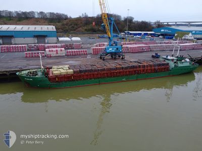
SCANLARK
General Cargo
Current Trip
| Trip Time | 6 days |
|---|---|
| Trip Distance | 948.33 nm |
| AVG Speed | 7.1 Knop |
| MAX Speed | 12.6 Knop |
| Djupgående | 3.7 m |
| AVG Wind | 11.1 knots |
| MAX Wind | 24 knots |
| MIN Temp | 0.8°C / 33.44°F |
| MAX Temp | 11.6°C / 52.88°F |
| Position mottagen | 3 d sen |
Current Position
| Longitud | --- |
|---|---|
| Latitude | --- |
| Status | Under way using engine |
| Fart | 6.8 Knop |
| Kurs | 250.1° |
| Område | North Sea |
| Station | T-AIS |
| Position mottagen | 3 d sen |
Info
Information
The current position of SCANLARK is in North Sea with coordinates 53.57109° / 5.12982° as reported on 2024-12-01 23:47 by AIS to our vessel tracker app. The vessel's current speed is 6.8 Knop and is currently inside the port of KINGS LYNN.
The vessel SCANLARK (IMO: 8505915, MMSI: 375354000) is a General Cargo that was built in 1985 ( 39 År gammal ). It's sailing under the flag of [VC] St Vincent Grenadines.
In this page you can find informations about the vessels current position, last detected port calls, and current voyage information. If the vessels is not in coverage by AIS you will find the latest position.
The current position of SCANLARK is detected by our AIS receivers and we are not responsible for the reliability of the data. The last position was recorded while the vessel was in Coverage by the Ais receivers of our vessel tracking app.
The current draught of SCANLARK as reported by AIS is 3.7 meters
Weather
| Temperature | 8.4°C / 47.12°F |
|---|---|
| Wind Speed | 20 knots |
| Direction | 180° S |
| Pressure | 1013.8 hPa |
| Humidity | 90.1 % |
| Cloud Coverage | 100 % |
Featured Company
Last Port Calls
| Port | Arrival | Departure | Time In Port |
|---|---|---|---|
| 2024-12-03 18:57 | |||
| 2024-11-26 15:00 | 2024-11-27 04:20 | 13 h | |
| 2024-11-17 20:46 | 2024-11-17 21:15 | 29 m | |
| 2024-11-11 23:18 | 2024-11-13 12:32 | 1 d | |
| 2024-11-05 05:12 | 2024-11-06 03:32 | 22 h | |
| 2024-10-22 15:27 | 2024-10-23 15:58 | 1 d | |
| 2024-10-20 05:37 | 2024-10-20 15:09 | 9 h | |
| 2024-10-16 07:06 | 2024-10-17 10:11 | 1 d | |
| 2024-10-11 15:17 | 2024-10-14 09:37 | 2 d | |
| 2024-10-07 20:26 | 2024-10-08 11:16 | 14 h |
Last Trips
| Origin | Departure | Destination | Arrival | Distance | |
|---|---|---|---|---|---|
| 2024-11-27 06:20 | 2024-12-03 18:57 | 948.33 nm | |||
| 2024-11-17 22:15 | 2024-11-26 17:00 | 623.37 nm | |||
| 2024-11-13 12:32 | 2024-11-17 21:46 | 339.13 nm | |||
| 2024-11-06 05:32 | 2024-11-11 23:18 | 935.55 nm | |||
| 2024-10-23 17:58 | 2024-11-05 07:12 | 538.00 nm | |||
| 2024-10-20 17:09 | 2024-10-22 17:27 | 309.38 nm | |||
| 2024-10-17 12:11 | 2024-10-20 07:37 | 429.17 nm | |||
| 2024-10-14 11:37 | 2024-10-16 09:06 | 293.70 nm | |||
| 2024-10-08 13:16 | 2024-10-11 17:17 | 177.83 nm | |||
| 2024-10-01 17:21 | 2024-10-07 22:26 | 345.45 nm |
Events
| Tid | Event | Detaljer | Position / Dest | Information |
|---|---|---|---|---|
| 2024-12-03 19:25 | STOPPAR förflyttning |
52.75934 / .39368
[GB] KINGS LYNN
|
Fart: 0.3 kn Kurs: 47° |
|
| 2024-12-03 18:57 | ANLÄNDER HAMN |
|
52.76345 / .38615
[GB] KINGS LYNN
|
Fart: 3.6 kn Kurs: 172° |
| 2024-12-03 17:25 | STARTAR förflyttning | 11.21 nm, North of KINGS LYNN |
52.94562 / .37608
GBKLN VIA NOK
|
Fart: 7.5 kn Kurs: 146° |
| 2024-12-03 05:02 | STOPPAR förflyttning | 11.39 nm, North of KINGS LYNN |
52.94837 / .36914
GBKLN VIA NOK
|
Fart: 0.3 kn Kurs: 13° |
| 2024-12-02 00:23 | Status ändrad | Default Under way using engine |
53.54760 / 5.02030
GBKLN VIA NOK
|
Fart: 6.8 kn Kurs: 250.1° |
| 2024-12-01 23:47 | UTANFÖR täckningsområde |
53.57109 / 5.12982
North Sea
GBKLN VIA NOK
|
Fart: 6.8 kn Kurs: 250.1° |
|
| 2024-12-01 23:32 | I täckningsområde |
53.57937 / 5.16741
North Sea
GBKLN VIA NOK
|
Fart: 6.6 kn Kurs: 251.1° |
|
| 2024-12-01 22:19 | Status ändrad | Default Under way using engine |
53.62477 / 5.38035
GBKLN VIA NOK
|
Fart: 6.2 kn Kurs: 250.8° |
| 2024-12-01 22:13 | UTANFÖR täckningsområde |
53.62807 / 5.39868
North Sea
GBKLN VIA NOK
|
Fart: 6.2 kn Kurs: 250.8° |
|
| 2024-12-01 20:38 | Status ändrad | Under way using engine Default |
53.67603 / 5.64537
GBKLN VIA NOK
|
Fart: 5.4 kn Kurs: 251° |