
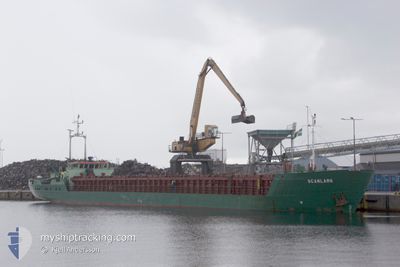
SCANLARK
General Cargo
Current Trip
| Time Travelled | 5 days |
|---|---|
| Remaining Time | --- |
| Distance Travelled | 944.14 nm |
| Remaining Distance | --- |
| AVG Speed | 7.9 Knots |
| MAX Speed | 11.1 Knots |
| AVG Wind | 14.1 knots |
| MAX Wind | 23.8 knots |
| MIN Temp | 2.1°C / 35.78°F |
| MAX Temp | 16.4°C / 61.52°F |
| Dybgang | 2.5 m |
| Position Modtaget | 1 d siden |
Current Position
| Longitude | 16.27349° |
|---|---|
| Latitude | 55.90306° |
| Status | Under way using engine |
| Fart | 8.1 Knots |
| Kurs | 60.6° |
| Område | Baltic Sea |
| Station | T-AIS |
| Position Modtaget | 1 d siden |
Info
Information
The current position of SCANLARK is in Baltic Sea with coordinates 55.90306° / 16.27349° as reported on 2024-04-16 01:49 by AIS to our vessel tracker app. The vessel's current speed is 8.1 Knots
The vessel SCANLARK (IMO: 8505915, MMSI: 375354000) is a General Cargo that was built in 1985 ( 39 år gamle ). It's sailing under the flag of [VC] St Vincent Grenadines.
In this page you can find informations about the vessels current position, last detected port calls, and current voyage information. If the vessels is not in coverage by AIS you will find the latest position.
The current position of SCANLARK is detected by our AIS receivers and we are not responsible for the reliability of the data. The last position was recorded while the vessel was in Coverage by the Ais receivers of our vessel tracking app.
The current draught of SCANLARK as reported by AIS is 2.5 meters
Weather
| Temperature | 2.6°C / 36.68°F |
|---|---|
| Wind Speed | 5 knots |
| Direction | 349° N |
| Pressure | 1007.7 hPa |
| Humidity | 93.6 % |
| Cloud Coverage | 16 % |
Featured Company
Last Port Calls
| Port | Arrival | Departure | Time In Port |
|---|---|---|---|
| 2024-04-11 09:09 | 2024-04-12 16:46 | 1 d | |
| 2024-04-04 18:05 | 2024-04-05 22:51 | 1 d | |
| 2024-03-15 23:43 | 2024-03-20 13:56 | 4 d | |
| 2024-03-13 02:15 | 2024-03-14 17:16 | 1 d | |
| 2024-03-07 22:53 | 2024-03-08 05:17 | 6 h | |
| 2024-03-03 11:05 | 2024-03-05 15:18 | 2 d | |
| 2024-02-24 12:59 | 2024-02-25 14:27 | 1 d | |
| 2024-02-19 15:11 | 2024-02-20 15:45 | 1 d | |
| 2024-02-16 18:14 | 2024-02-17 00:43 | 6 h | |
| 2024-02-12 07:56 | 2024-02-13 20:37 | 1 d |
Last Trips
| Origin | Departure | Destination | Arrival | Distance | |
|---|---|---|---|---|---|
| 2024-04-06 01:51 | 2024-04-11 10:09 | 941.03 nm | |||
| 2024-03-20 14:56 | 2024-04-04 21:05 | 713.29 nm | |||
| 2024-03-14 18:16 | 2024-03-16 00:43 | 254.48 nm | |||
| 2024-03-08 06:17 | 2024-03-13 03:15 | 635.77 nm | |||
| 2024-03-05 15:18 | 2024-03-07 23:53 | 140.12 nm | |||
| 2024-02-25 16:27 | 2024-03-03 11:05 | 939.17 nm | |||
| 2024-02-20 16:45 | 2024-02-24 14:59 | 615.56 nm | |||
| 2024-02-17 01:43 | 2024-02-19 16:11 | 184.81 nm | |||
| 2024-02-13 20:37 | 2024-02-16 19:14 | 390.83 nm | |||
| 2024-02-02 23:10 | 2024-02-12 07:56 | 995.91 nm |
Events
| Tid | Hændelsen | Detaljer | Position / Dest | Info |
|---|---|---|---|---|
| 2024-04-17 16:01 | STOP Sejllads | 6.46 nm, North of RIGA |
57.04878 / 24.02707
LVRIX
|
Fart: 0.1 kn Kurs: 160° |
| 2024-04-16 01:55 | Status er ændret | Default Under way using engine |
55.90968 / 16.29506
LVRIX
|
Fart: 8.1 kn Kurs: 60.6° |
| 2024-04-16 01:49 | Udenfor Dækning |
55.90306 / 16.27349
Baltic Sea
LVRIX
|
Fart: 8.1 kn Kurs: 60.6° |
|
| 2024-04-15 21:38 | Ændre havområde | Swedish part of the Baltic Sea Danish part of the Kattegat |
55.61523 / 15.39193
Baltic Sea
LVRIX
|
Fart: 8.3 kn Kurs: 58.4° |
| 2024-04-15 14:38 | Ændre havområde | Danish part of the Kattegat Swedish part of the Baltic Sea |
55.03038 / 14.09113
Kattegat
LVRIX
|
Fart: 8.2 kn Kurs: 68.4° |
| 2024-04-15 13:50 | Ændre havområde | Swedish part of the Baltic Sea German part of the Baltic Sea |
54.98880 / 13.91348
Baltic Sea
LVRIX
|
Fart: 8.3 kn Kurs: 64.9° |
| 2024-04-15 12:38 | Status er ændret | Under way using engine Default |
54.92909 / 13.64931
LVRIX
|
Fart: 8.1 kn Kurs: 68° |
| 2024-04-15 12:26 | Indenfor Dækning |
54.92909 / 13.64931
Baltic Sea
LVRIX
|
Fart: 8.2 kn Kurs: 69° |
|
| 2024-04-15 10:38 | Status er ændret | Default Under way using engine |
54.83232 / 13.22299
LVRIX
|
Fart: 7.9 kn Kurs: 66.8° |
| 2024-04-15 10:32 | Udenfor Dækning |
54.82730 / 13.20195
Baltic Sea
LVRIX
|
Fart: 7.9 kn Kurs: 66.8° |