

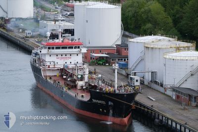
SAN BACCO
Tanker

Current Trip
| Time Travelled | 5 days |
|---|---|
| Remaining Time | --- |
| Distance Travelled | 346.21 nm |
| Remaining Distance | --- |
| AVG Speed | 12.7 Knop |
| MAX Speed | 14.4 Knop |
| AVG Wind | 7.9 knots |
| MAX Wind | 23.8 knots |
| MIN Temp | 6°C / 42.8°F |
| MAX Temp | 14°C / 57.2°F |
| Djupgående | 6.5 m |
| Position mottagen | 5 m sen |
Current Position
| Longitud | --- |
|---|---|
| Latitude | --- |
| Status | At anchor |
| Fart | |
| Kurs | 270° |
| Område | North Sea |
| Station | T-AIS |
| Position mottagen | 5 m sen |
Information
The current position of SAN BACCO is in North Sea with coordinates 54.69926° / -0.90017° as reported on 2025-03-28 03:54 by AIS to our vessel tracker app. The vessel's current speed is 0 Knop
The vessel SAN BACCO (IMO: 9753818, MMSI: 256831000) is a Tanker It's sailing under the flag of [MT] Malta.
In this page you can find informations about the vessels current position, last detected port calls, and current voyage information. If the vessels is not in coverage by AIS you will find the latest position.
The current position of SAN BACCO is detected by our AIS receivers and we are not responsible for the reliability of the data. The last position was recorded while the vessel was in Coverage by the Ais receivers of our vessel tracking app.
The current draught of SAN BACCO as reported by AIS is 6.5 meters
Weather
| Temperature | 8.7°C / 47.66°F |
|---|---|
| Wind Speed | 17 knots |
| Direction | 241° WSW |
| Pressure | 1004.4 hPa |
| Humidity | 82.3 % |
| Cloud Coverage | 100 % |


Featured Company
Last Port Calls
| Port | Arrival | Departure | Time In Port |
|---|---|---|---|
| 2025-03-20 21:27 | 2025-03-22 19:45 | 1 d | |
| 2025-03-17 20:28 | 2025-03-19 15:02 | 1 d | |
| 2025-03-14 00:06 | 2025-03-15 02:43 | 1 d | |
| 2025-03-09 18:47 | 2025-03-10 22:02 | 1 d | |
| 2025-03-06 05:00 | 2025-03-07 08:34 | 1 d | |
| 2025-03-03 13:18 | 2025-03-04 11:56 | 22 h | |
| 2025-03-01 13:11 | 2025-03-02 16:33 | 1 d | |
| 2025-02-26 04:50 | 2025-02-26 05:57 | 1 h | |
| 2025-02-24 22:59 | 2025-02-25 15:16 | 16 h | |
| 2025-02-22 00:13 | 2025-02-23 20:42 | 1 d |
Most Visited Ports (Last year)
| Port | Arrivals | |
|---|---|---|
| 27 | ||
| 18 | ||
| 15 | ||
| 11 | ||
| 10 | ||
| 7 |
Last Trips
| Origin | Departure | Destination | Arrival | Distance | |
|---|---|---|---|---|---|
| 2025-03-19 15:02 | 2025-03-20 21:27 | 337.55 nm | |||
| 2025-03-15 02:43 | 2025-03-17 20:28 | 390.62 nm | |||
| 2025-03-10 22:02 | 2025-03-14 00:06 | 395.20 nm | |||
| 2025-03-07 08:34 | 2025-03-09 18:47 | 393.89 nm | |||
| 2025-03-04 11:56 | 2025-03-06 05:00 | 405.37 nm | |||
| 2025-03-02 16:33 | 2025-03-03 13:18 | 266.85 nm | |||
| 2025-02-26 05:57 | 2025-03-01 13:11 | 350.59 nm | |||
| 2025-02-25 15:16 | 2025-02-26 04:50 | 164.71 nm | |||
| 2025-02-23 20:42 | 2025-02-24 22:59 | 326.14 nm | |||
| 2025-02-18 11:21 | 2025-02-22 00:13 | 857.59 nm |
Events
| Tid | Event | Detaljer | Position / Dest | Information |
|---|---|---|---|---|
| 2025-03-28 03:51 | Status ändrad | At anchor Default |
54.69930 / -.90011
GBTEE
|
Fart: 0.2 kn Kurs: 274° |
| 2025-03-28 03:45 | Status ändrad | Default At anchor |
54.69913 / -.90029
GBTEE
|
Fart: Kurs: 274° |
| 2025-03-28 03:39 | Status ändrad | At anchor Default |
54.69913 / -.90034
GBTEE
|
Fart: Kurs: 271° |
| 2025-03-28 03:33 | Status ändrad | Default At anchor |
54.69919 / -.90023
GBTEE
|
Fart: Kurs: 272° |
| 2025-03-28 03:18 | Status ändrad | At anchor Default |
54.69902 / -.90053
GBTEE
|
Fart: Kurs: 274° |
| 2025-03-28 03:15 | I täckningsområde |
54.69902 / -.90053
North Sea
|
Fart: Kurs: 185.4° |
|
| 2025-03-28 02:12 | Status ändrad | Default At anchor |
54.69948 / -.90001
GBTEE
|
Fart: Kurs: 258° |
| 2025-03-28 02:06 | Status ändrad | At anchor Default |
54.69960 / -.89992
GBTEE
|
Fart: 0.1 kn Kurs: 256° |
| 2025-03-28 02:06 | UTANFÖR täckningsområde |
54.69960 / -.89992
North Sea
|
Fart: Kurs: 185.4° |
|
| 2025-03-28 02:00 | Status ändrad | Default At anchor |
54.69978 / -.89982
GBTEE
|
Fart: Kurs: 256° |