

SAIKO
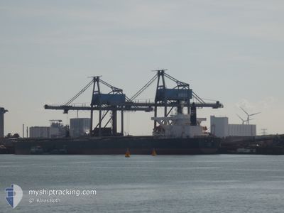
Bulk Carrier

Current Trip
| Time Travelled | 5 days |
|---|---|
| Remaining Time | --- |
| Distance Travelled | 1242.10 nm |
| Remaining Distance | --- |
| AVG Speed | 10.6 Knop |
| MAX Speed | 14.9 Knop |
| AVG Wind | 7.4 knots |
| MAX Wind | 27.8 knots |
| MIN Temp | 6.8°C / 44.24°F |
| MAX Temp | 27°C / 80.6°F |
| Djupgående | 18.2 m |
| Position mottagen | 22 d sen |
Current Position
| Longitud | --- |
|---|---|
| Latitude | --- |
| Status | Under way using engine |
| Fart | 7.5 Knop |
| Kurs | 83° |
| Område | Singapore Strait |
| Station | T-AIS |
| Position mottagen | 22 d sen |
Information
The current position of SAIKO is in Singapore Strait with coordinates 1.27577° / 104.25180° as reported on 2025-03-01 15:04 by AIS to our vessel tracker app. The vessel's current speed is 7.5 Knop and is heading at the port of QINGDAO.
The vessel SAIKO (IMO: 9446087, MMSI: 356335000) is a Bulk Carrier that was built in 2010 ( 15 År gammal ). It's sailing under the flag of [PA] Panama.
In this page you can find informations about the vessels current position, last detected port calls, and current voyage information. If the vessels is not in coverage by AIS you will find the latest position.
The current position of SAIKO is detected by our AIS receivers and we are not responsible for the reliability of the data. The last position was recorded while the vessel was in Coverage by the Ais receivers of our vessel tracking app.
The current draught of SAIKO as reported by AIS is 18.2 meters
Weather
| Temperature | 27.6°C / 81.68°F |
|---|---|
| Wind Speed | 8 knots |
| Direction | 255° WSW |
| Pressure | 1009.4 hPa |
| Humidity | 70.5 % |
| Cloud Coverage | 41 % |


Featured Company
Events
| Tid | Event | Detaljer | Position / Dest | Information |
|---|---|---|---|---|
| 2025-03-19 04:25 | STARTAR förflyttning | 7.43 nm, South East of TAICANG |
31.58777 / 121.31036
CN_QDG
|
Fart: 3.4 kn Kurs: 269° |
| 2025-03-19 02:36 | STOPPAR förflyttning | 7.7 nm, South East of TAICANG |
31.58908 / 121.31825
CN_QDG
|
Fart: 0.2 kn Kurs: 316° |
| 2025-03-19 01:26 | STARTAR förflyttning | 1.05 nm, North West of TAICANG |
31.67785 / 121.18365
CN_QDG
|
Fart: 8.3 kn Kurs: 128° |
| 2025-03-19 01:19 | AVGÅTT HAMN |
|
31.67785 / 121.18365
CN_QDG
|
Fart: 0.2 kn Kurs: 296° |
| 2025-03-17 05:12 | ANLÄNDER HAMN |
|
31.68242 / 121.16660
[CN] TAICANG
|
Fart: 0.7 kn Kurs: 292° |
| 2025-03-17 01:22 | STARTAR förflyttning | 6.55 nm, South East of TAICANG |
31.60607 / 121.30434
CN_QDG
|
Fart: 3.5 kn Kurs: 310° |
| 2025-03-15 06:45 | STOPPAR förflyttning | 6.37 nm, South East of TAICANG |
31.60828 / 121.30182
CN_QDG
|
Fart: Kurs: -1° |
| 2025-03-14 22:41 | STARTAR förflyttning |
31.17870 / 122.56950
CN_QDG
|
Fart: 4.1 kn Kurs: 282° |
|
| 2025-03-14 19:17 | STOPPAR förflyttning |
31.17818 / 122.57948
CN_QDG
|
Fart: 0.2 kn Kurs: 329° |
|
| 2025-03-14 15:33 | STARTAR förflyttning |
31.16542 / 122.73025
CN_QDG
|
Fart: 4.3 kn Kurs: 189° |